Map size in jpg-format: 15.9763MiB
Click to open in high resolution (open in new tab).
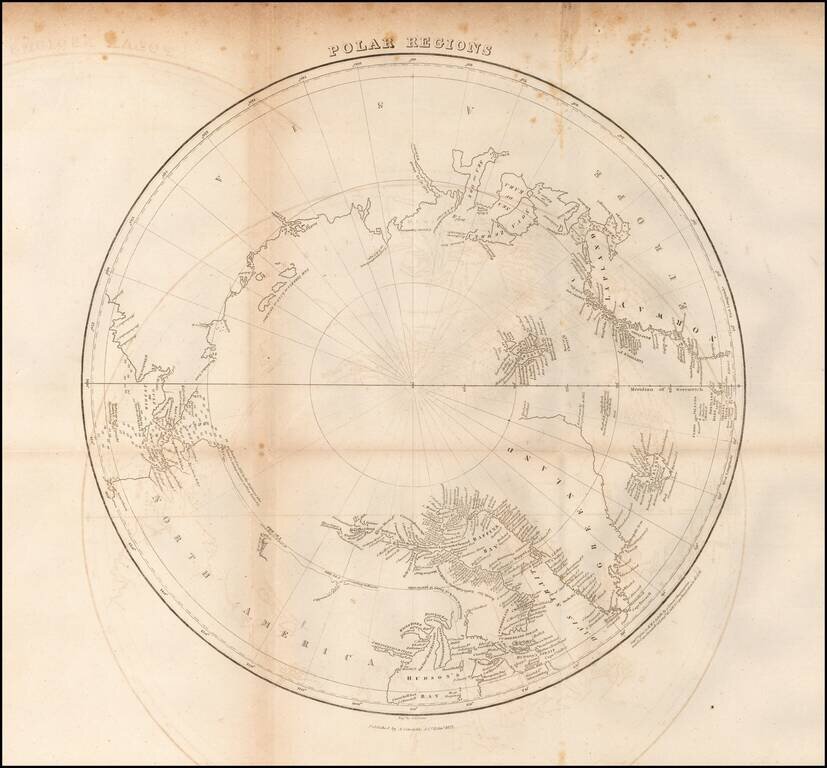
Scarce map of the Polar regions of the Arctic, published in 1822 in Edinburgh.
This fascinating map of the North Pole shows a region still in the process of being discovered. There is little detail in western Canada beyond a few notes such as The Sea according to McKenzie or The Sea according to Hearne. The intended course of William Parry's contemporary search for a passage on the northwest end of the Hudson Bay is marked with a dotted line. The coasts of Baffin Bay are littered with place names. Bering Strait is filled with depth soundings.
The map includes the following identified discoveries:
If you are a student, write to us in telegram: @antiquemaps and indicate what material you need and for what work you need a map in high detail. We are ready to provide material on special terms. For students only!
![[Eastern Hemisphere Globe Gores] (Nova et integra universi Orbis descriptio)](/map/small/54480.jpg)

