Map size in jpg-format: 869012B
Click to open in high resolution (open in new tab).
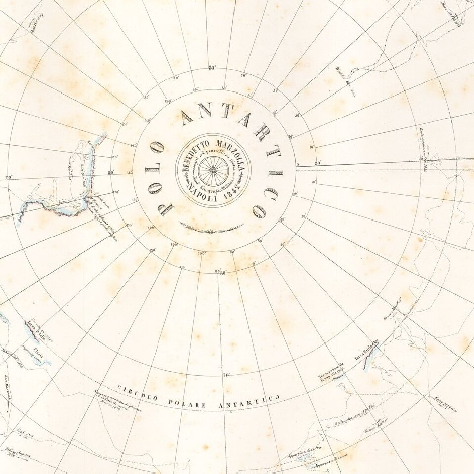
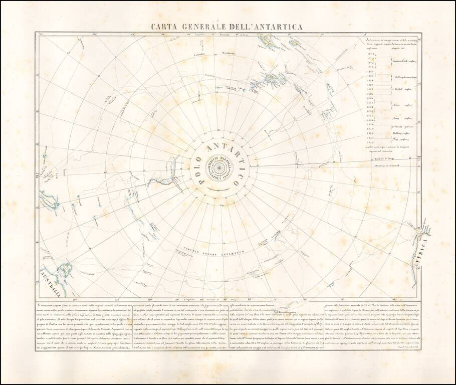
Rare map of the Antarctic regions, by Neapolitan mapmaker, Benedetto Marzolla.
The map shows the tracks of South Polar Explorers, from Captain James Cook, in 1772, to Ross, in 1842. Voyages depicted are:
The map illstrates the tracks of the expeditions and their discoveries.
Benedetto Marzolla is one of the most important Italian cartographers of the 19th century. Active from the early 1840s to the late 1850s, this is also one of his earliest maps.
If you are a student, write to us in telegram: @antiquemaps and indicate what material you need and for what work you need a map in high detail. We are ready to provide material on special terms. For students only!
![[Eastern Hemisphere Globe Gores] (Nova et integra universi Orbis descriptio)](/map/small/54480.jpg)

