Map size in jpg-format: 17.6987MiB
Click to open in high resolution (open in new tab).
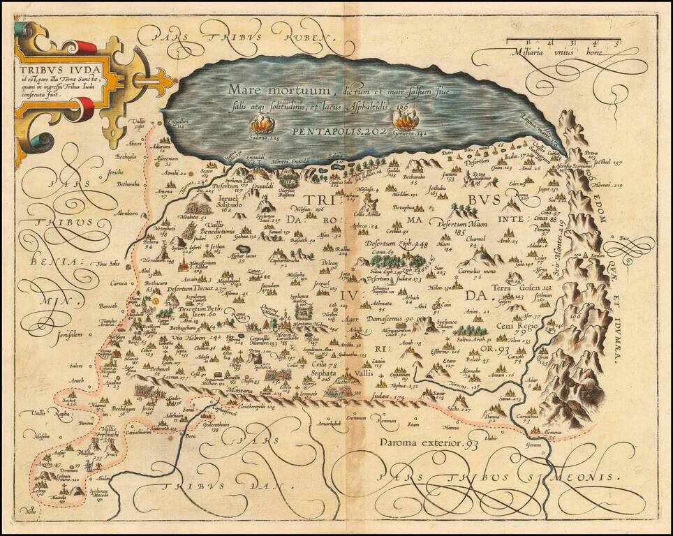
Detailed map of the lands of the Tribe of Judah in the Holy Land, from Christian van Adrichom's Theatrum Terrae Sanctae, first publshed in 1590.
The map extends to the Dead Sea.
Numerous biblical sites are depicted and identified by both name and number, and are more fully described in Adrichom's text.
The Theatrum Terrae Sanctae was an atlas and history of the Holy Land and was Adrichom's most important and famous work. Born in Delft, Christian Kruik van Adrichem, or Christianus Crucius Adrichomius, was a priest and theologian. Adrichom worked for thirty years on his three-part history of the Holy Land, but only published the first part, Urbis Hierosolyma Depicta, during his lifetime. The remaining two parts were published posthumously by Georg Braun in 1590, with subsequent editions in 1593, 1600, 1613, 1628, and 1682.
The Theatrum Terrae Sanctae contained 12 maps and plans: one of the Holy Land, nine of territories of the Tribes of Israel, one of the Exodus, and a town plan of Jerusalem.
If you are a student, write to us in telegram: @antiquemaps and indicate what material you need and for what work you need a map in high detail. We are ready to provide material on special terms. For students only!


![[Early Montanus World Map in Volume Eight of the Plantin Polyglot Bible]](/map/small/53766.jpg)