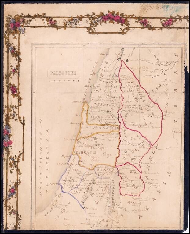
Hand Drawn Antique Map of Palestine / Holy Land Detailed map of Palestine, divided by the Tribes of Israel, with a partial decorative border.
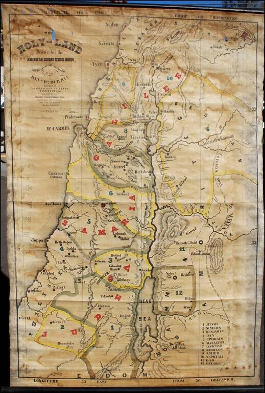
Interesting large format map of the Holy Land, printed on linen. Covers Palestine, western Jordan, and Damascus region. Relief shown by shading. "Entered according to Act of Congress in the year 1846 by the American Sunday-School Union ......
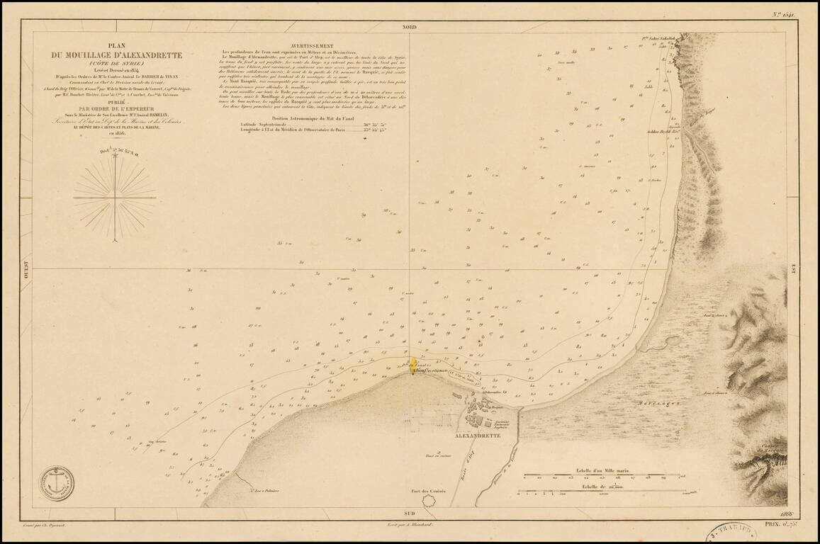
Fine chart of the coastal region of Syria, centered on Alexandrette (now called İskenderun or Scanderoon), published by the French Hydrographical Department in 1856. The chart shows soundings, the Iskendrun lighthouse, and topographical features,...
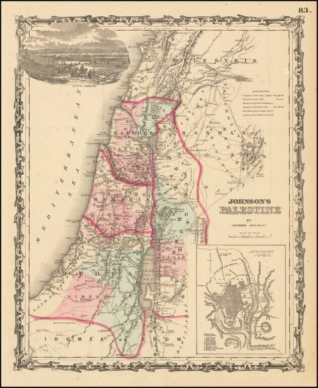
Attractive map of the Holyland, based upon the 12 tribes and contemporary (to mid-19th Century) borders. Insets of view of Damascus and town plan of Jerusalem. Shows towns, roads, rivers, lakes, mountains, etc. Includes biblical, classical and...
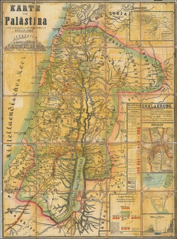
Scarce separately issued map of the Holy Land, published by F. von Rappard in Berlin. The map shows both Biblical, Historical and modern place names and boundaries. The routes of the the Israelites exodus from Egypt is shown, as are the wanderings of...
![[Haifa] Situation Plan von der Deutschen Colonie bei Haifa rep. Tempel Station](/map/small/61139.jpg)
German-American Colonization in Haifa. Fine cadastral map of the German-American Colony in Haifa, sponsored by the Temple Station of Germany and New York State. As noted on the map, it is a: Sketch of the German-American Colony and Mission-Station...
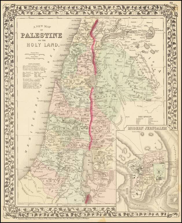
Interesting map of the Holy Land, hand colored by the 13 tribes, with an inset of modern Jerusalem. Key shows cities, towns, roads, etc.
![Планъ Современнаго Іерусалима [Plan of Contemporary Jerusalem.]](/map/small/56472.jpg)
Rare, large format, color-lithographed Russian map of Jerusalem published in 1885 by the Russian Imperial Orthodox Palestinian Society. The map is printed in five colors, with topography shown by contour lines. It records information of use to Russian...
![[An Irgun Modified Map of Palestine and the Middle East]](/map/small/68844.jpg)
The Irgun Repurposes a British Arabic Language Broadside To Warn Against The British-Arab "Conspiracy" Color-lithographed map of the Middle East as one great Arab kingdom, with the Royal Navy and British merchant vessels sailing in the Red Sea and...
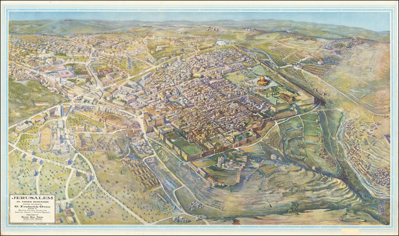
Scarce, large bird's eye view of Jerusalem published by G. Frederick Owen, in Kansas City, Missouri in 1947, the year before Israel was founded. The view looks north-northeast over Jerusalem, with the focus on the old walled city. Individual buildings...
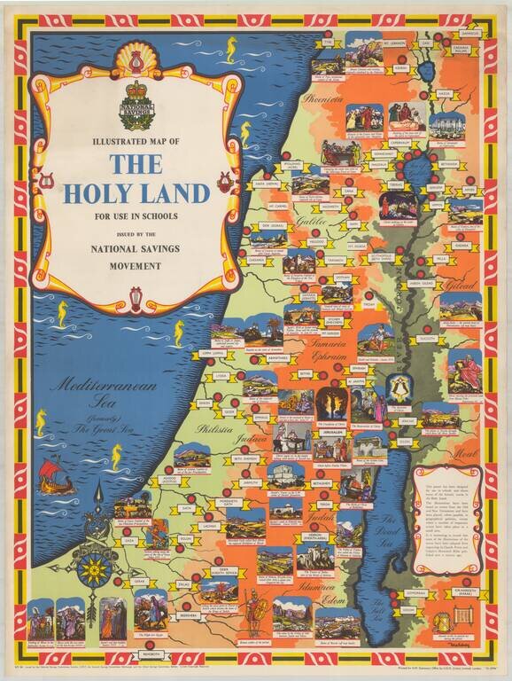
Fine pictorial / historical map of the Holy Land, issued by the National Savings Movement. We note that the map is signed by Mahoney, whose name appears on at least one other poster published by the National Savings Movement. A wide range of printed...
![[Six-Sheet Map of Israel]](/map/small/67584.jpg)
Detailed 1:100,000 six-sheet Survey of Israel map of Israel, published in 1981. The map shows Israel's claims to the Golan Heights, immediately preceding the 14 December 1981 passage of the Golan Heights Law.
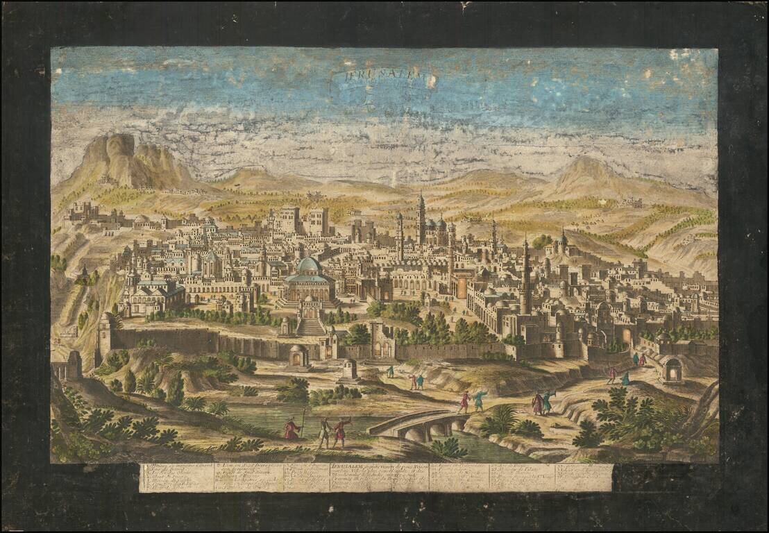
Scarce old color example of Jacques Chereau's view of Jerusalem, published in Paris. Chereau's town-view of Jerusalem is very rare. It includes a numbered (1-36) key in lower margin. The view was first engraved by Aveline and first published in 1692...
![[Arabia] Skizze einer Karte von Asyr und einem Theile von Kedjas und Nedjd, nach Chedufeaus Materialien, entworen von den Capt. Ing. Galinier und Ferret . . . .](/map/small/62167.jpg)
Detailed map of the Southwestern part of Saudi Arabia, extending from Djidda (Jedda) and Mekka to Ras Torfa and Djisan (Jezan). One area noted is the Nordlichster Kaffeedistrict (Northernmost Coffee District), in the area that is now the Al Baha...
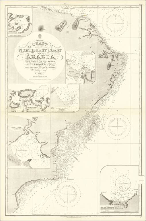
Detailed sea chart of the easternmost tip of the Arabian Peninsula in present-day Oman. Interestingly, the map was made from surveys of the Indian Navy in 1849. Muscat is shown towards the top of the map. Hundreds, if not thousands, of soundings dot...
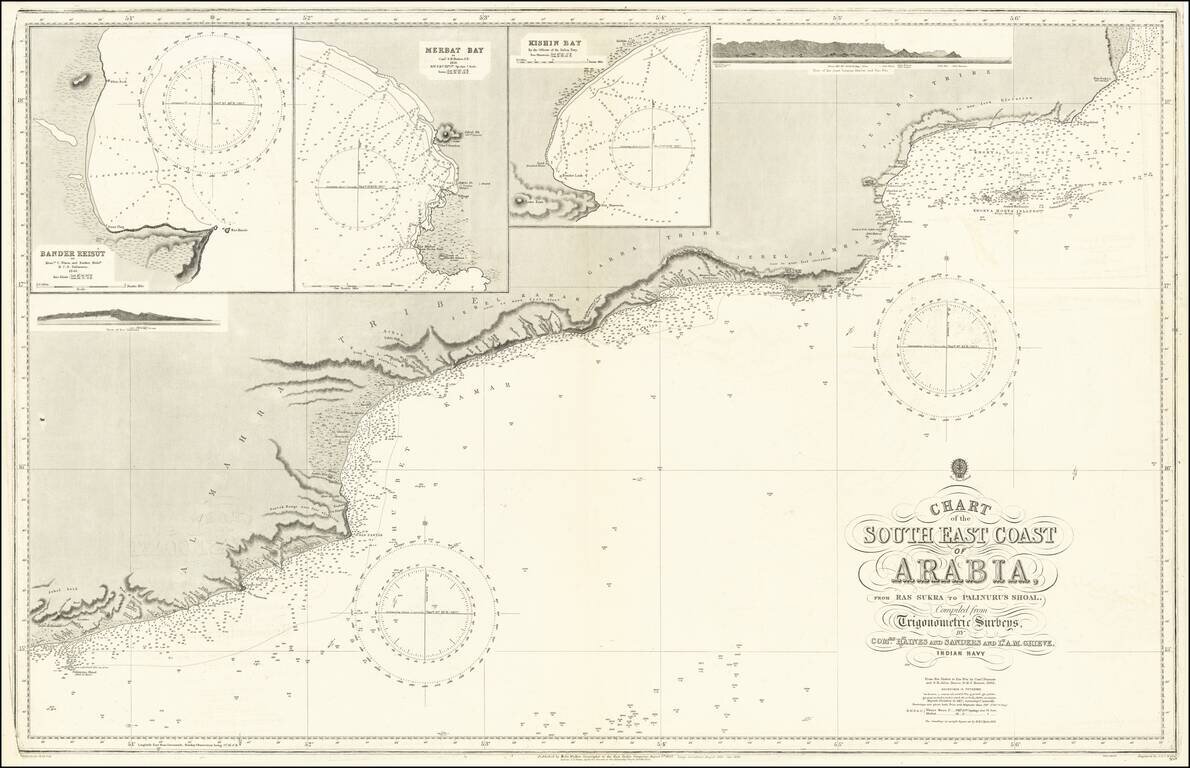
Fine map of the South Coast of Arabia from southern Oman and northern Yemen. Large inset maps of Bander Reisut, Merbat Bay, Kishin Bay and two profile views.