Map size in jpg-format: 34.7698MiB
Click to open in high resolution (open in new tab).
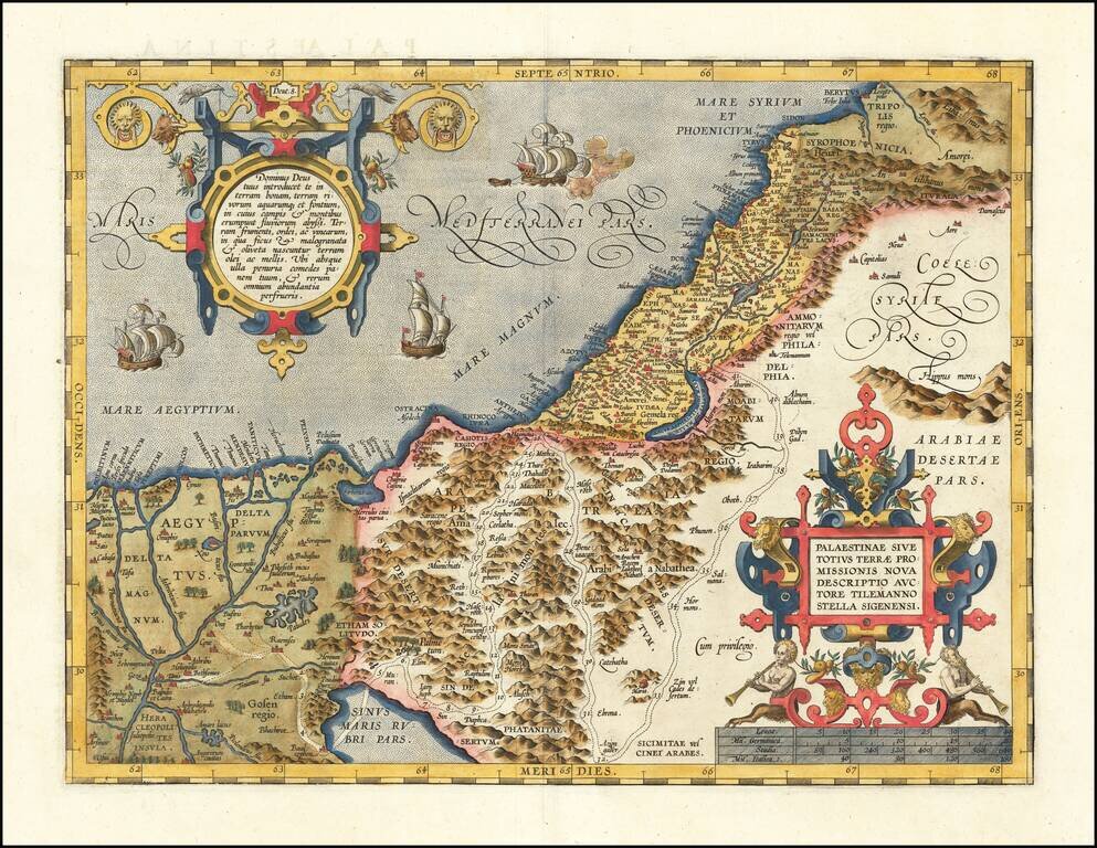
A nice example of Ortelius' map of the Holy Land, from the 1592 Latin edition of his Theatrum Orbis Terrarum, the first modern atlas.
The map shows all of the Holy Lands with Egypt. In the upper left is a text box describing the region. In the bottom right is a fine title cartouche with mileage scale below it. Five sailing ships and a sea monster in the ocean.
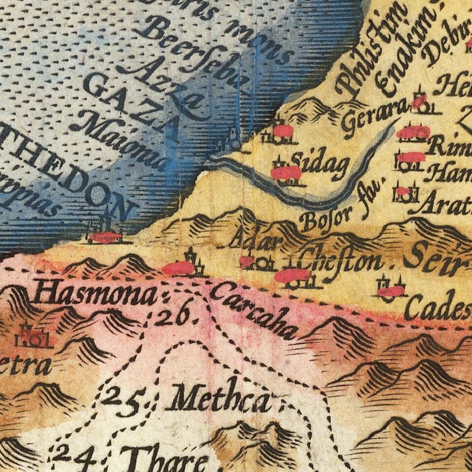
The path taken by the Israelites after their departure from Egypt can be seen, beginning with the assembly of the tribes at Ramses from 6 other locations, crossing of the Red Sea near the town of Baal Zephon (shown between the markers for year 4 and 5), headed north to Hasmona (year 26), then south to Aziongaber (year 32), then finally crossing the Jordan River just north of the Dead Sea into Palestine in year 42.
If you are a student, write to us in telegram: @antiquemaps and indicate what material you need and for what work you need a map in high detail. We are ready to provide material on special terms. For students only!


![[Early Montanus World Map in Volume Eight of the Plantin Polyglot Bible]](/map/small/53766.jpg)