logo

1600. Palaestina Quae et Terra Sancta vel Terra Promissionis, particularis Syrie provincia . . .

  • Palaestina Quae et Terra Sancta vel Terra Promissionis, particularis Syrie provincia . . .

Palaestina Quae et Terra Sancta vel Terra Promissionis, particularis Syrie provincia . . . information:

Year of creation: 
Resolution size (pixels): 
 7570x5530 px
Disk Size: 
 10.2031MiB
Number of pages: 
 1
Place: 
 Cologne

Print information. Print size (Width x height in inches):
Printing at 72 dpi 
  105.14 х 76.81
Printing at 150 dpi 
 50.47 х 36.87
Printing at 300 dpi 
 25.23 х 18.43

An example of detailing the file of this map of in a printable high-resolution:

Click to open in high resolution (open in new tab).
Attention! this is just the central piece (central area 960x960 px) of the map file!
This is an example, so that you can see and study the level of detail of a given map. The entire Map will be fully available after payment!

Palaestina Quae et Terra Sancta vel Terra Promissionis, particularis Syrie provincia . . .

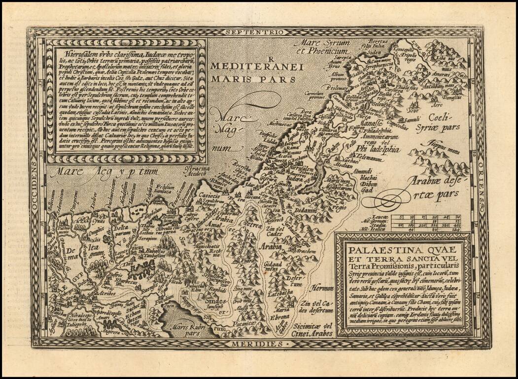
Scarce early map of the Holy Land, engraved in Cologne by Johann Bussemacher for Quad.

Laor, E. 630.

Special conditions for students!

If you are a student, write to us in telegram: @antiquemaps and indicate what material you need and for what work you need a map in high detail. We are ready to provide material on special terms. For students only!

Item information:

Year of creation:
Size:
7570x5530 px
Disk:
10.2031MiB
Number of pages:
1
Place:
Cologne
Author:
Matthias Quad. Johann Bussemachaer.
$14.99

Related item