Map size in jpg-format: 2478200B
Click to open in high resolution (open in new tab).
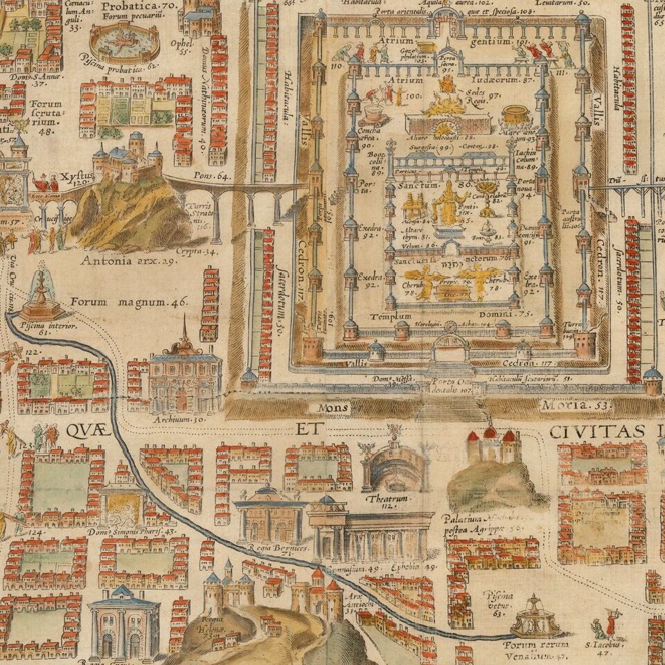
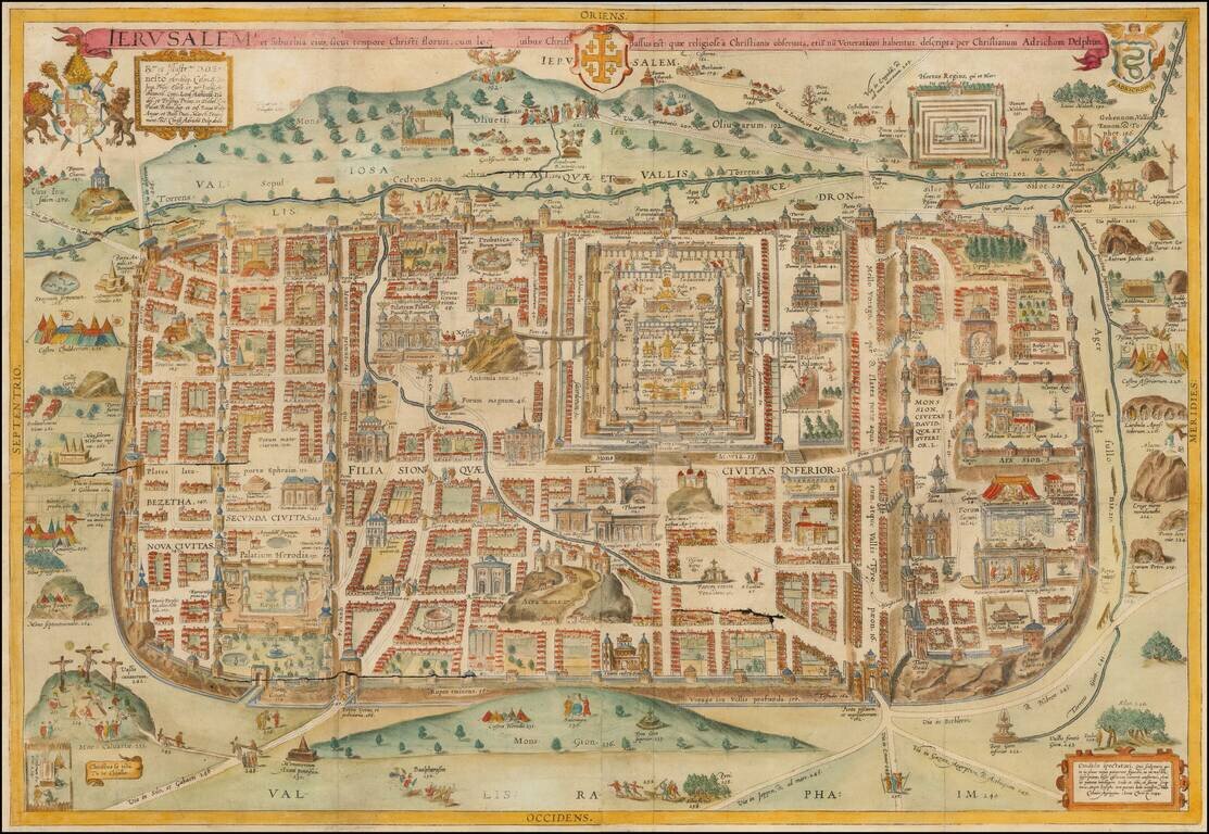
Decorative hand-colored example of Christan Van Adrichom's plan of ancient Jerusalem and its suburbs at the time of Jesus Christ, which was later copied by a number of early mapmakers for their works on the Holy Land.
The plan was originally issued in Theatrum Terrae Sanctae by Christian van Adrichom, in 1584 in Koln. It was subsequently added to all the editions of the Theatrum.
The plan contains sites and scenes of Jerusalem, both within and outside the city, identified by two hundred and seventy captions - each depicting an item mentioned in the Scriptures, and other historical and traditional sources. There is no chronological order to the scenes, as ancient scenes and characters are displayed alongside European buildings and characters of the sixteenth century. The plan itself is surrounded by many illustrations of biblical and historical interest. The map is dedicated to the Archbishop of Cologne.
Van Adrichom's plan was later copied by Jodocus Henricus Kramer in the late 17th Century and also forms the basis for Braun & Hogenberg's 2 sheet vertical plan of Ancient Jerusalem (c 1588) and by Jan Jansson in his 1657 town book.
Adrichom (1533-1585) was a Dutch priest whose scholarly research of the Bible and writings of pilgrims and Josephus made him the acknowledged expert on Holy Land geography. Josephus was a Jewish historian who was employed by the Romans to write about the history of Roman Palestine during the Jewish revolt of 60-70 AD. Many of his works contain accurate geographic details based on his firsthand observations. Adrichom was assigned to Cologne during the time it was a thriving center for cartography and atlas publishing.
If you are a student, write to us in telegram: @antiquemaps and indicate what material you need and for what work you need a map in high detail. We are ready to provide material on special terms. For students only!


![[Early Montanus World Map in Volume Eight of the Plantin Polyglot Bible]](/map/small/53766.jpg)