Map size in jpg-format: 26.9694MiB
Click to open in high resolution (open in new tab).
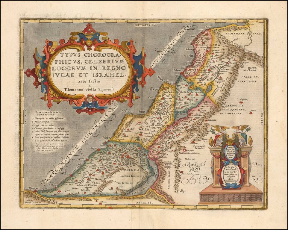
Detailed Ortelius Map of the Holy Land, Based on Tilemann Stella’s Extremely Rare Holy Land Maps
Nice example of Ortelius' map of the kingdoms of Judah and Israel from the Parergon, an atlas depicting both secular and religious histories of the ancient world. The Parergon was a supplemental set of maps issued in conjunction with Ortelius’ Theatrum Orbis Terrarum, the first modern atlas.
This map is oriented northward and shows the Holy Land from Egypt in the southwest corner to Phoenicia in the northeast, encompassing parts of modern-day Egypt, Israel, Jordan, Syria, and Lebanon. Though the Mediterranean Sea appears empty except for stippling, its simplicity is more than made up for by the amount of detail included on land. The Holy Land itself is divided into three sections; Judah (Iudaea) in the south, Samaria (Samaria) and upper Galilee (Galilaea inferior) in the center, and lower Galilee (Galilaea superior) in the north.
Both large and small mountain ranges are pictured, as well as several water bodies such as the Dead Sea (Mare Salsum, vel Mortuum), the Sea of Galilee (Mare Genesareth), and the Jordan River (Iordanis flu.). These landmarks help to orient the viewer and give a sense of the physical geography of the land. However, the focus of the map is truly the cities and territories themselves, which tell the viewer about the people who lived there. The Twelve Tribes of Israel, descended from the sons of Jacob, have territories tentatively marked out by dashed lines, which often cross the more distinct boundaries between the three regions.
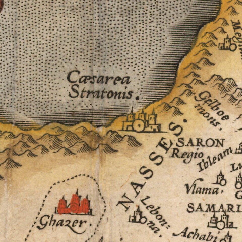
As is typical of an Ortelius map, cities are uniquely drawn with clusters of buildings. . This map has additional symbols detailing information on the size and importance of each city. A key located on the western side of the map explains these symbols. The largest city is Jerusalem (Ierusalem) in the kingdom of Judah (Iudaea), marked as both a significant city and a holy place. However, other important cities and locations can also be found, such as the ancient fortress of Masada on the coast of the Dead Sea. The city of Nazareth (Nasareth), the birthplace of Jesus Christ, can also be located in the upper Galilee.
Two ornate strapwork cartouches adorn the map. The cartouche in the upper left contains the title of the map, Typus Chorographicus, Celebrium Locorum In Regno Iudae et Israhel arte factus a Tilemanno Stella Sigenensi, which indicates that this is a map of the ancient kingdoms of Judah and Israel drawn by Tilemann Stella of Siegen. The cartouche in the lower right corner contains an acknowledgement to Abraham Ortelius, who published the map. This cartouche exhibits figures as well as the typical strapwork, and both cartouches use as texture and shading to give them a three-dimensional appearance.
A number of aspects of the map are not accurate to the topography known today. For example, the coastline pictured in the map is quite meandering from the southwest to the northeast, with numerous inlets, whereas in reality this coast should be closer to a straight north-south line. The Dead Sea (Mare Salsum, vel Mortuum) on the map is sickle-shaped, yet it should be oriented straight northward, almost parallel to the Mediterranean coast. These differences are likely due to incomplete knowledge of the region’s actual geography, as Ortelius never traveled outside of Europe and was basing this map on Tilemann Stella’s 1552 depiction of the Holy Land.
Influence from Tilemann Stella’s Holy Land Maps
Tilemann Stella (originally Stolz, but later Latinized to Stella) was a German geographer and mathematician from a town called Siegen. Stella published two maps of the Palestine region in the 1550s which significantly influenced later mapping of the area by Ortelius and other cartographers. His 1557 map focused on depicting the Exodus, when the Israelites’ fled from Egypt. However, it is his earlier map, from 1552, from which this Ortelius map was compiled.
Unfortunately, though Stella’s Palestine maps were printed prolifically, only one 1557 map and no 1552 maps are known to remain today. Knowledge of these maps must then come from those printed by cartographers who copied them, and it is sometimes unclear if aspects of these later maps are original to Stella or an addition or change by the successive cartographer. For example, Ortelius’ version of Typus Chorographicus contains a note in the smaller cartouche indicating that the map had been made smaller, indicating that Stella’s 1552 original may have been larger.
There is also the question of the map’s orientation, which places the coast of Palestine diagonally across the northward-oriented map. Yet, a version of the map copied by Gerard de Jode in 1578 oriented the coast correctly along a north-south axis. Which copy reflects the original? It is likely that Ortelius’ copy more closely reflects Stella’s original, as Stella’s 1557 map of Palestine also used this diagonal orientation. However, without an actual copy of the 1552 map, uncertainty remains, reminding viewers of the complexity of cartographic history.
Parergon
Although best known for his world atlas, the Theatrum Orbis Terrarum, the Parergon was a project of personal interest and the work that Ortelius himself considered his greatest achievement. He had a deep interest in classical antiquity which spurred him to create the Parergon maps, and the amount of time and detail he put into each map is clearly evident. Rather than copying from existing maps, as he had done for the Theatrum, Ortelius hand drew almost every map of the Parergon, which required considerable skill and knowledge of the area’s history and geography. It is considered the first historical atlas.
Parergon means supplementary, and accordingly, the first three Parergon maps were published as supplements to the 1579 edition of the Theatrum, which had already been in print for nine years. Over time, successive editions of the Theatrum were supplemented with more Parergon maps, and there are 55 known plates overall. The Parergon was also published as its own atlas separate from the Theatrum on two occasions, once in 1595 and again in 1624.
The Parergon was highly successful both as a supplement to the Theatrum and on its own. It was variously translated into French, German, Italian, and English and regularly printed until 1612. Further editions were more sporadic but still popular, such as the 1624 edition which was published twenty-six years after Ortelius’ death in 1598.
This detailed map blends geography and religious history, and it is a clear example of Ortelius’ skill and dedication to his craft. This map is also closely related to the cartographer Tilemann Stella, whose maps are exceedingly rare, and it may be one of few accurate copies of Stella’s 1552 Holy Land map. This would be a valuable addition to a collection of Ortelius maps, biblical maps, or maps of the Middle East.
If you are a student, write to us in telegram: @antiquemaps and indicate what material you need and for what work you need a map in high detail. We are ready to provide material on special terms. For students only!


![[Early Montanus World Map in Volume Eight of the Plantin Polyglot Bible]](/map/small/53766.jpg)