Map size in jpg-format: 38.9607MiB
Click to open in high resolution (open in new tab).
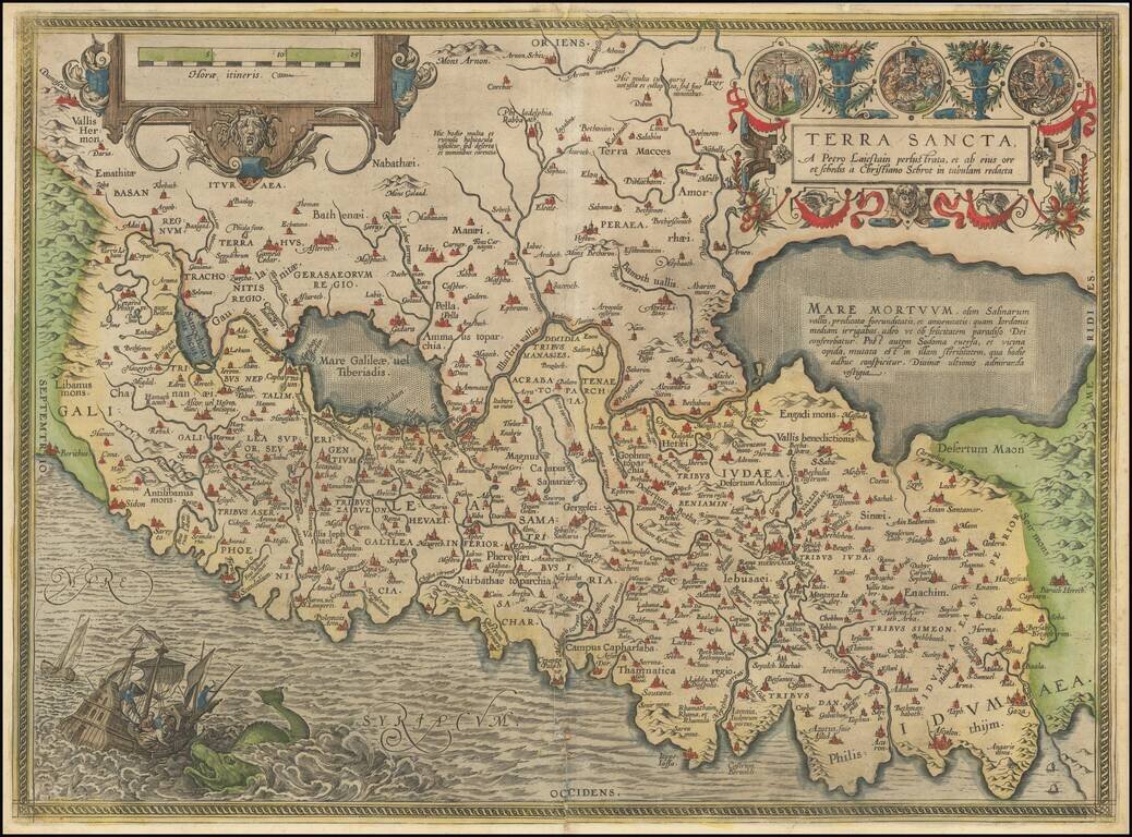
Abraham Ortelius's Modern Map of the Holy Land
The most modern of Ortelius' maps of the Holy Land, which first appeared in Ortelius' Theatrum Orbis Terrarum in 1584.
The map is based on a 9 sheet map of Palestine by Christian Sgrothen (Christian Schrot), published around 1570, which in turn was based on cartographical sources collected by the Dutch astronomer, Petrus Laiksteen, during his visit to the Holy Land in 1566.
Shows the shore line from Beirut to Gaza. The shore line is distorted by many fanciful bays and promontories. Wide meanderings of the River Jordan are also quite fanciful at best. The title cartouche is surrounded by biblical vignettes. The map is oriented with the north to the left. In the bottom left corner the dramatic scene of Jonah and the whale.
If you are a student, write to us in telegram: @antiquemaps and indicate what material you need and for what work you need a map in high detail. We are ready to provide material on special terms. For students only!


![[Early Montanus World Map in Volume Eight of the Plantin Polyglot Bible]](/map/small/53766.jpg)