
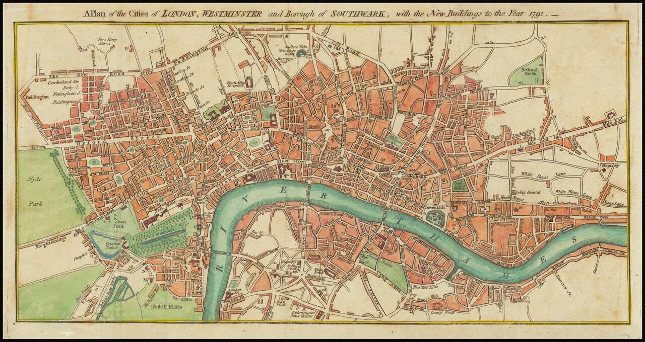
A detailed antique engraved plan of London published in London 1791. The map appeared in Kearsleys’ Stranger’s Guide, or Companion through London and Westminster, and the Country Round: Containing a Description of the Situation, Antiquity, and...

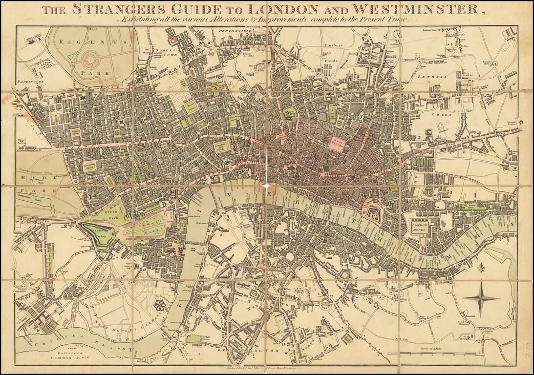
Rare two-sheet (joined as one) map of London at the end of the 18th century, published by Bowles & Carver in London in 1795. The map shows London as it was about to burst into the countryside and takeover the surrounding farmland. The whole map is...
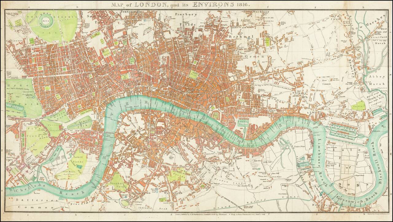
Fine large format map of London, originally published in 1813. The map stretches from Hyde Park in the west to the East India Docks. Parks are shown in green with the urban areas in red.
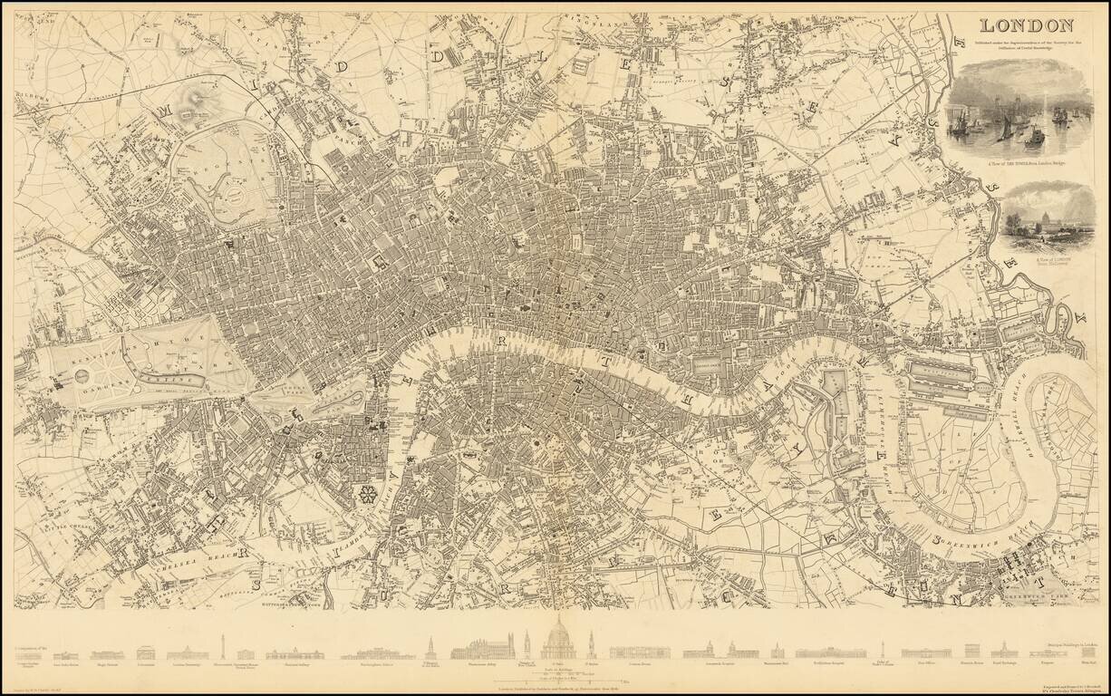
Unrecorded Early Edition of Mogg's Map of London. Antique map of London issued by Edward Mogg in London in 1817. Detailed plan of Georgian London, which at the time extended from Hyde Park to just east of the Tower of London. The City of London is...
Rare first edition of this detailed map of London, centered on the Thames and extending from Greenwich Reach and Bromley, to Kensington Gardens and St. Marleybone. The first edition can be recognized by the inclusion of 2 vignettes: Tower of London...
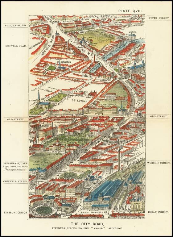
Antique wood-engraved view of London pointing north from Finsbury Circus towards Islington. The view was apparently drawn by Thomas Sulman (1834-1900) while flying in a balloon above London. The wood-engraving was done by George William Ruffle...
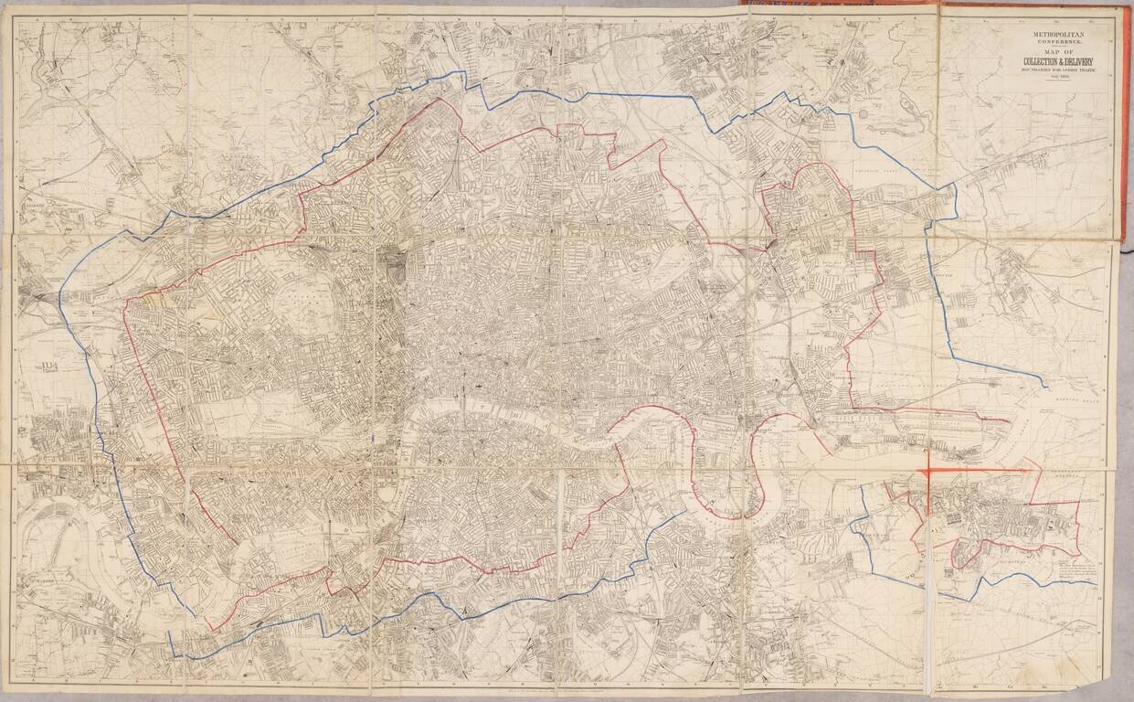
An expansive and detailed map of London, produced for the transportation of goods at the turn of the century. Detail on the map is very extensive, with thousands of streets, parks, railways, buildings, and more all labeled. The map accompanies a...
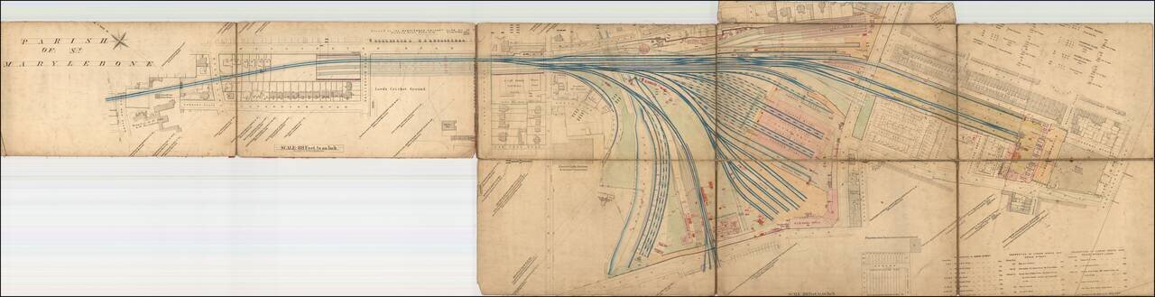
An Early Map of the Marylebone Station, with Lord's Cricket Ground and Public Bar! Rare large format map of the Marlyebone Train Station and surrounding part of St. Marylebone Parish, immediately west of Regent's Park in London. The map locates...
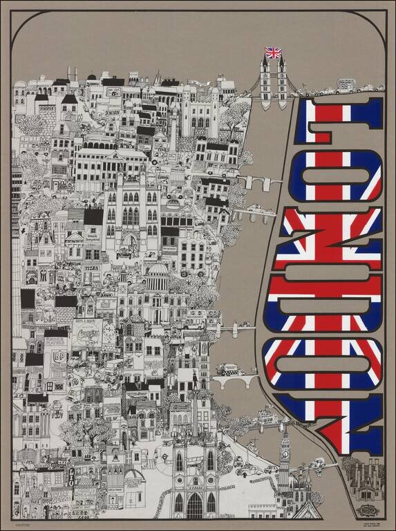
An Iconic Rock 'n Roll Post Map of London Lively illustrated View of London by California artist David Schiller. David Schiller was one of the kings of rock art, producing album covers and posters for many 1960's bands and venues: The Beatles, The...
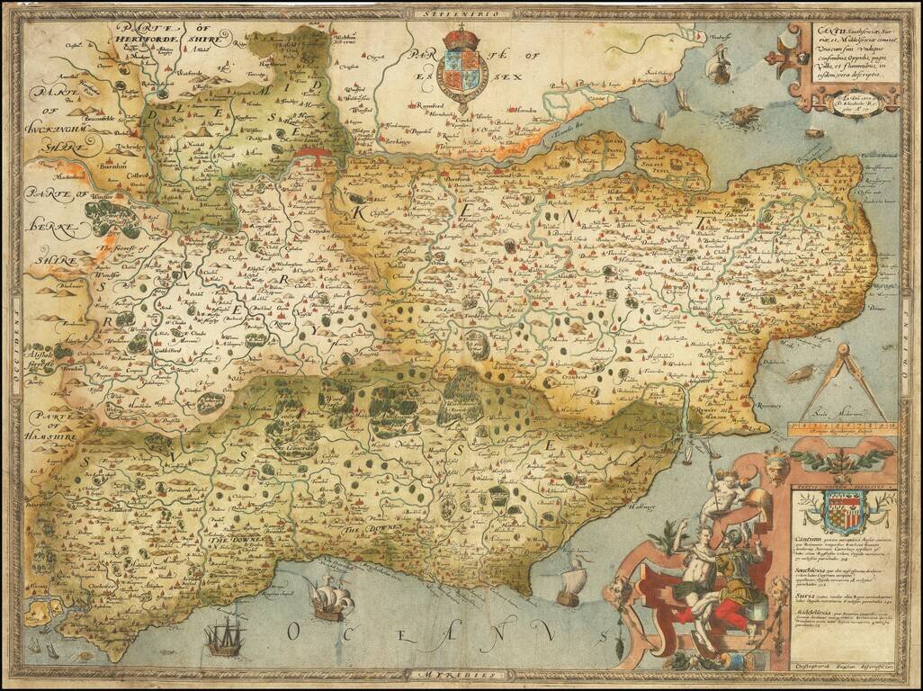
The First Printed Map of Kent, Sussex, Surrey and Middlesex, drawn from Christopher Saxton's 16th Century Survey of England. Fine example of Christopher Saxton's map of Kent, Sussex, Surrey and Middlesex, dated 1575, the 17th year of the Reign of...
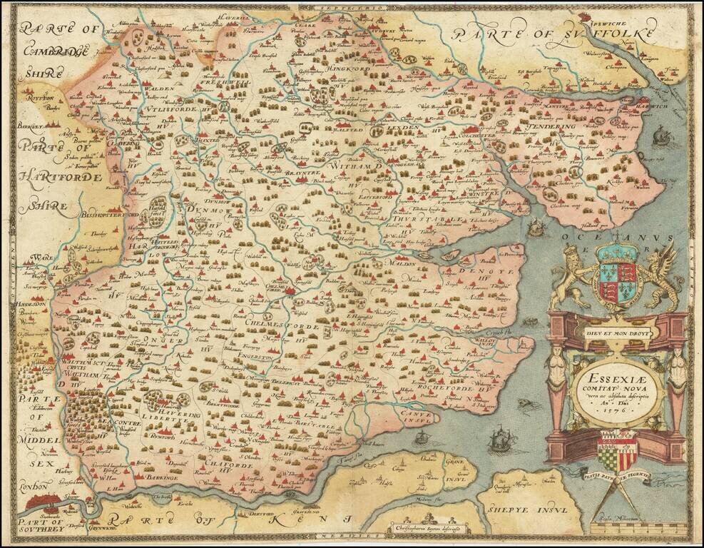
The First Printed Map of Essex A fabulous Saxton map of Essex, showing the county at a time when it nearly reached the City of London. The detail on the map is fabulous, with many cities and townships displayed. Parts of adjacent counties, including...
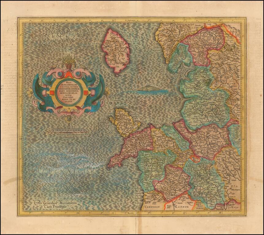
Decorative regional map of Northwestern England, the Isle of Man, Angelsey and part of Wales. From Mercator's Atlas Sive Cosmographia . . .
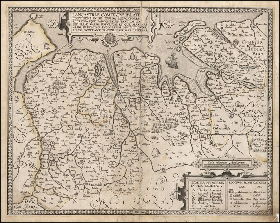
Rare Map of the County of Lancaster, published in London by Peter Stent. Oriented with west at the top. In the early 1600s the Herald and genealogist, William Smith, began compiling maps of each county mainly based on those of Christopher Saxton or...
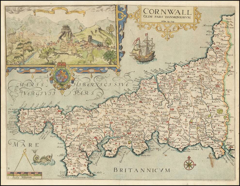
Attractive full color example of Christopher Saxton's map of Cornwall, from the 1637 edition of Camden's Britannia. Decorated with a strapwork title cartouche and an inset of Launceston, the Royal Arms, galleon, sea-monster, a pair of compasses on the...
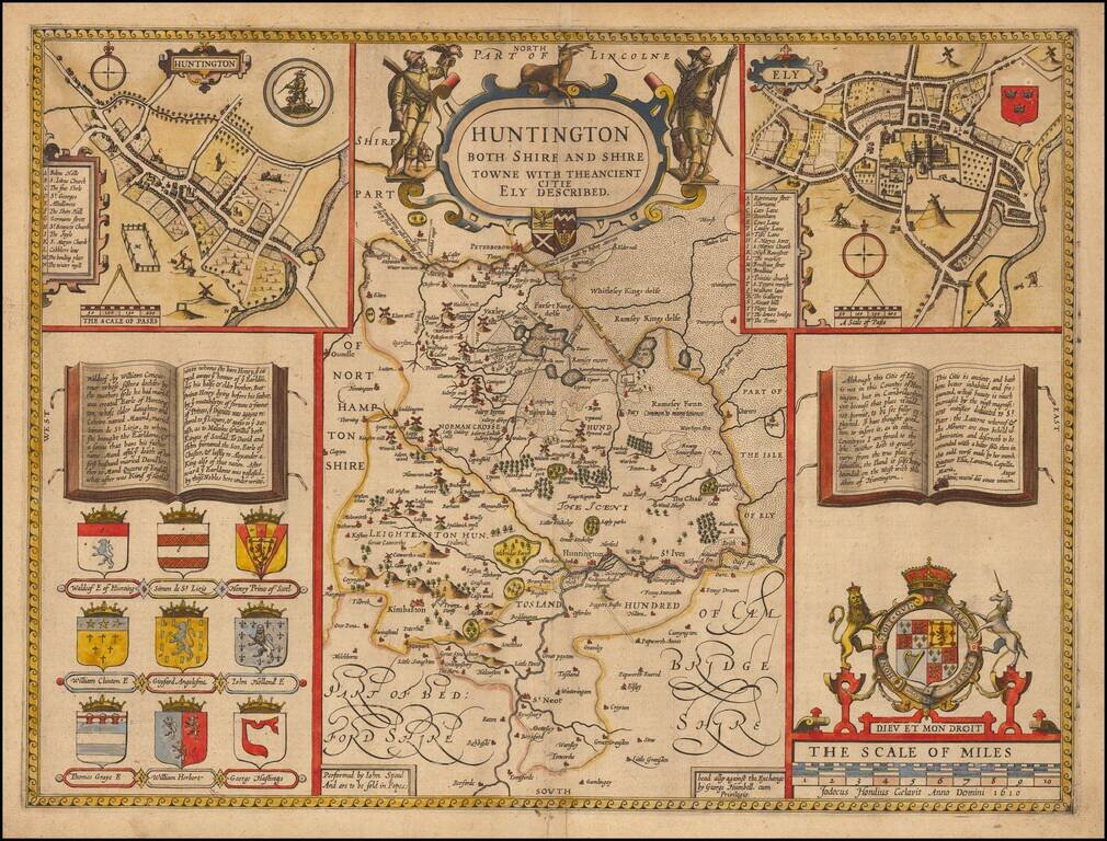
A nice example of this decorative County map of Huntingtonshire by John Speed. Includes insets of Huntington and Ely with the coat of arms for each city and 10 additional large heraldic images. The earliest obtainable map of the county, from the most...
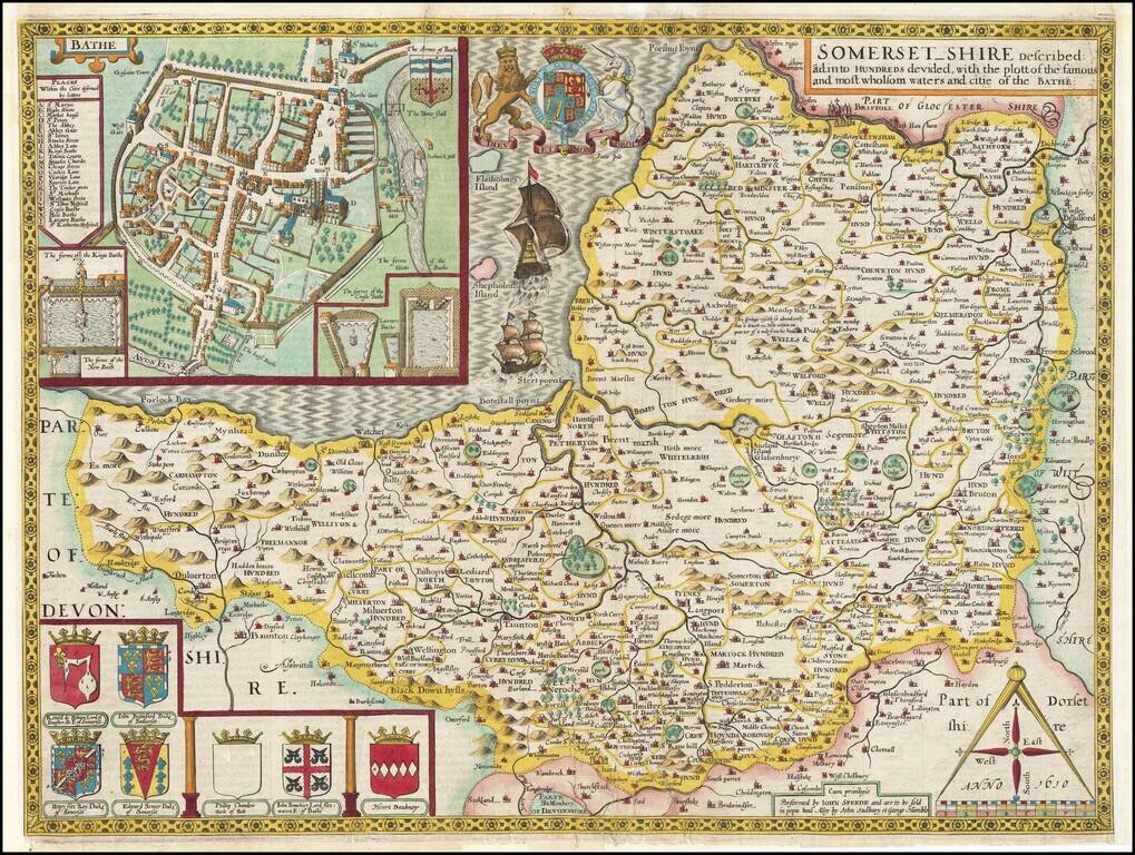
Early (Sudbury & Humble) edition of this fine decorative map of Somerset, from Speed's Theatre of Great Britain. Includes a plan of Bath, a number of coats of arms and other embellishments. John Speed (1552-1629) is arguably the most famous...