Map size in jpg-format: 7.09739MiB
Click to open in high resolution (open in new tab).
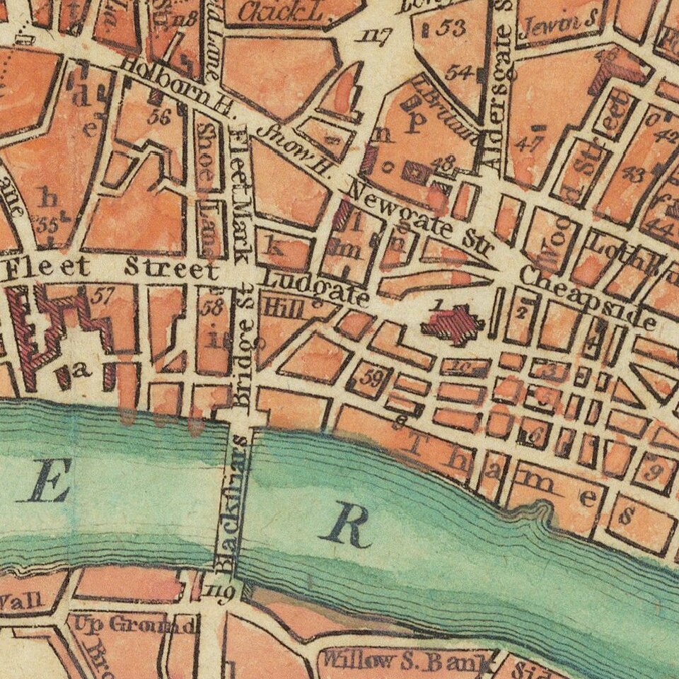
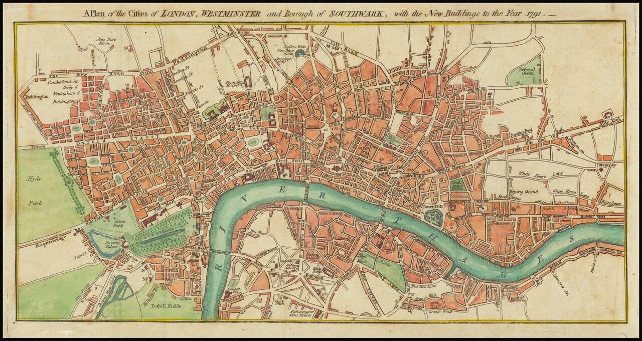
A detailed antique engraved plan of London published in London 1791.
The map appeared in Kearsleys’ Stranger’s Guide, or Companion through London and Westminster, and the Country Round: Containing a Description of the Situation, Antiquity, and Curiosities of Every Place, within the Circuit of Fourteen Miles, Together with a Map of the Surrounding Country, and a Plan of the Cities of London and Westminster, and the Borough of Southwark. Printed for and Sold by C. and G. Kearsley, Fleet-Street. Circa 1791.
If you are a student, write to us in telegram: @antiquemaps and indicate what material you need and for what work you need a map in high detail. We are ready to provide material on special terms. For students only!