Map size in jpg-format: 44.7535MiB
Click to open in high resolution (open in new tab).
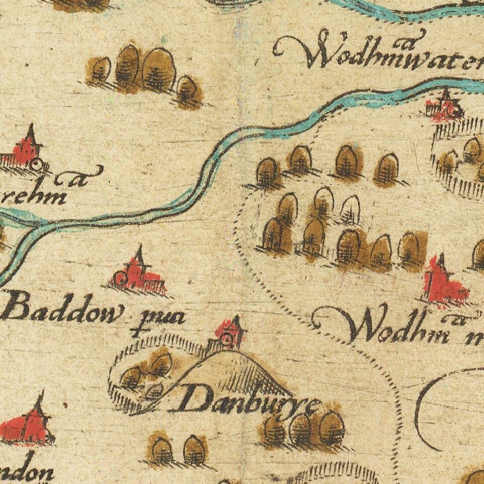
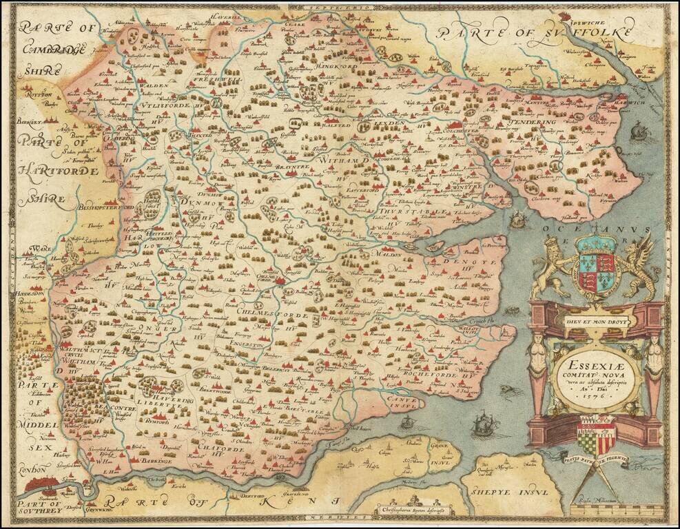
The First Printed Map of Essex
A fabulous Saxton map of Essex, showing the county at a time when it nearly reached the City of London. The detail on the map is fabulous, with many cities and townships displayed. Parts of adjacent counties, including Suffolk, Cambridgeshire, and Hertfordshire, Middlesex, Southrey, and Kent can be seen.
The design on the map is elegant and simple. A decorative cartouche includes the coats of the United Kingdom at the top, and of Saxton's patron, Thomas Seckford, at the bottom. The cartouche builds on a neoclassical design. On the map, ships sail at sea, and rowers pass up the Thames, while a lonely sea monster lurks at the mouth of the Thames.
Essex has always been an important home county for the United Kingdom. It would eventually shrink in size with the growth of London, while it is here pictured nearly reaching the Isle of Dogs. The county is, of course, divided into its Hundreds on the map. A particularly intriguing detail on the map is the display of fenced forests, undoubtedly indicating aristocratic lands. Some elements of the Crown Estate, such as the Blockhouse on Mersea Island, are present.
This map was produced as part of Saxton's Atlas of England and Wales. The Queen's Privy Council, represented by Thomas Seckford, had authorized Saxton to map the counties of England and Wales, which he would complete by 1579. These tools were both produced as to serve administrative purposes, as well as assess defensive capabilities.
If you are a student, write to us in telegram: @antiquemaps and indicate what material you need and for what work you need a map in high detail. We are ready to provide material on special terms. For students only!