
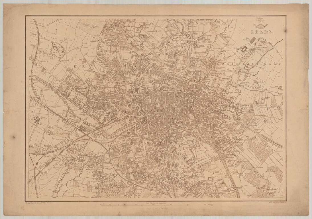
Detailed map of Leeds, which appeared in the Dispatch Atlas, published by the Weekly Dispatch and engraved by Edward Weller in London.
![(Karamanli Turkish-Language Map) Ṫζεζαϊρι Πριταnια [Great Britain / British Isles?]](/map/small/66716.jpg)
Fascinating and highly unusual map of the British Isles, written in Karamanli Turkish, and published in Istanbul in the 1860s or 1870s. Karamanli Turkish (called Kαραμανλήδικα in Greece) is a dialect of written and spoken Turkish that uses...
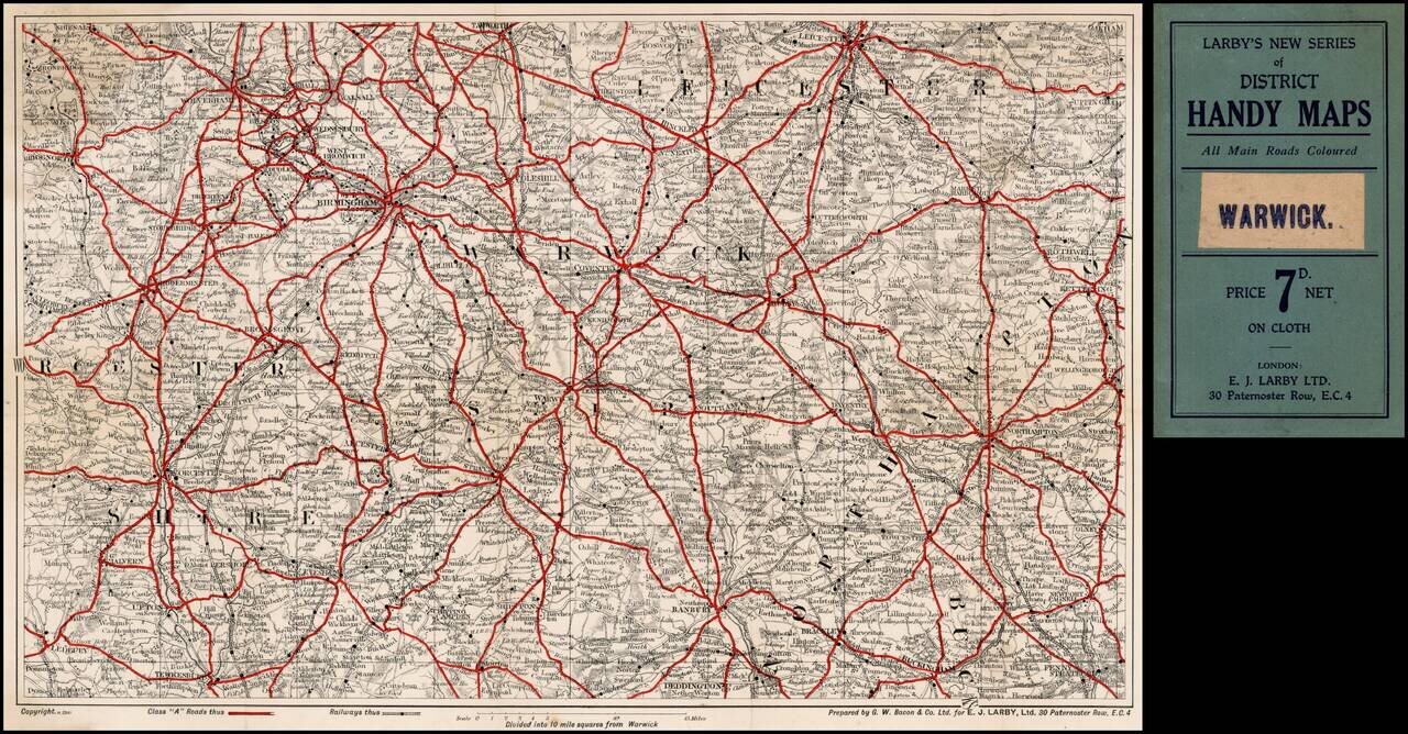
Includes the areas areund Wolverhampton, Birmingham, West Bromwich, Coventry, Leicester, Warwick, Leamington, Stratford, Upton, Worcester, Buckingam, Northampton, Rugby, etc.
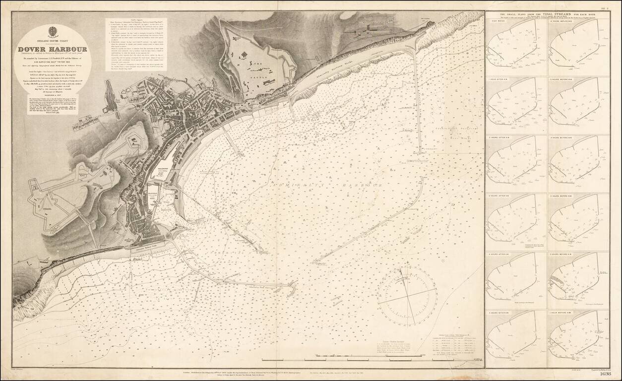
Highly detailed map of the Port of Dover, published in 1910. The finely detailed chart reflects the revisions of the Admiralty over a number of years. The Military Prison, Castle, Harbor Works, Citadel and docks are plainly illustrated, along with a...
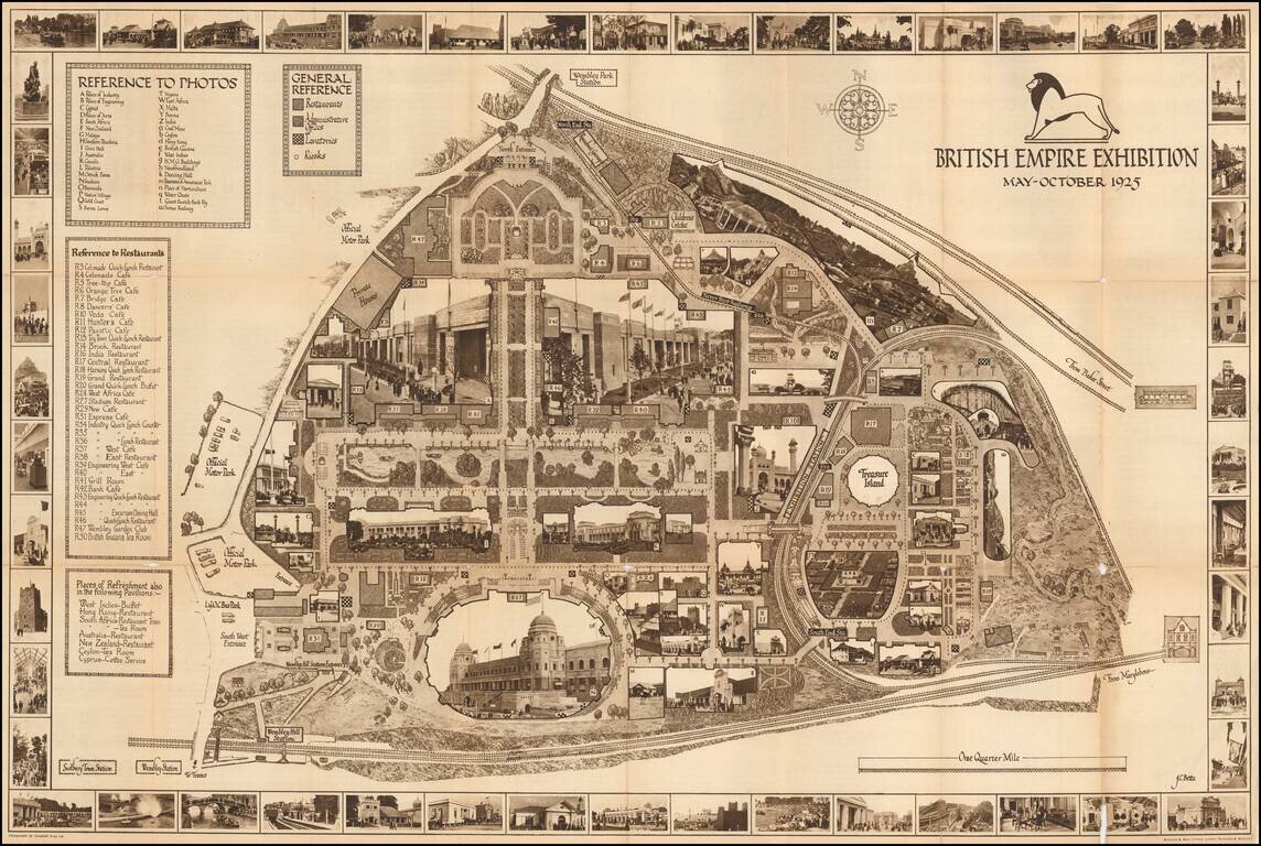
A highly decorative and detailed map of the 1926 British Empire Exhibition, incorporating many photographs of buildings both in the border, and integrated into the map image. The map includes keys to the photos, a general reference key (describing...
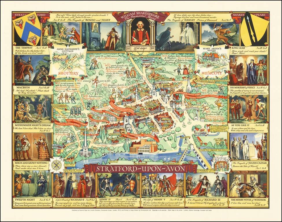
Rare pictorial map of Stratford-upon-Avon, the ancestral home of William Shakespeare. In the center, a map of the town is shown, naming streets, famous buildings, churches, parks, Inns, etc. The homes of famous locals are noted, with some William...
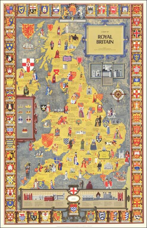
Striking pictorial map of England, Wales & Scotland, published by the British Travel Association. The map is embellished with images illustrating the royal lineage and events of British history. Surrounded with the crests of different regions...
![Oxonium nobile Anglie oppidum Septenrionalem . . . [with] Vindesorium celeberrimum Anglia castrum locus amoenißimus aedificia magnifica . . .](/map/small/69917.jpg)
Decorative pair view of Oxford and Windsor Castle, from Braun & Hogenberg's Civitatus Orbis Theatrum, the most famous atlas of city views published in the 16th Century. Fine full color example with wide clean margins.
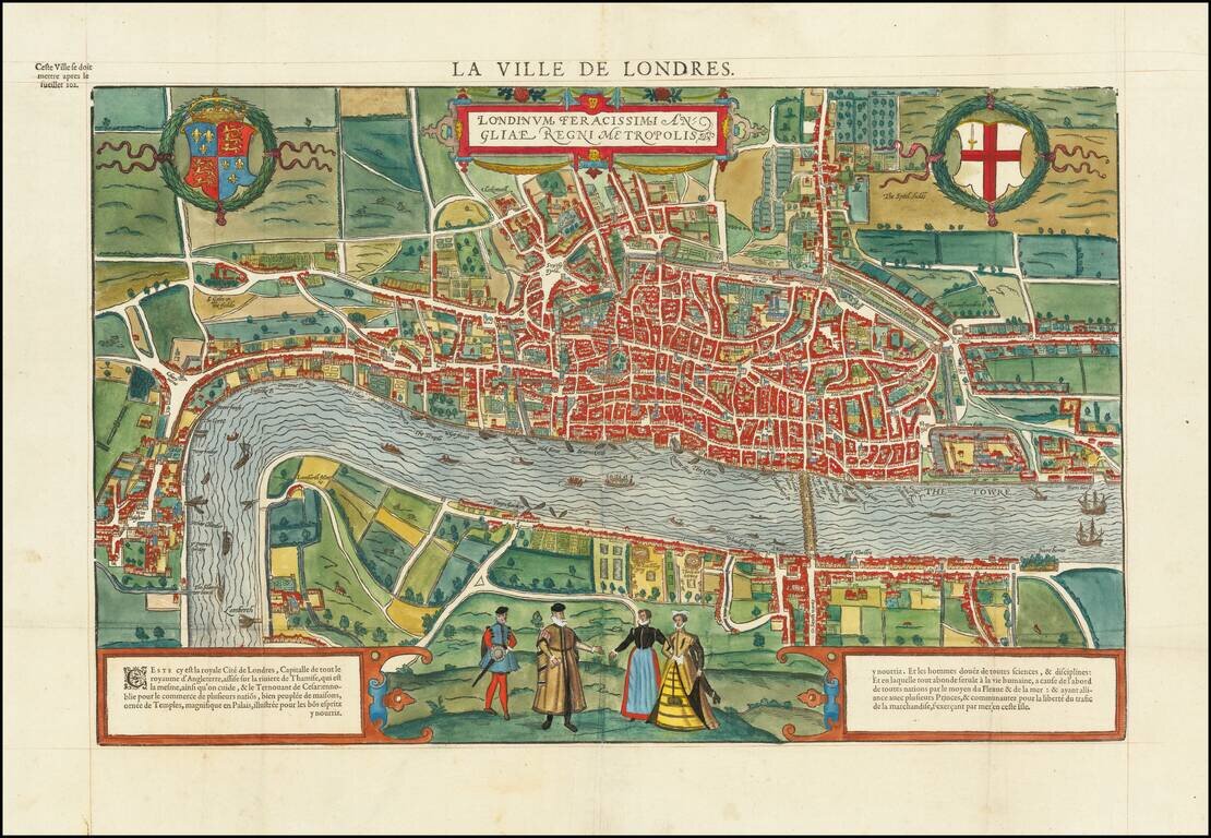
One of the earliest bird's-eye views of London, created by Francois De Belleforest for his La Cosmographie Universelle de Tout la Monde, published in Paris in 1575. The map is drawn based on the view of London which appeared in Braun & Hogenberg's...
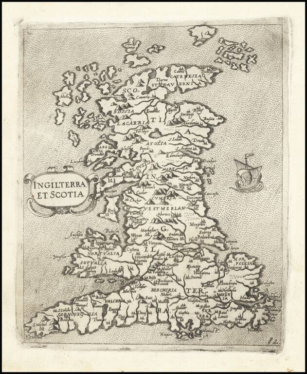
One of the Earliest Modern Maps of England, Wales & Scotland Nice example of Camocio's finely engraved map of England, Wales & Scotland, published in Venice. The map is derived from George Lily. Lily's map is generally considered to be the...
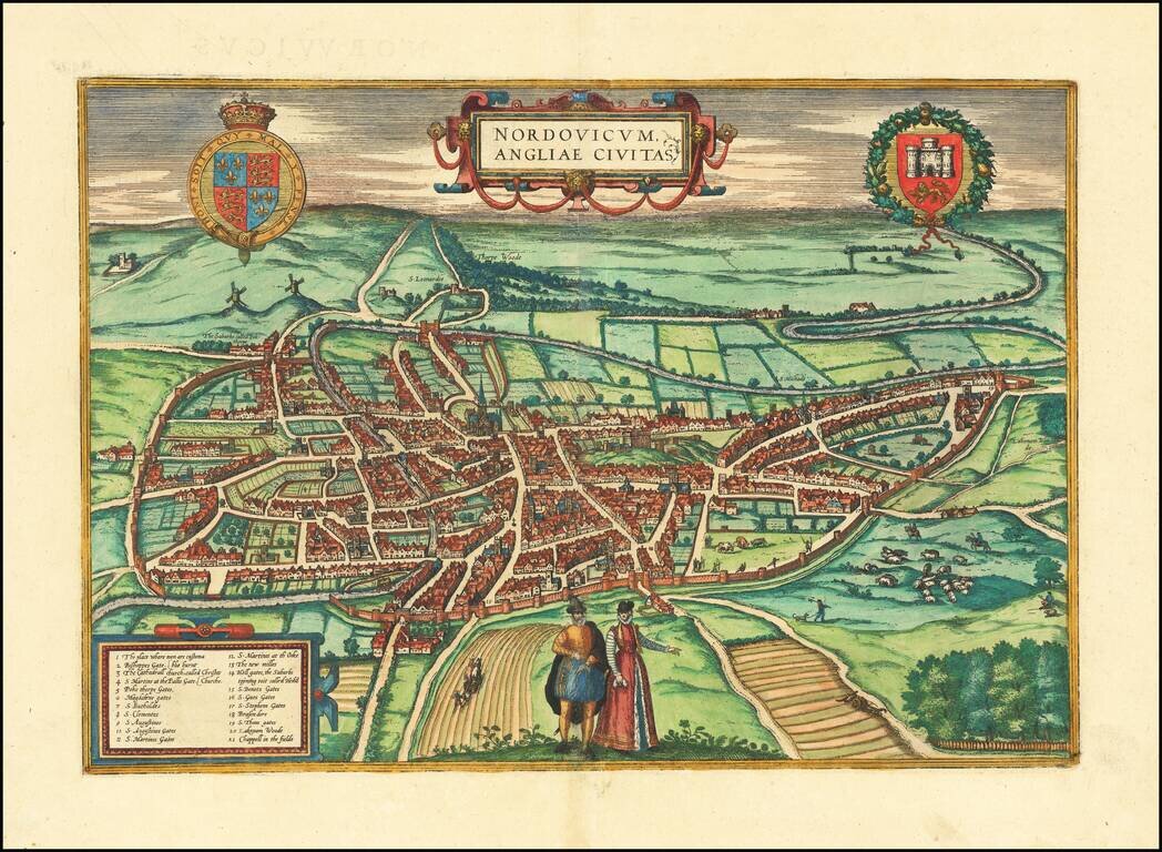
Important early view of Norwich, from Braun & Hogenberg's Civitatus Orbis Terrarum, the most important book of town plans and views published in the 16th Century. This fine view of Norwich is based on William Cuningham's plan of 1558. Viewed from...
![[East Coast of England - Great Yarmouth to Newcastle] Eijgentlijck ontwerp vande Noortcuste van Engelandt, tuschen Iarmunen en het Coggen eijlandt...](/map/small/62061.jpg)
Early Sailing Chart of the East Coast of England. Rare sea chart of the east coast of England, with Great Yarmouth at the far left (i.e., south) of the chart, stretching through The Wash, and mouth of the Humber, to Newcastle. The chart appeared in J...
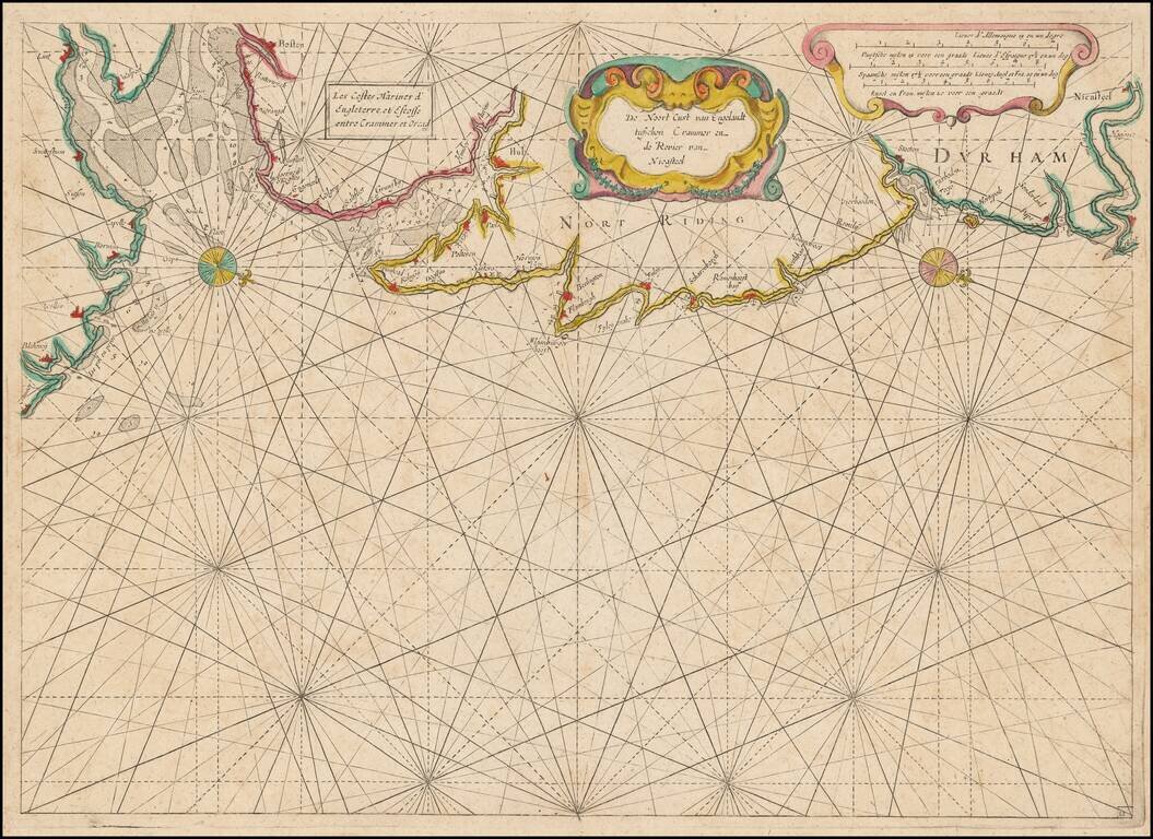
Rare Dutch Sea chart of the Coast of England, published by Jacob Colom, circa 1639. The map appeared in Colom's The New Fierie Sea-Colomne, one of the earliest of Colom's works. Oriented with west toward the top, the chart extends from Cromer in the...
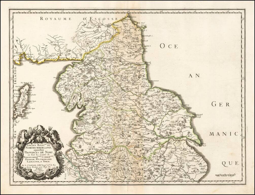
Nicolas Sanson's double-page engraved map of northern England, focusing on Northumberland. The map was published in Paris in 1658. The map features an impressive cartouche of horses and putti.
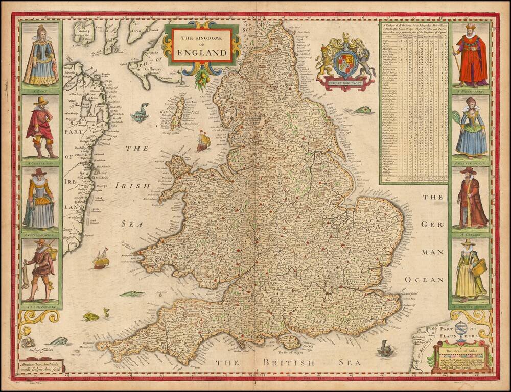
Striking map of England, with costumed figures, a compass rose and a detailed table of the Shires of England, published by John Speed and engraved by Abraham Goos. Originally drawn from the map of Christopher Saxton, this is the second of Speed's maps...
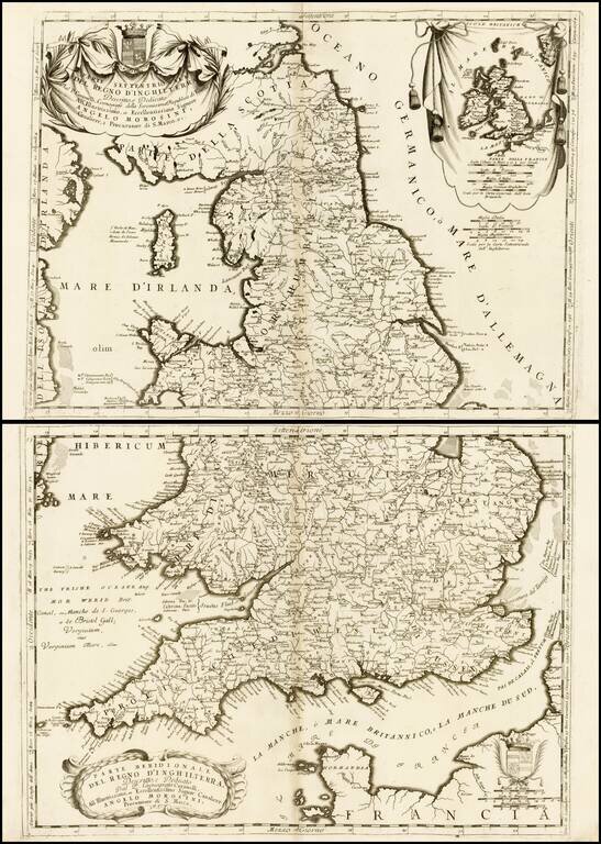
Nice example of Coronelli's attractive and beautifully engraved map of England and Wales. England is divided within the boundaries of the seven ancient Anglo-Saxon kingdoms, and some alternative place names are given (marked with an asterisk) based on...