
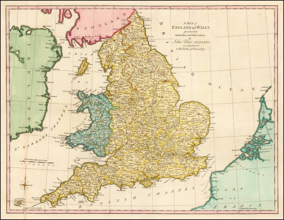
Gorgeous large format map of the England and Wales. Includes a decorative compass rose. From John Blair's Chronology and History of the World, first published in 1754.
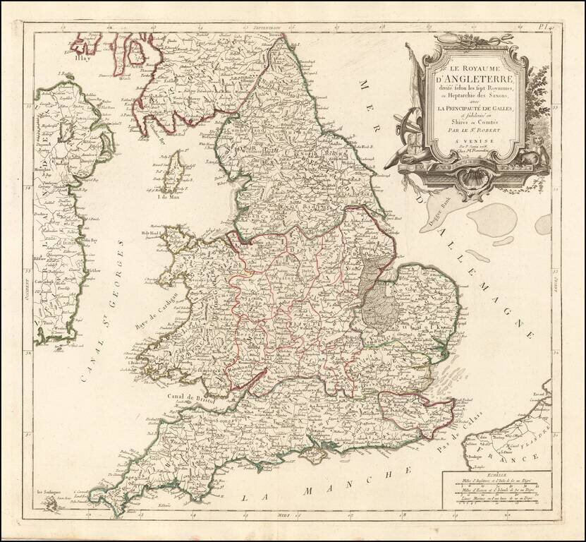
Detailed Santini/Remondini map of the English Heptarchy. An excellent large format map of England and Wales, divided by Heptarchies and showing towns, rivers, lakes, roads and many other details. Based upon De Vaugondy's map first issued in the early...
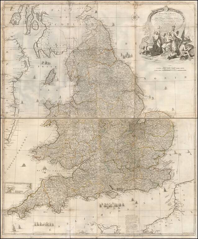
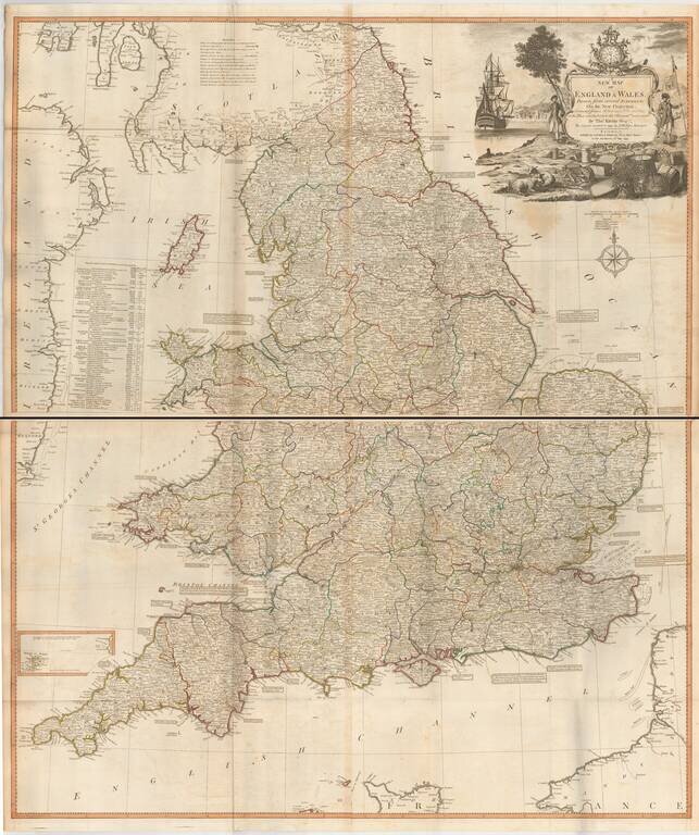
Detailed 4 sheet map of England and Wales, by John Rocque, an immigrant Huguenot who worked in London from 1735 to 1762. Little is known about the early life of Rocque, who worked as a surveyor, engraver and publisher, even though he is mentioned in...
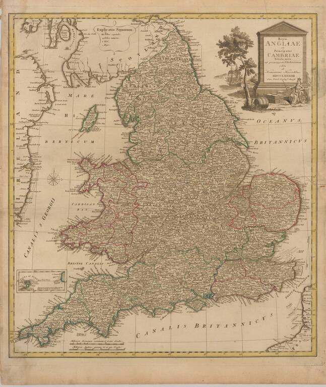
Decorative map of England and Wales, published in Nuremberg. The map is partially colored by counties and is based upon the map of Thomas Kitchin.
Fine large format map of England and Wales, published by Laurie & Whttle, based upon an earlier map by Thomas Kitchin. The map is updated to incorporate all British Canals through 1792. A number of annotations are shown along the coastlines,...
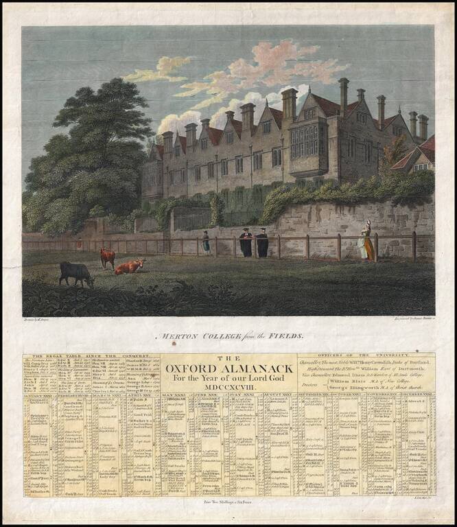
Scarce broadside Oxford Almanac for the year 1798. Appears quite rare with only 2 other examples, one at the British Library (on OCLC) and a second at the British Museum. Issued in 1798 by Dayes. The example at the British Museum is blank in the...
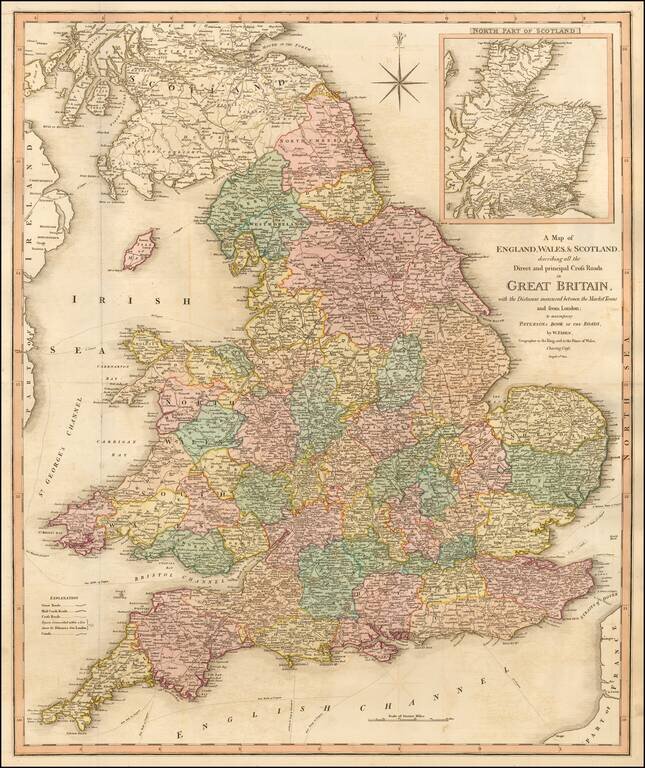
Detailed map of England, Wales and Scotland focusing on the roads between the principal market towns and showing distances. The explanation notes the Great Roads, Mail Coach Roads, Cross Roads, Distances from London, Canals, etc.
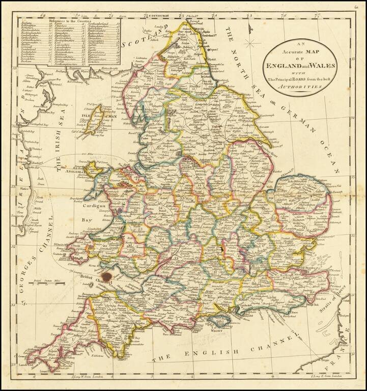
Detailed map of England, showing towns, roads, rivers mountains, lakes, etc. Nice detail. From the 1814 edition of Carey's American Atlas.
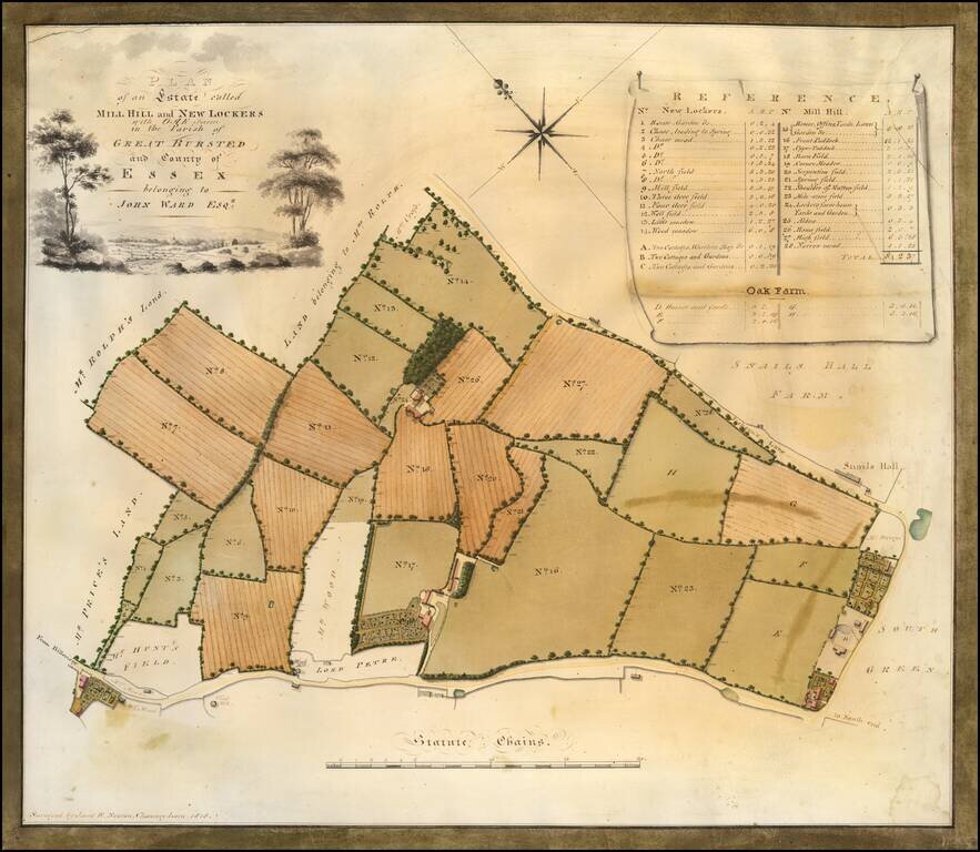
A Hand Drawn Survey Map on Vellum -- Great Bursted Township, Essex County Detailed cadastral survey map of New Lockers, Mill Hill and Oak Farm, "Surveyed by J and W. Newton, Chancery Lane, 1818." Very attractive example of the mapmaker’s art from...
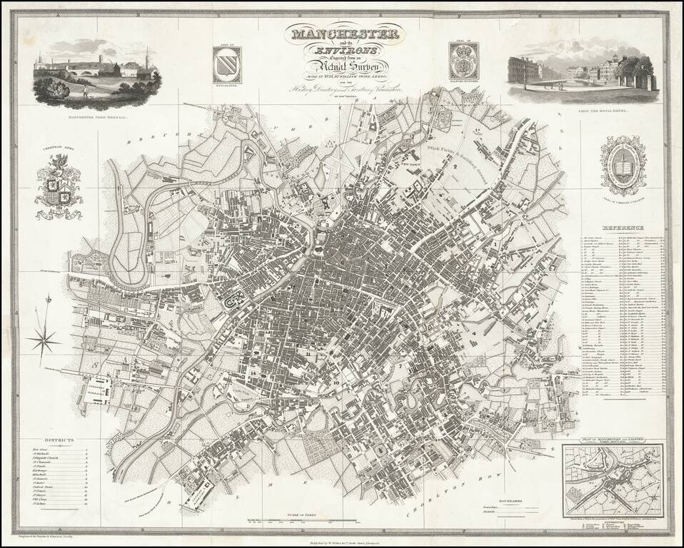
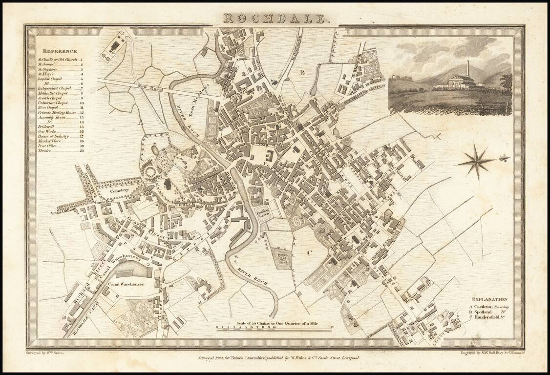
Highly detailed map of Manchester, published by Edward Baines. Includes 2 views and multiple coats of arms and vignettes.
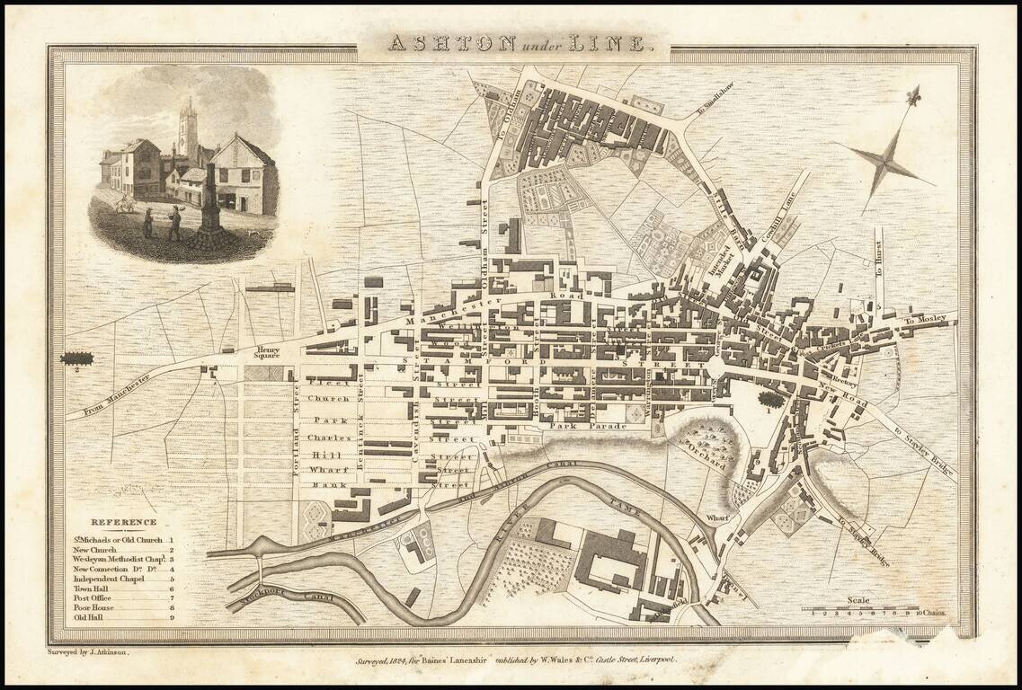
Detailed map of the town of Ashton under Line, in Lancashire, just east of Manchester.
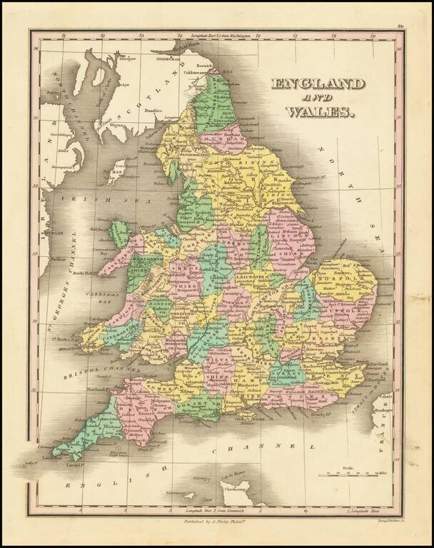
Decorative and detailed map of England and Wales, published in Philadelphia by Anthony Finley. The map is colored by counties.
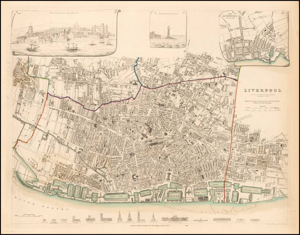
Detailed plan of Liverpool, with inset views from the Harbor and Black Rock Lighthouse, along with a profile showing the 15 major buildings and churches and a small plan of Liverpol in 1729. Marvelous town plan.
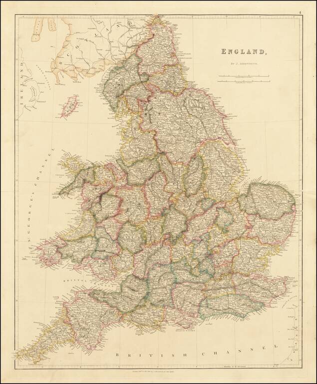
Arrowsmith's Map of England This is a striking example of Arrowsmith's map of England. The map is very detailed, naming thousands of towns and showing many roads, railways, rivers, mountains, and more. Wales is included in this map entitled England....