
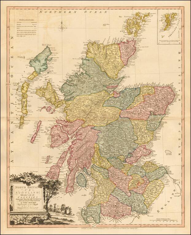
Striking map of Scotland, colored by shires, from Faden's General Atlas. One of the best late 18th Century maps of Scotland to appear in a commercial atlas.
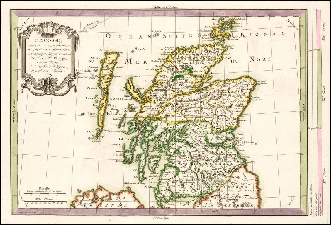
Scarce map of Scotland, published in Paris by Philippe Pretot. Includes a decorative cartouche.
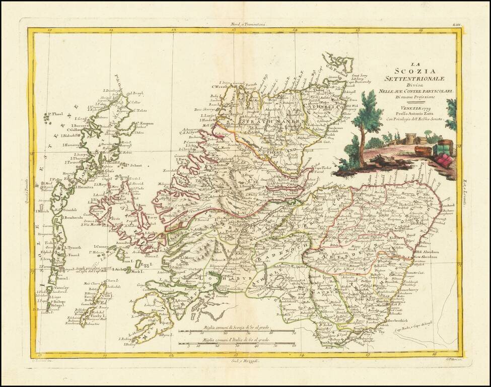
Decorative Italian map of Northern Scotland, with a large decorative vignette. The map appeared in Antonio Zatta's 4 volume 'Atlante Novissimo". Zatta was a major Italian cartographer of the time, and his works are increasingly popular with collectors.
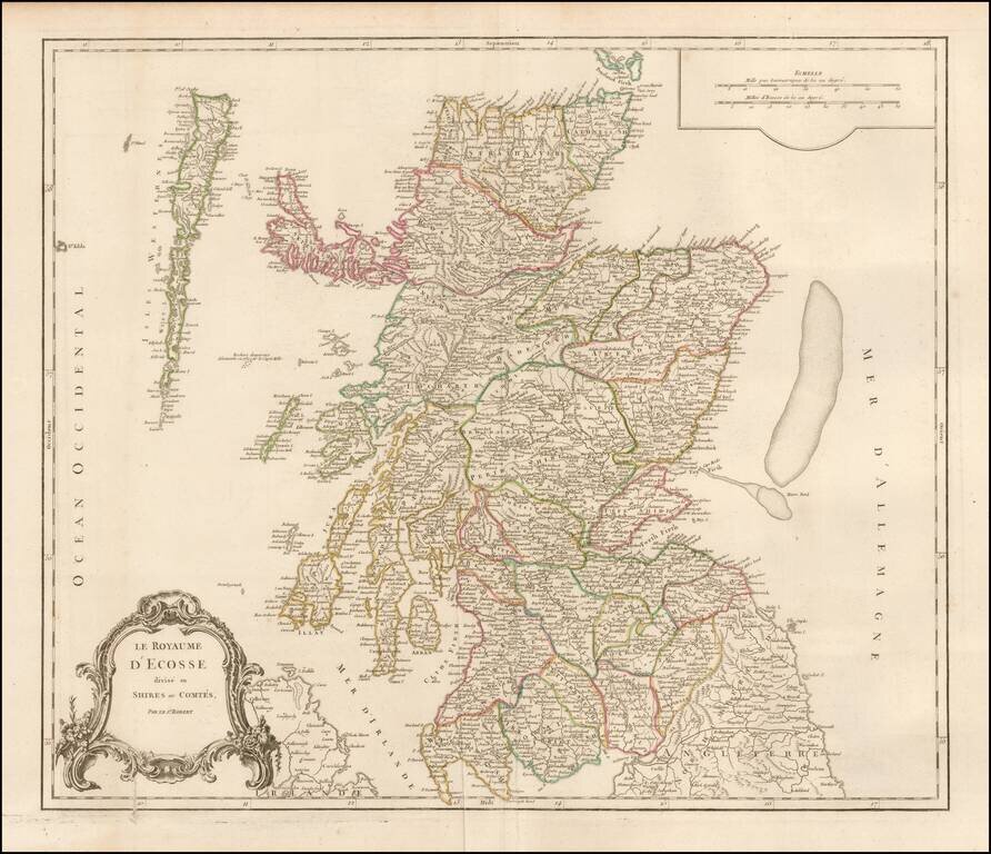
Detailed map of Scotland from a later edition of DeVaugondy's Atlas Universel. Includes towns, mountains, rivers, lakes and a host of other details.
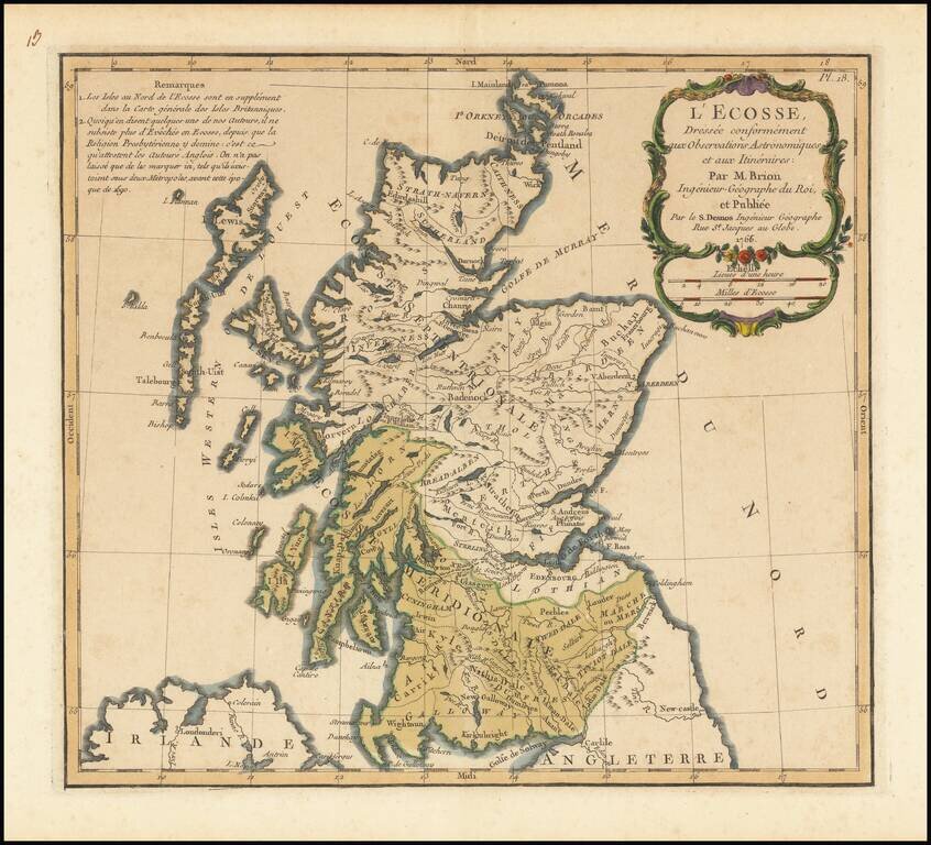
Interesting map of Scotland, published by Brion in 1766.
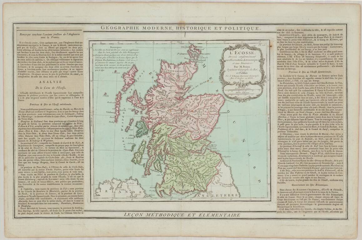
Interesting map of Scotland, with decorative cartouche and side paneled text.
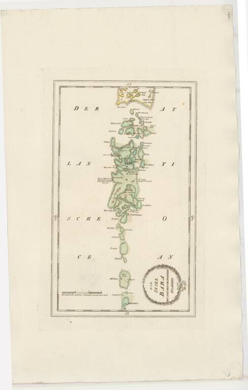
Striking map of Barra and some of the other Western Scottish Islands, from Von Reilly's remarkable atlas. The map extends as far south as Bernera (Barra Head) and Megala (Mingulay), also showing Papa (Pabbay), Linga (Lingeigh), Flada (Flodday),...
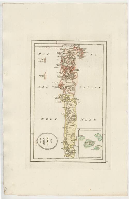
Striking map of Uist, other western Scotish Islands, from Von Reilly's remarkable atlas. Extends north to Harries (Harris) Island and south the the southernmost tip of South Uist Island.
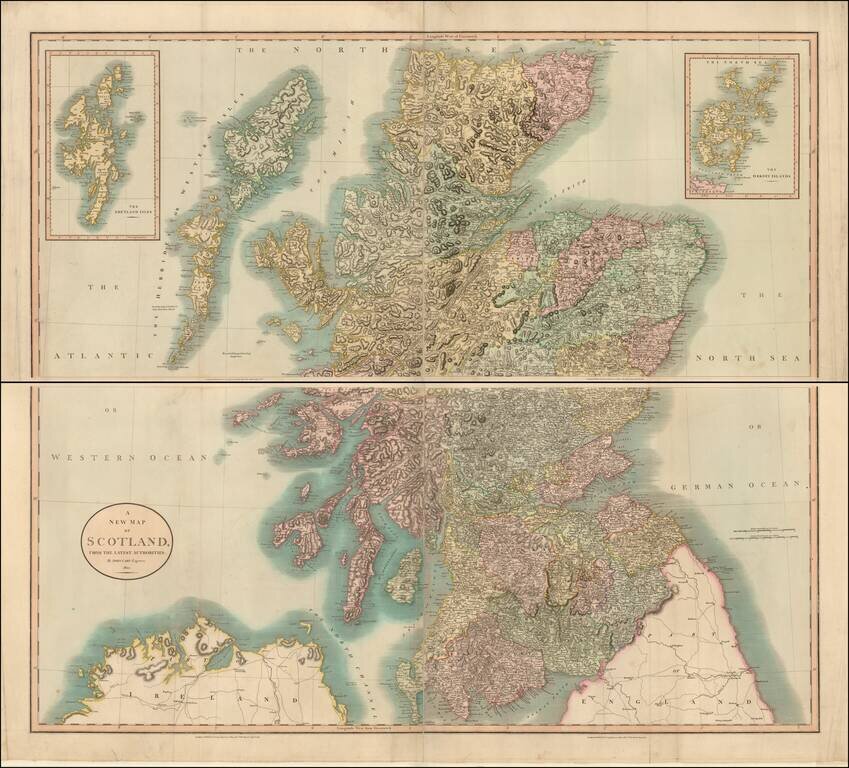
A large and detailed four sheet map of Scotland, published by John Cary. The map is hand colored by counties and includes precise topographical detail, including lakes, rivers, mountains, bays, towns, roads with milage, political divisions, and a host...
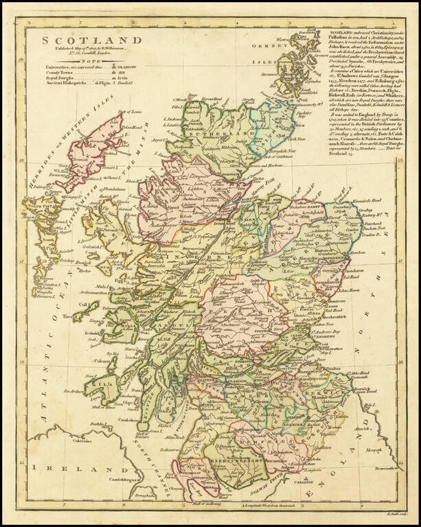
Updated map of Scotland, published by Wilkinson. This is an extensively revised example of the map, with three paragraphs of notes at the right on the history of Scotland. The map is hand colored by counties and shows rivers, lakes, islands, etc....
![Scotland (Northern Part) [and] Scotland (Southern Part)](/map/small/53210.jpg)
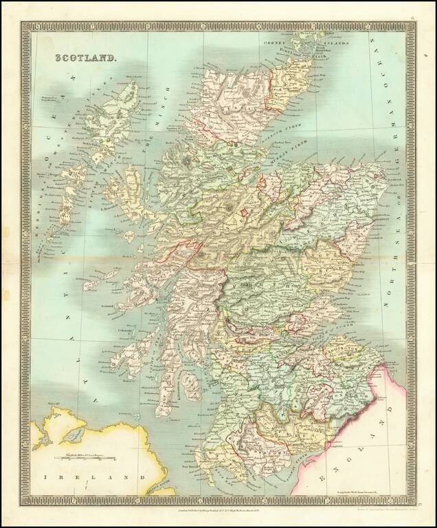
Large and highly detailed two sheet map of Scotland, published in London by Pinkerton. One of the best large format atlas maps of the period.
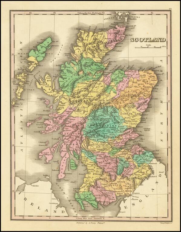
Decorative and detailed map of Scotland, colored by Counties, from Finley's New General Atlas. Wonderful color.
Striking early map of Scotland, published by Henry Teesdale. The map is colored by counties, and shows towns, roads, mountains, rivers and other details.
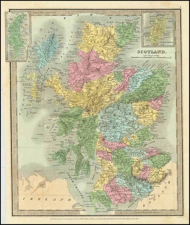
Fine example of Henry Schenk Tanner's map of Scotland, published in Philadelphia. The map is hand colored by counties and showing towns, rivers, lakes, railroads, roads, etc. Tanner was perhaps the single most important American commercial mapmaker...
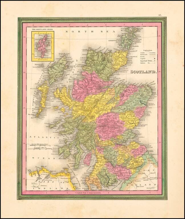
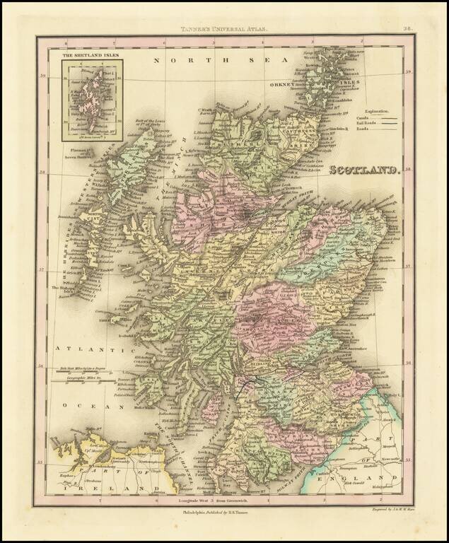
Detailed and interesting map of Scotland, hand colored by county and showing towns, rivers, lakes, railroads, roads, etc. Inset of the Shetland Islands. A decorative interesting map.