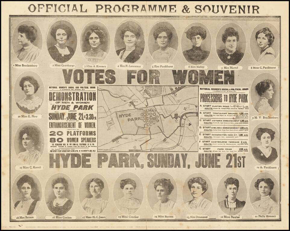
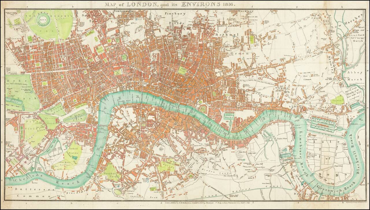
logo

1816. Map of London and its Environs 1816.

  • Map of London and its Environs 1816.

Map of London and its Environs 1816. information:

Year of creation: 
Resolution size (pixels): 
 17502x9920 px
Disk Size: 
 51.7951MiB
Number of pages: 
 1
Place: 
 London

Print information. Print size (Width x height in inches):
Printing at 72 dpi 
  243.08 х 137.78
Printing at 150 dpi 
 116.68 х 66.13
Printing at 300 dpi 
 58.34 х 33.07

An example of detailing the file of this map of in a printable high-resolution:

Click to open in high resolution (open in new tab).
Attention! this is just the central piece (central area 960x960 px) of the map file!
This is an example, so that you can see and study the level of detail of a given map. The entire Map will be fully available after payment!

Map of London and its Environs 1816.

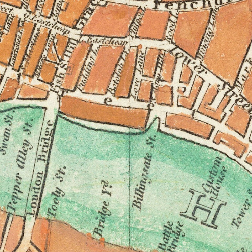
Fine large format map of London, originally published in 1813.

The map stretches from Hyde Park in the west to the East India Docks.

Parks are shown in green with the urban areas in red.

Howgego 260.3

Special conditions for students!

If you are a student, write to us in telegram: @antiquemaps and indicate what material you need and for what work you need a map in high detail. We are ready to provide material on special terms. For students only!

Item information:

Year of creation:
Size:
17502x9920 px
Disk:
51.7951MiB
Number of pages:
1
Place:
London
Author:
Sherwood, Neely & Jones.
$14.99

Related item