
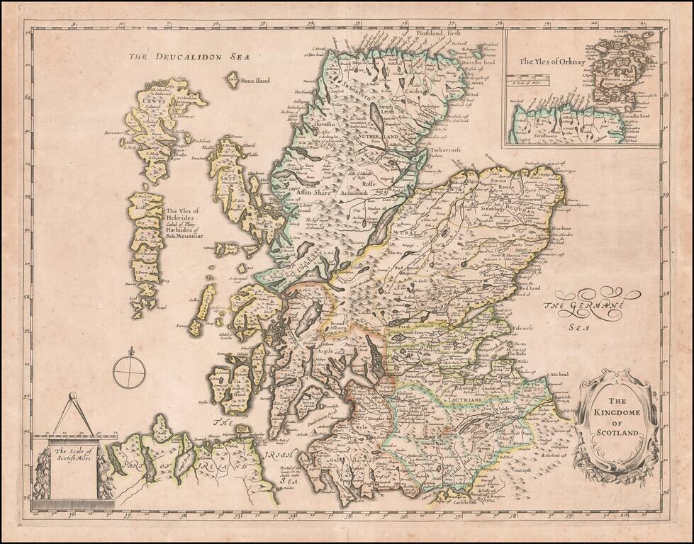
Rare separately published map of Scotland, attributed to Thomas Jenner. The map is known to have appeared in Jenner's catalog in 1662, however the few surviving examples of the map are bound into composite atlases from the early 1640s. A later...
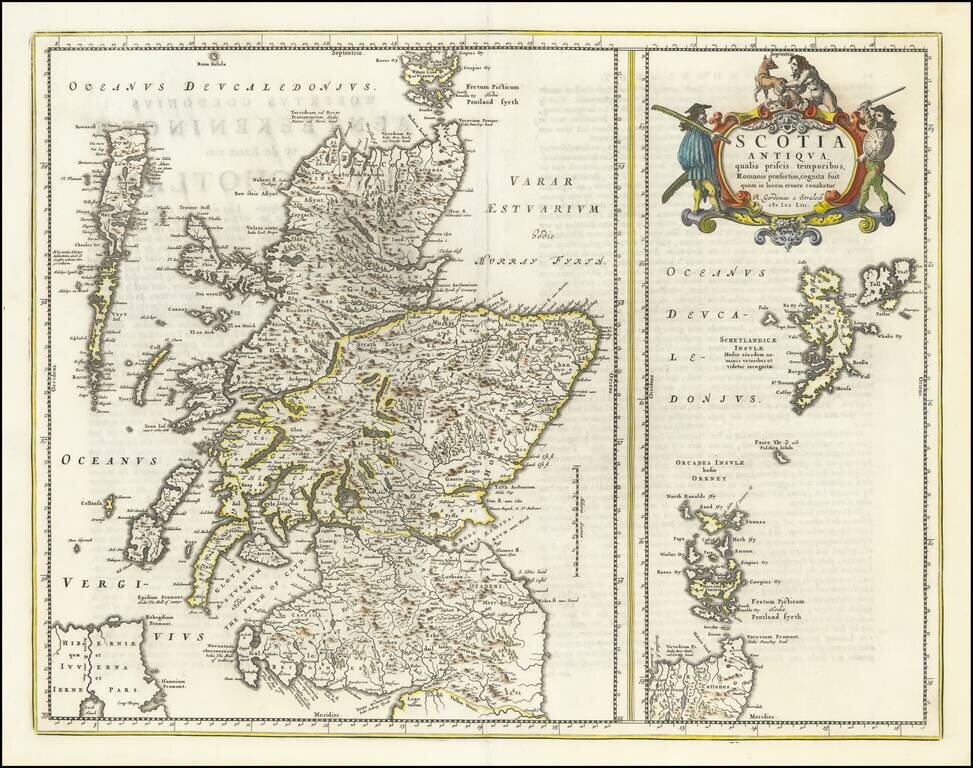
Robert Gordon's Map of Ancient Scotland Fine old example of Blaeu's map of Ancient Scotland, which appeared in the Atlas Maior, heightened in Gold Leaf. Includes a second map of Orcades and Shetlands, with 2 highly decorative cartouches. The map...
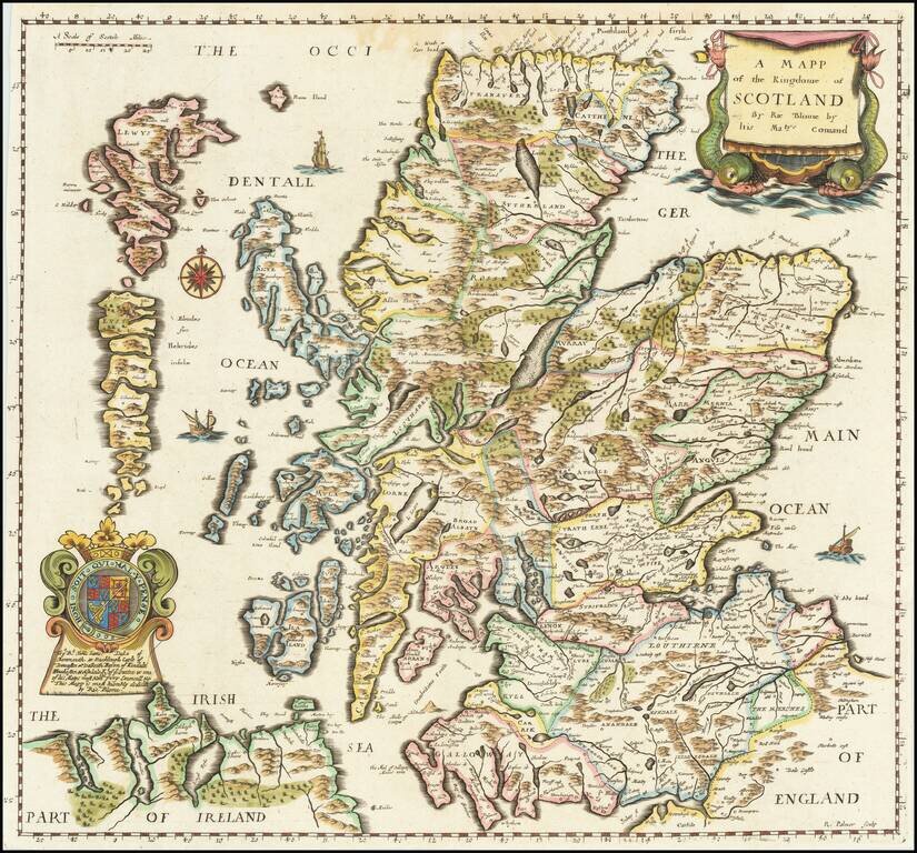
Finely executed map of Scotland, published by Richard Blome. This important early map of Scotland appeared in the first edition Blome's of 'Britannia', his series of county maps. The map includes an elaborate cartouche, coat of arms, and a dedication...
![[Scotland] Scotia Parte Settentrionale . . . [and] Scotia Partie Meridionale . . .](/map/small/35543.jpg)
Nice example of Coronelli's 2 sheet map of Scotland, including 4 large cartouches and table of counties, towns, etc. Showns towns, mountains, rivers, lakes, islands, bays, churches and other features. One of the most decorative large format 17th...
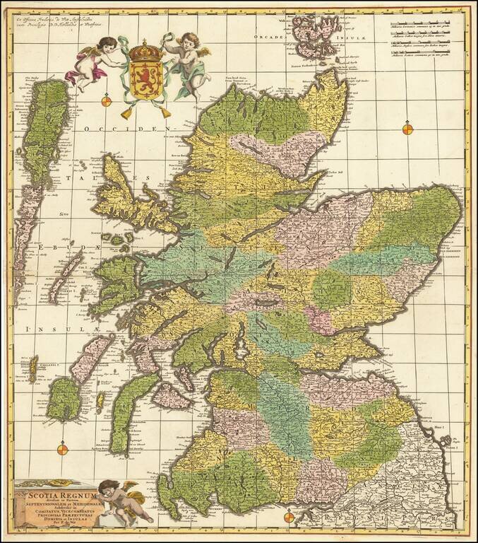
Fine old color example of De Wit's scarce map of Scotland. The map is hand colored by counties, vice counties and other small political subdivisions, and includes tremendous detail. Decorative cartouche and coat of arms.
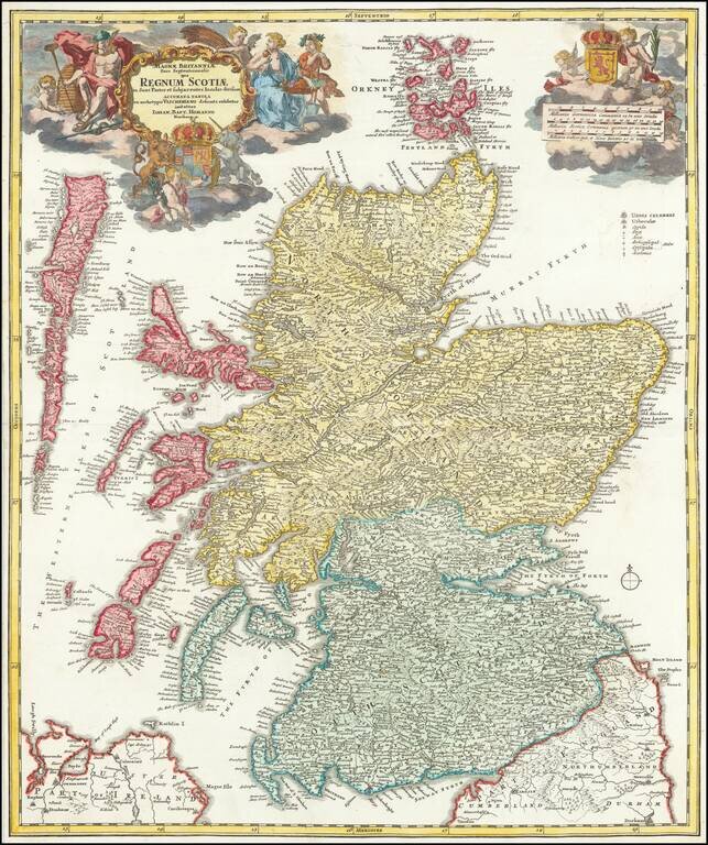
Striking Early 18th Century Map of the Kingdom of Scotland Fine dark impression of Johann Baptiste Homann's decorative map of Scotland, with 2 large format cartouches, coats of arms and other decorations. Credit is given to Nicholas Visscher as the...
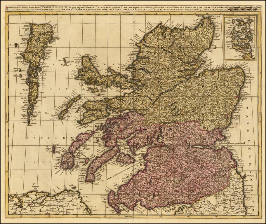
Scarce and highly detailed map of Scotland, published by Gerard and Leonard Valk. The map locates towns, roads, rivers, lakes, islands, etc. The map has an inset of the Orkney Islands in the upper-right corner.
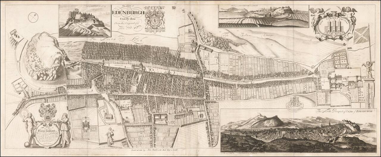
Rare Decorative Plan and View of Edinburgh Dedicated to George Lockhart esq. Rare town plan, bird's-eye view and prospect of Edinburgh, engraved by the Scots mapmaker Andrew Johnston, and first published in 1714. The map first appeared in the...
A nice example of Albrizzi's scarce map of Scotland, with 2 decorative cartouches. The map is remarkably detailed, showing towns, roads, rivers, mountains, lakes, etc.
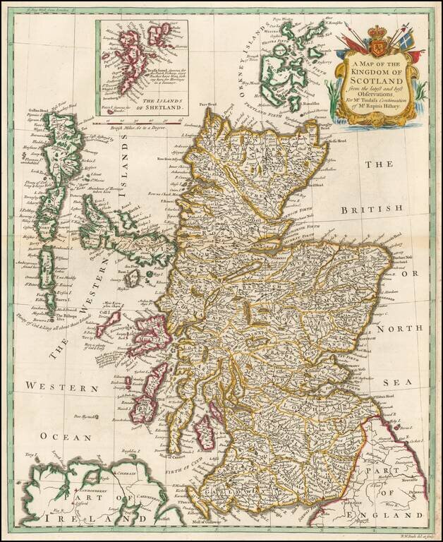
A handsome mid eighteenth century map of Scotland, on a scale of some nineteen miles to the inch, with a cartouche. Interspersed among the place names are some interesting notes and comments - "Aggat & Chrystal Marble found here", "Abundance of...
Detailed map of Scotland, showing towns, rivers, lakes, islands, bays, etc. Fine dark impression.
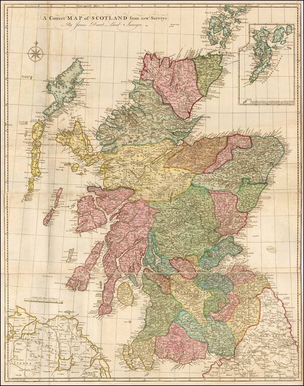
Finely executed map of Scotland, based upon James Dorret's General Map of Scotland . . . , issued in 1750. Dorret's map of Scotland was the standard depiction of Scotland for the next 40 years, used by the likes of Thomas Kitchin, Marcus Armstrong,...
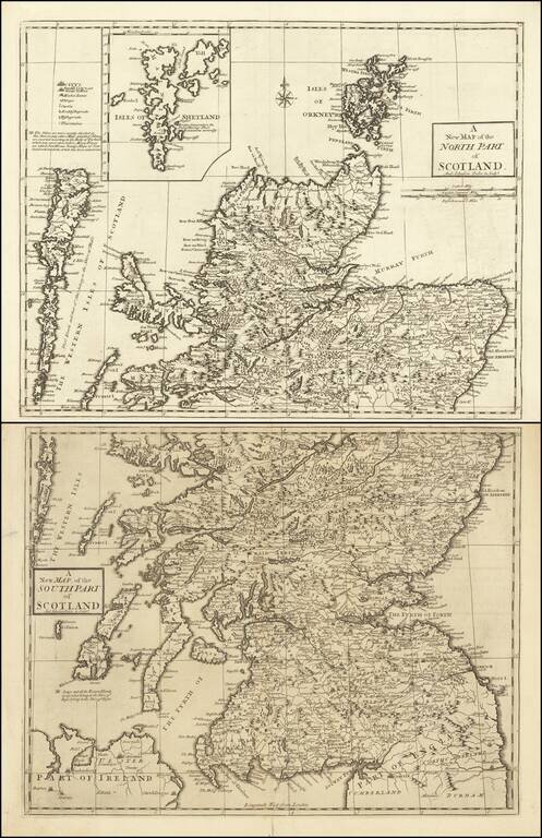
Finely engraved pair of maps comprising northern and southern Scotland, drawn and engraved by Andrew Johnston, published in the third edition of William Camden's 'Britannia' in 1753. The maps provide a meticulous accounting of the towns, rivers,...
Decorative map of Scotland, with an elaborate title cartouche. From Bonne's Atlas Moderne.
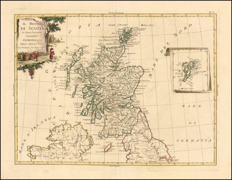
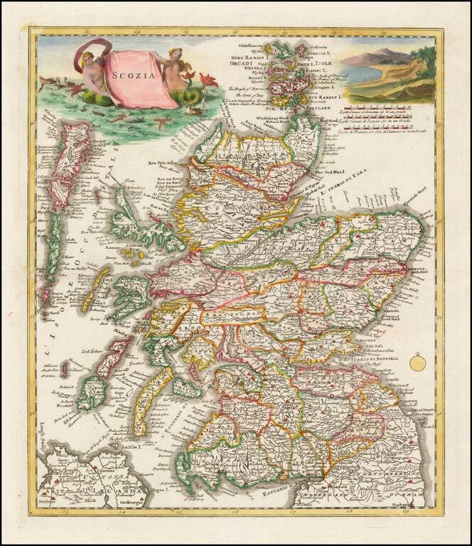
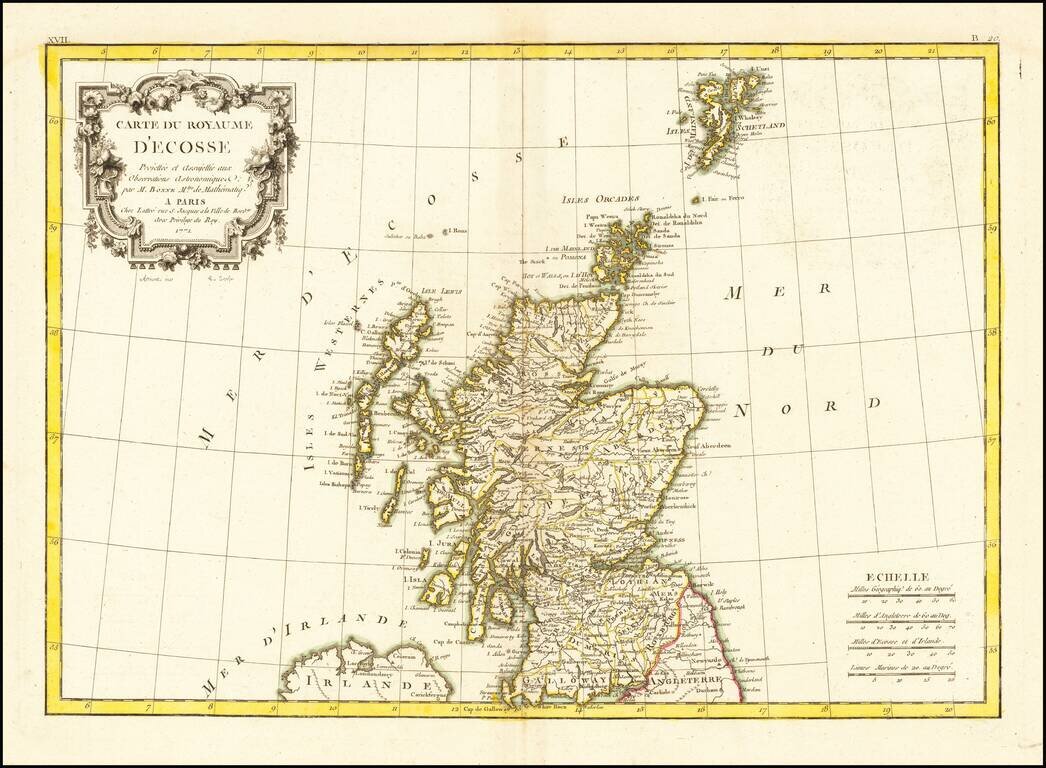
Decorative Italian map of Scotland, with an attractive inset of the Shetland Islands. The map appeared in Antonio Zatta's 4 volume 'Atlante Novissimo". Zatta was a major Italian cartographer of the time, and his works are increasingly popular with...
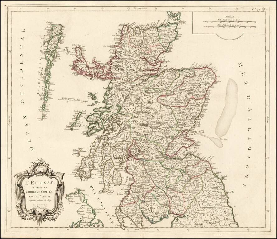
Decorative Italian map of Scotland, published by Santini in Venice and engraved by Remondini. The map includes a decorative cartouche and scale of miles in the top right corner. The map is colored by the early provinces and counties, with the...