logo

1885. Sud-Polar-Karte . . . 1885

  • Sud-Polar-Karte . . . 1885

Sud-Polar-Karte . . . 1885 information:

Year of creation: 
Resolution size (pixels): 
 10699x8914 px
Disk Size: 
 24.7829MiB
Number of pages: 
 1
Place: 
 Gotha
Author: 

Print information. Print size (Width x height in inches):
Printing at 72 dpi 
  148.6 х 123.81
Printing at 150 dpi 
 71.33 х 59.43
Printing at 300 dpi 
 35.66 х 29.71

An example of detailing the file of this map of in a printable high-resolution:

Click to open in high resolution (open in new tab).
Attention! this is just the central piece (central area 960x960 px) of the map file!
This is an example, so that you can see and study the level of detail of a given map. The entire Map will be fully available after payment!

Sud-Polar-Karte . . . 1885

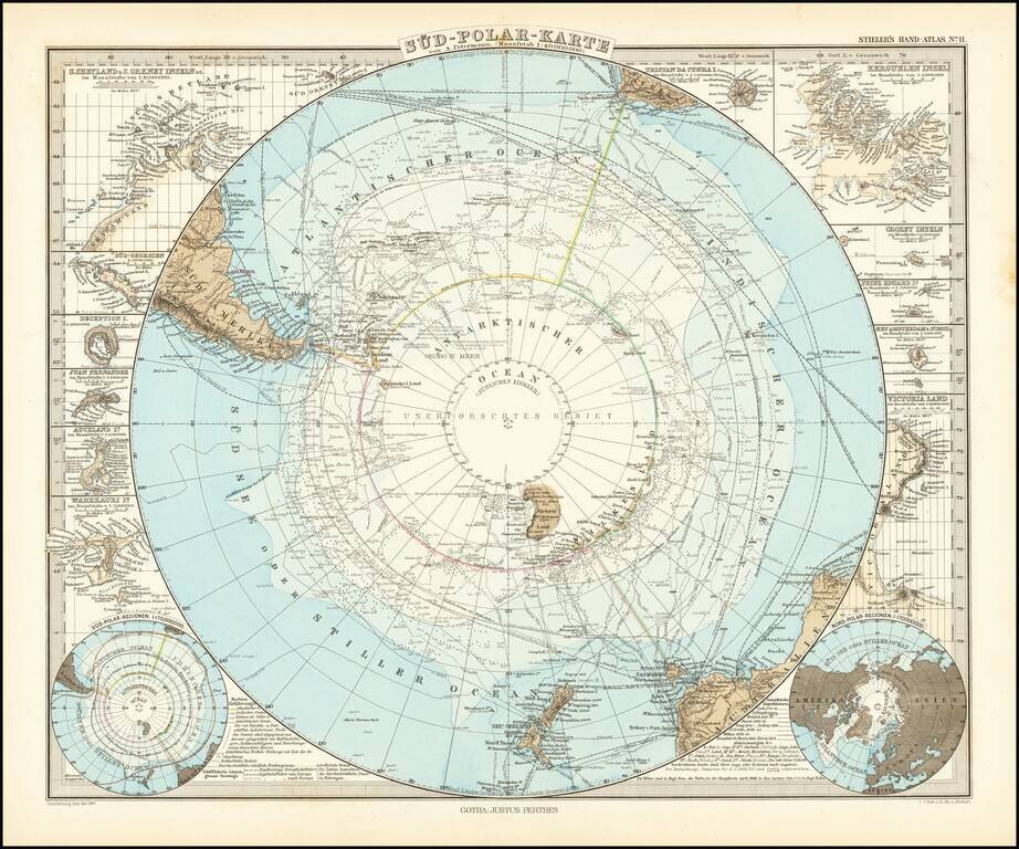
Very detailed map of the south polar regions, illustrating the great precision of Stieler's work.

Remarkable amount of explorer details, including:

  • Cook 1772-75
  • Bellinghausen 1819-21
  • Wedell 1822-23
  • Biscoe 1830-32
  • Kemp 1834
  • Ballen 1839
  • D'Urville 1838-40
  • Wilkes 1839-40
  • Ross 1840-43
  • Moore 1845
  • Nares 1874

The map is ringed with more than a dozen inset maps, showing mostly Islands in the southern most part of the hemisphere.


Special conditions for students!

If you are a student, write to us in telegram: @antiquemaps and indicate what material you need and for what work you need a map in high detail. We are ready to provide material on special terms. For students only!

Item information:

Year of creation:
Size:
10699x8914 px
Disk:
24.7829MiB
Number of pages:
1
Place:
Gotha
Author:
Adolf Stieler.
$14.99

Related item