Map size in jpg-format: 47.4956MiB
Click to open in high resolution (open in new tab).
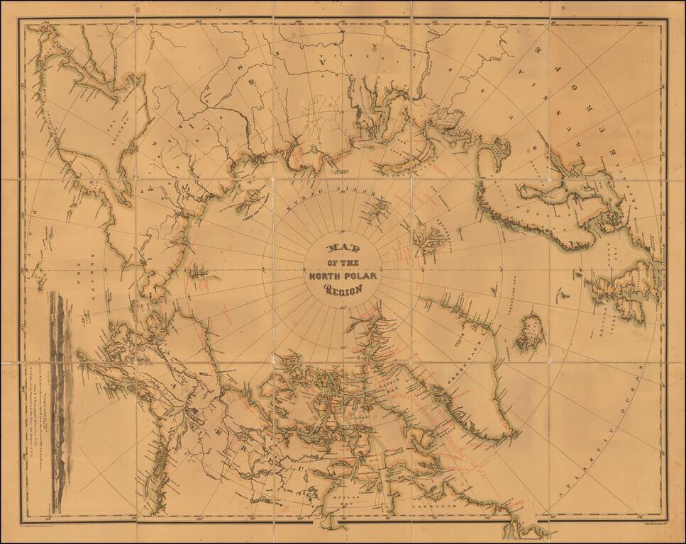
Interesting map of the North Polar regions.
The map provides a remarkable overview of Polar Exploration up to the mid-1870s. Approximately 70 explorers spanning four centuries are noted on the map, including the dates of voyages and coastlines covered, etc.
The map combines information from explorations as early as the 16th and 17th centuries, although the majority are 19th century expeditions.
The map was produced to accompany the posthumous report of Captain Charles F. Hall's 1864-69 expedition to determine the fate of the British Arctic explorer and cause célèbre, Sir John Franklin. It includes both Franklin's probable route to his final destination at King William's Land and Hall's arrival there in 1869. The map also includes the details of Captain Hall's final, fatal voyage of 1871, which was the first American attempt to reach the North Pole. The map shows the furthest point north achieved by the expedition, as well as the scattered locations from which the expedition's survivors were rescued. These include the path via which one group of survivors drifted on an ice flow for six months and 1800 miles before their rescue near the Labrador coast.
The map provides significant up to date information on the effort to discover a Northeast Passage, which would finally be discovered 1879 by Adolf Erik Nordenskiöld. The map includes Nordenskiöld's corrections of the mapping of the north coast of Asia.
A fine example of this fascinating documentation of Arctic exploration in the late 19th Century.
If you are a student, write to us in telegram: @antiquemaps and indicate what material you need and for what work you need a map in high detail. We are ready to provide material on special terms. For students only!
![[Eastern Hemisphere Globe Gores] (Nova et integra universi Orbis descriptio)](/map/small/54480.jpg)

