logo

1862. Wellington Channel, Melville Island &c. from Admiralty Chart

  • Wellington Channel,  Melville Island &c. from Admiralty Chart

Wellington Channel, Melville Island &c. from Admiralty Chart information:

Year of creation: 
Resolution size (pixels): 
 2273x1208 px
Disk Size: 
 506793B
Number of pages: 
 1
Place: 
 London
Author: 

Print information. Print size (Width x height in inches):
Printing at 72 dpi 
  31.57 х 16.78
Printing at 150 dpi 
 15.15 х 8.05
Printing at 300 dpi 
 7.58 х 4.03

An example of detailing the file of this map of in a printable high-resolution:

Click to open in high resolution (open in new tab).
Attention! this is just the central piece (central area 960x960 px) of the map file!
This is an example, so that you can see and study the level of detail of a given map. The entire Map will be fully available after payment!

Wellington Channel,  Melville Island &c. from Admiralty Chart

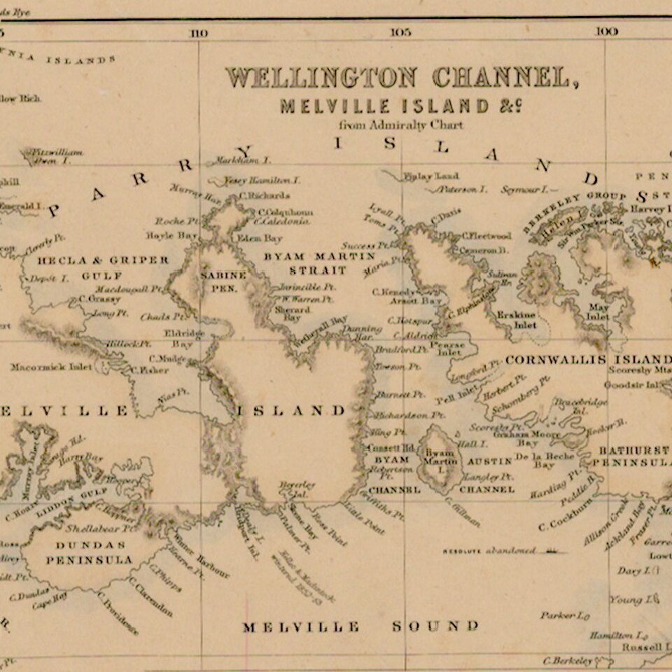
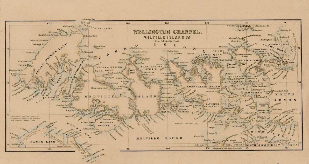
Interesting map of the Region being explored by the British in the second half of the 18th Century, with many up to date discoveries and place names.


Special conditions for students!

If you are a student, write to us in telegram: @antiquemaps and indicate what material you need and for what work you need a map in high detail. We are ready to provide material on special terms. For students only!

Item information:

Year of creation:
Size:
2273x1208 px
Disk:
506793B
Number of pages:
1
Place:
London
Author:
Anonymous.
$9.99

Related item