Map size in jpg-format: 61.6104MiB
Click to open in high resolution (open in new tab).
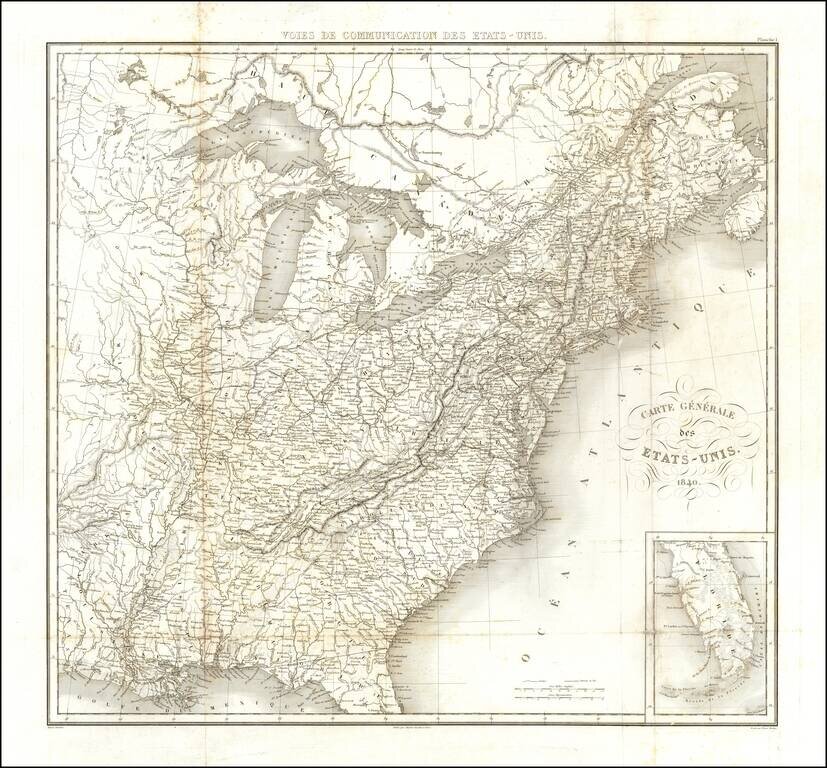
Detailed map of the United States, engraved by Tardieu for Michael Chevalier's Historie et description des voies de Communication aux Etats-Unis.
The map focuses on the early railroad lines throughout the United States as of 1840.
Pierre Antoine Tardieu (1784-1869), also known to sign his works as PF Tardieu, was a prolific French map engraver and geographer. The Tardieu family, based in Paris, was well known for their talent in engraving, cartography, and illustration. Pierre Antoine’s father, Antoine Francois Tardieu, was an established cartographer who published numerous atlases. His son is said to have collaborated with him for many years before establishing his own independent career.
Pierre Antoine Tardieu’s most famous work includes engravings of the islands of La Palma and Tenerife, for which in 1818 he was awarded a bronze medal by King Louis-Phillipe for the beauty and accuracy of his mapping. Other famous work includes his mapping of Louisiana and Mexico, engravings of Irish counties, maps of Russia and Asia, and his highly celebrated illustrations of all the provinces of France. He was also the first mapmaker to engrave on steel.
Tardieu was a popular map engraver in his lifetime, enjoying the patronage of the likes of Alexander von Humboldt and respect among his peers. In 1837, he was appointed the title Chevalier de la Légion d’honneur. As was written in his obituary in the Bulletin of the Geographical Society of France, he was renowned for his combination of technical talent and scholarly research skills and praised for furthering his family’s well-respected name in the scientific arts.
If you are a student, write to us in telegram: @antiquemaps and indicate what material you need and for what work you need a map in high detail. We are ready to provide material on special terms. For students only!

![[Signed Political Satire Artwork] Vietnam ... Vietnam ... Vietnam ...](/map/small/68726.jpg)
