logo

1839. United States

  • United States

Map size in jpg-format: 18.9848MiB

Download "United States", in high resolution.

United States information:

Year of creation: 
Resolution size (pixels): 
 7678x9673 px
Disk Size: 
 18.9848MiB
Number of pages: 
 1
Place: 
 Philadelphia
Author: 

Print information. Print size (Width x height in inches):
Printing at 72 dpi 
  106.64 х 134.35
Printing at 150 dpi 
 51.19 х 64.49
Printing at 300 dpi 
 25.59 х 32.24

An example of detailing the file of this map of in a printable high-resolution:

Click to open in high resolution (open in new tab).
Attention! this is just the central piece (central area 960x960 px) of the map file!
This is an example, so that you can see and study the level of detail of a given map. The entire Map will be fully available after payment!

United States

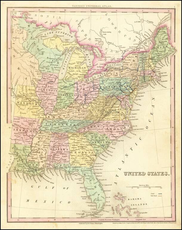
Tanner's scarce map of the United States, including massive unnamed region west of Lake Michigan and oddly shaped Michigan.

Shows towns, roads, rivers, lakes, forts, etc.


Special conditions for students!

If you are a student, write to us in telegram: @antiquemaps and indicate what material you need and for what work you need a map in high detail. We are ready to provide material on special terms. For students only!

Item information:

Year of creation:
Size:
7678x9673 px
Disk:
18.9848MiB
Number of pages:
1
Place:
Philadelphia
Author:
Henry Schenk Tanner.
$14.99

Related item