Map size in jpg-format: 26.9913MiB
Click to open in high resolution (open in new tab).

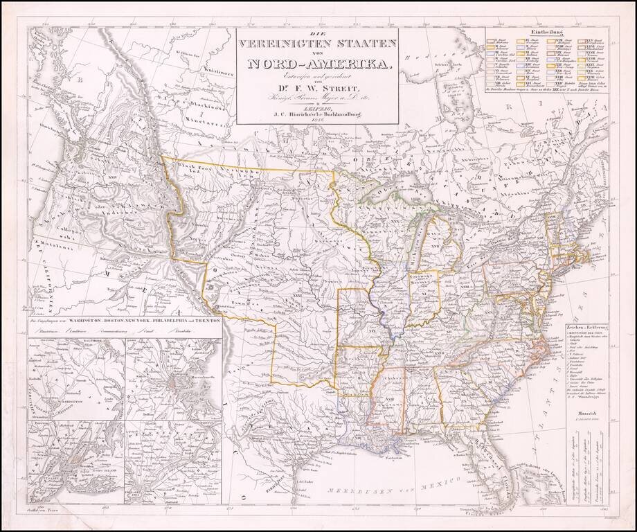
Rare late edition of Streit's fascinating map of the United States with inset maps of the region around Washington DC, Boston, Philadelphia and New York.
Very nice detail along the Upper Missouri River and in Oregon Territory.
The west is configured as it appeared immediately before the Treaty of Guadalupe Hidalgo, with Texas still shown as a Republic, albeit 2 years after it gained admission into the Union. Two Salt Lakes and rivers connecting each to the Pacific Ocean are prominent in the Cartography of California.
This is the first time we have ever seen this 1846 example.
If you are a student, write to us in telegram: @antiquemaps and indicate what material you need and for what work you need a map in high detail. We are ready to provide material on special terms. For students only!

![[Signed Political Satire Artwork] Vietnam ... Vietnam ... Vietnam ...](/map/small/68726.jpg)
