Map size in jpg-format: 109.468MiB
Click to open in high resolution (open in new tab).

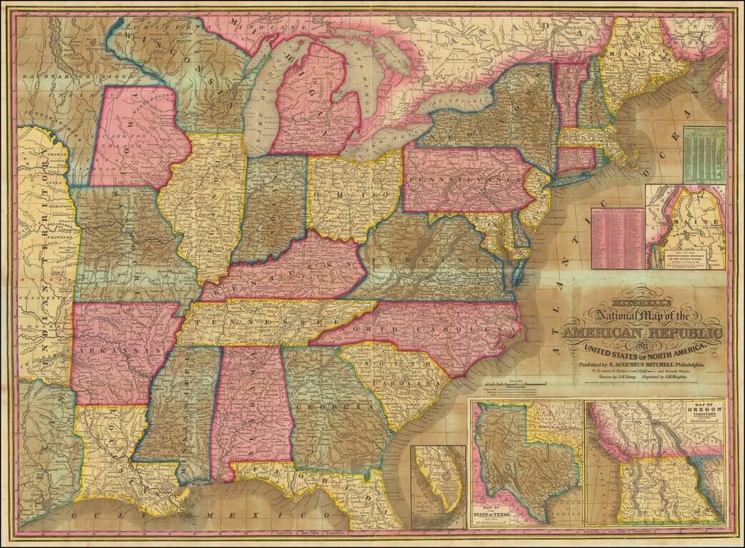
Including Unusual Territorial Representations of Iowa and Wisconsin / New State of Texas / Upper California
Good example of Mitchell's most popular map of the United States of the period.
The map extends west to Texas, Indian Territory and a massive ephemeral Iowa Territory, which at the time extended to the Missouri River and Canada.
Includes large large inset maps of:
If you are a student, write to us in telegram: @antiquemaps and indicate what material you need and for what work you need a map in high detail. We are ready to provide material on special terms. For students only!

![[Signed Political Satire Artwork] Vietnam ... Vietnam ... Vietnam ...](/map/small/68726.jpg)
