Map size in jpg-format: 57.3214MiB
Click to open in high resolution (open in new tab).
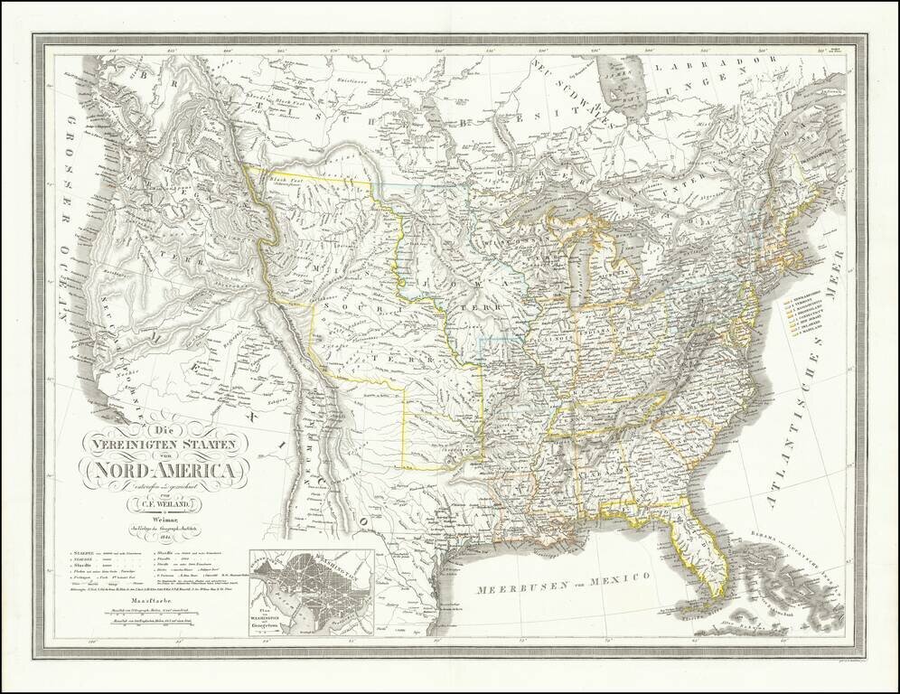
Republic of Texas
Fine dark impression of this early coast to coast map of the United States, issued just after the declaration of Independence for the Republic of Texas in 1836.
Marvelous large format map of the United States and the Republic of Texas. The map includes a marvelous treatment of the Western Territories of the United States, including a massive Neu-Californien, large "Oregan" Territory, extending to the Rocky Mountains, and large Missouri Territory, pre-dating the appearance of Nebraska Territory, Kansas, etc.
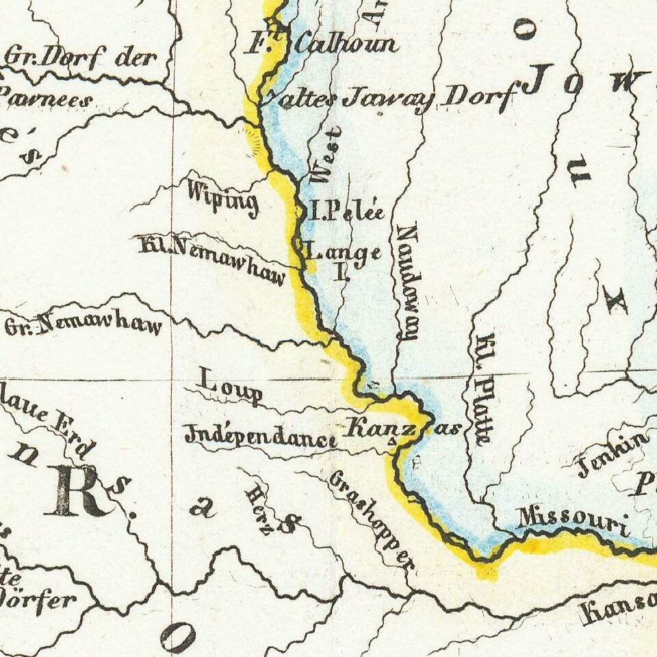
In this edition, a curious serpentine boundary is shown for the Republic of Texas, with many new placenames added for the first time, including:
Upper California is shown in great detail, immediately before the explorations of John Fremont would eliminate the cartographic myths of the two large salt lakes (Timanogos and Teguayo) and the river systems connecting each to the Pacific Ocean. In fact, this map is one of the most remarkably clear and bold depictions of these two mythical lakes and rivers, showing side by side with a relatively accurate and modern depiction of the Upper Colorado River, which had been explored for many years by Spanish missionaries, offering a stark contrast of the semi-explored regions of the West and those which were still virtually unknown.
In Oregon Territory, the river systems reflect the explorations of Lewis & Clark, the Hudson Bay Company outposts, etc.
If you are a student, write to us in telegram: @antiquemaps and indicate what material you need and for what work you need a map in high detail. We are ready to provide material on special terms. For students only!

![[Signed Political Satire Artwork] Vietnam ... Vietnam ... Vietnam ...](/map/small/68726.jpg)
