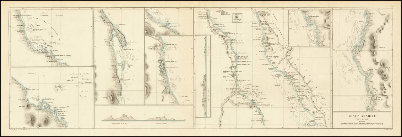
This is an antique map of the middle portion of the Red Sea, referred to on the map as the Sea of Arabia, stretching from approximately the latitude of Medina to the northern coast of Eritrea. This region, one of the most important shipping lanes in...
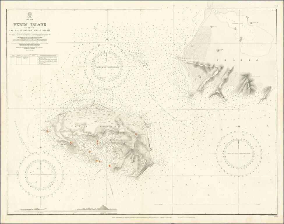
Extremely detailed chart of Perim Island (also called Mayyun in Arabic) in the Strait of Mandeb, at the southern entrance to the Red Sea. Perim is a small but geopolitically important island at the entrance to the Red Sea. With the beginning of the...
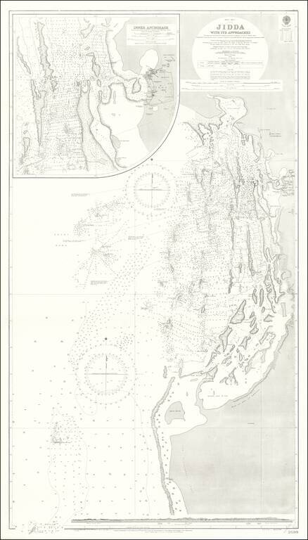
Detailed British Admiralty chart of the approaches to Jeddah, present-day Saudi Arabia, with an inset chart Jeddah Harbor and the city itself. This is undoubtedly one of the better antiquarian maps of the gateway city to Mecca and Medina. Jeddah was...
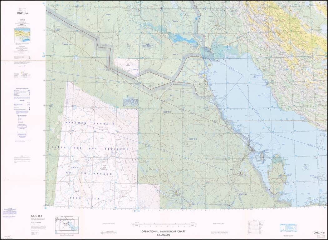
Interesting aeronautical map of the northern half of the Persian Gulf, with great detail of oil wells and pipelines. The map was issued by the Defense Mapping Agency Aerospace Center. The map also features disputed borders and other information...
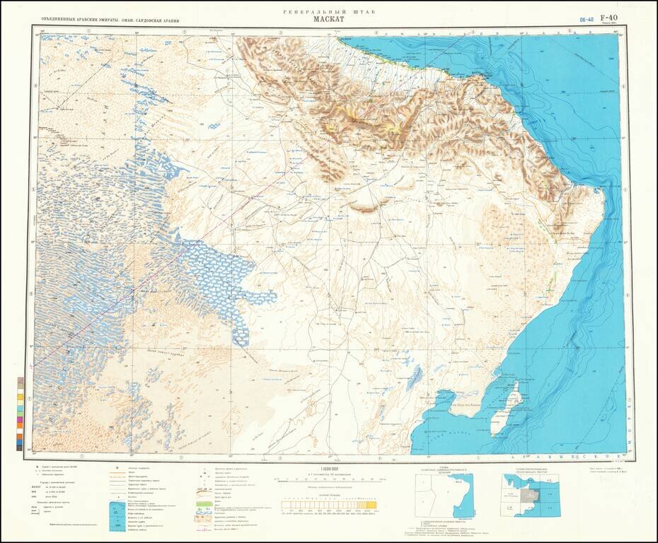
This is an attractive Soviet military map of the region around Muscat, showing part of the United Arab Emirates, Oman, and Saudi Arabia. The map is detailed, showing many cities, rivers, wadis, mountains, and more. The map is particularly detailed...
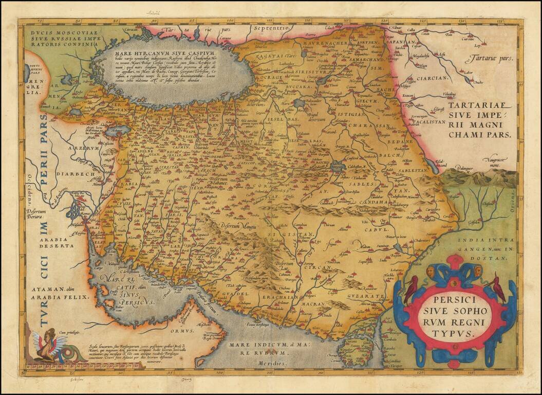
Fine Ortelius Map of Persia from the World’s First Modern Atlas Highly-influential and beautifully-detailed map of Persia from Abraham Ortelius' Theatrum Orbis Terrarum, the first modern atlas of the world. The map shows the Persian Gulf and the...
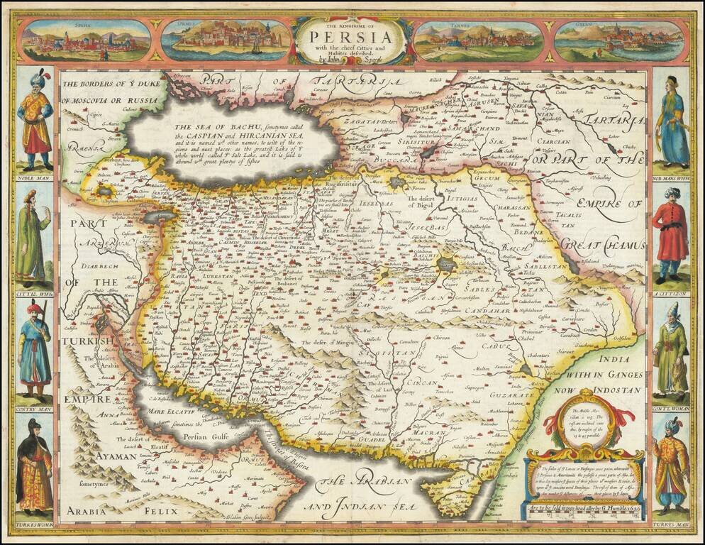
First state of this scarce decorative map of the Persian Empire from the final edition of John Speed's Atlas. Includes four town view vignettes across the top and 4 sets of costumes. The text on the verso provides a colorful Anglo-centric view of life...
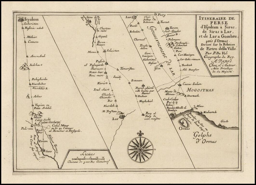
Interesting three-part map showing the journey of Renaissance writer Pietro Della Valle through Persia. The route extends from Isfahan to the Gulf of Hormuz.
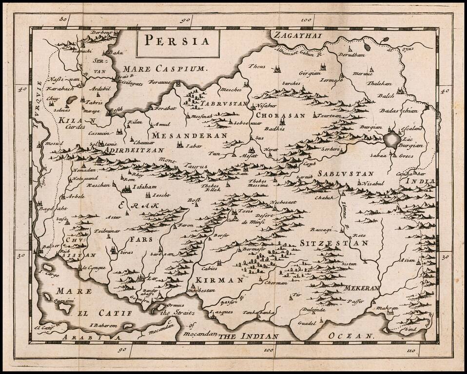
Rare Miniature English Map of Persia Rare map of the Kingdom of Persia, published by Sir Jonas Moore in London. The map appeared in Moore's A New Geography. Many of the plates in the work were engraved by Herman Moll, who had moved to London in...
![[Kashan] Prospect der Stadt Caschan in Persien sunff tag reisen von Ispahan](/map/small/62095.jpg)
Scarce panoramic town-view of Caschan (Iran) near Ispahan with good detail of Mosques etc.
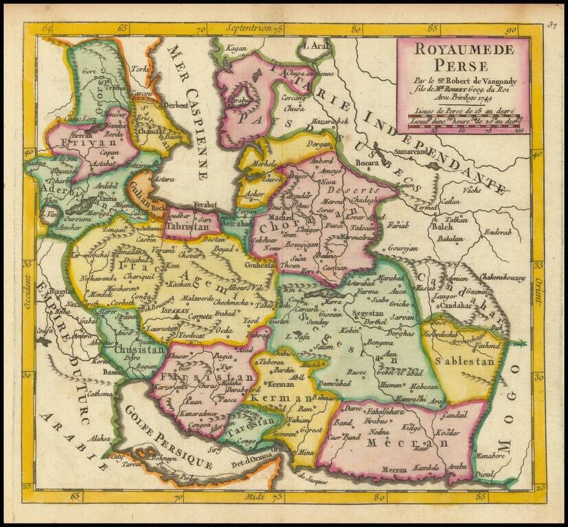
Detailed map of Persia, showing the extent of its territory from the border with the Mogol Empire to the Caucasus and the eastern side of the Caspian Sea. Internal regions are named and colored individually.
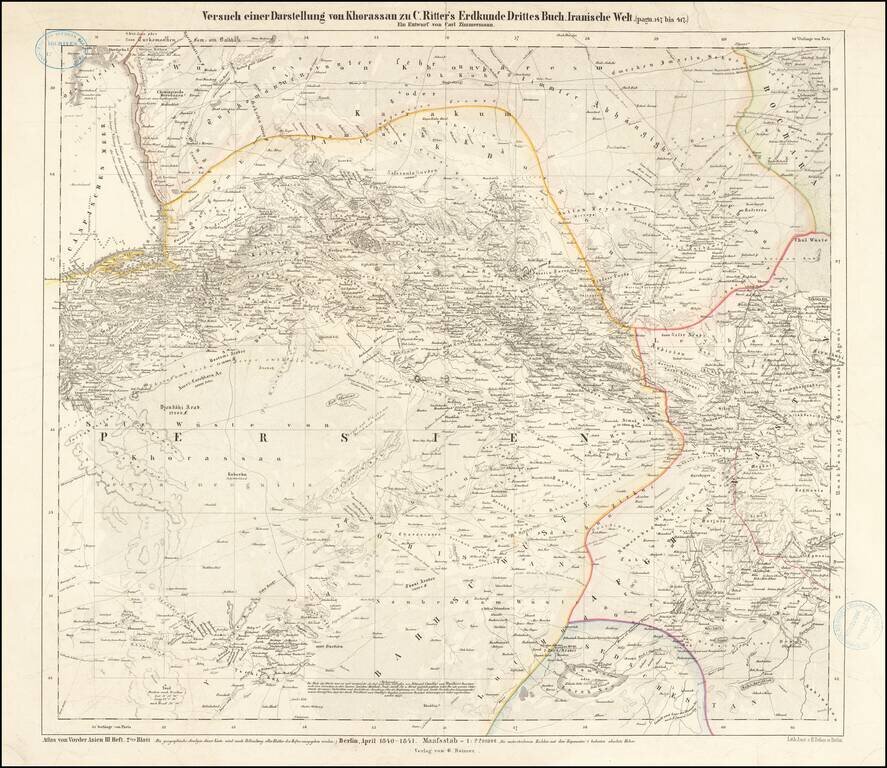
One of two "Earliest maps known to me that indicate a greater readiness to modernize the content of maps of Iran"--Sonja Brentjes, Scientific Historian at the Max Planck Institute. Very Rare. This is a very rare attractive map of the northeastern...
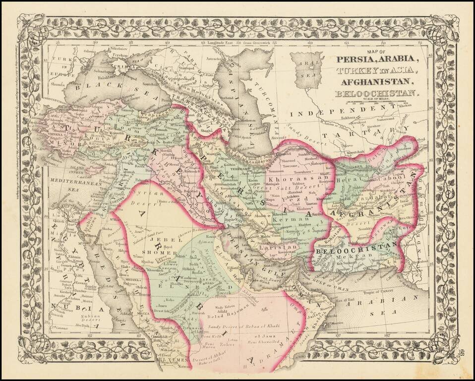
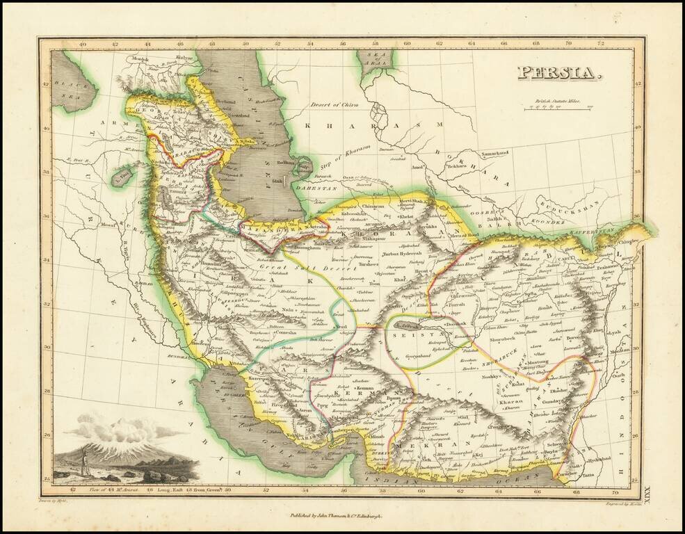
Fine example of Mitchell's map of the Middle East, Persia and Afghanistan, colored by tribal regions.
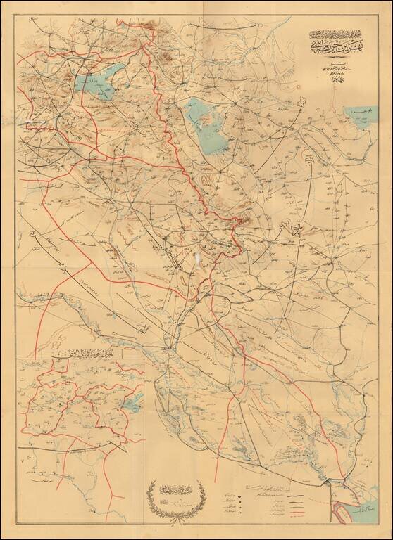
The Berlin-Baghdad Railway Detailed map of Eastern Iraq and Western Iran, published to illustrate the progress of the Baghdad Railway. The map extends from Basra in the South, along the border between Iran and Iraq, up to Lake Urmia and Southeastern...
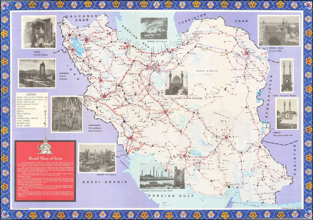
Detailed tourist map of Iran, published in Tehran. The map is focused on transportation around Iran, noting: First Class Roads (Tarmac) Second Class Roads (Dust) Third Class Roads Road Caravan Tracks Railways Projected Railways International...