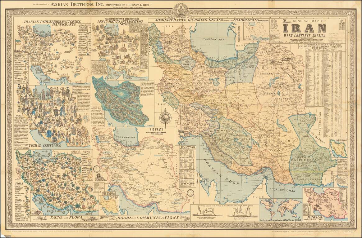
Interesting separately issued map of Iran, published in Tehran by A Sahab, one of the leading Iranian cartographic publishers. The main map is the primary depicts the cities and regions of Iran, with the surrounding maps showing This magnificent map...
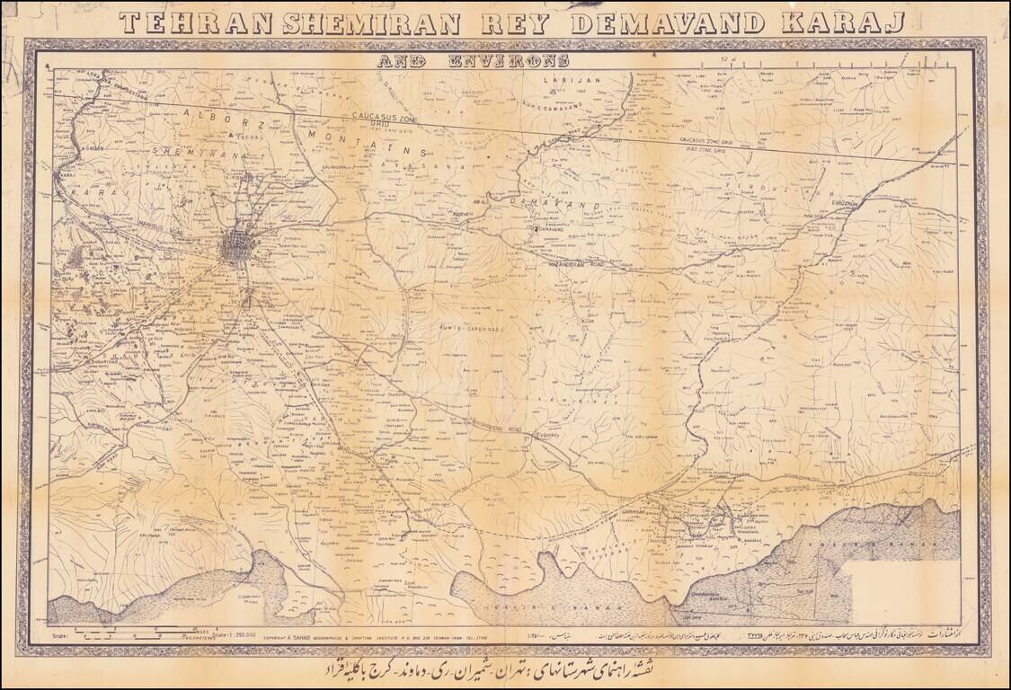
Detailed map of the area around modern Tehran, incorporating Tehran and 4 other cities, published by the Sahab Geographic and Drafting Institute. The map shows an area that is now greater Tehran and the regions to the West, extending to Firukuh and...
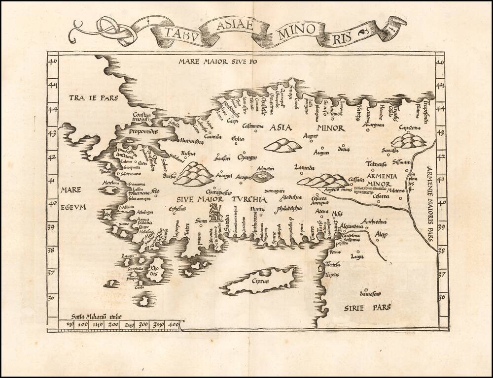
Rare early state of Fries map of Asia Minor and Cyprus, based upon the work of Claudius Ptolemy. Latin text and elaborate decorations on the verso.
Rare Early Map of Asia Minor Nice example of the 1525 edition of Lorenz Fries modern map of Asia Minor and Cyprus, one of the earliest modern maps to focus on this region. First published in Strasbourg by Johannes Gruninger in 1522, Fries map is...
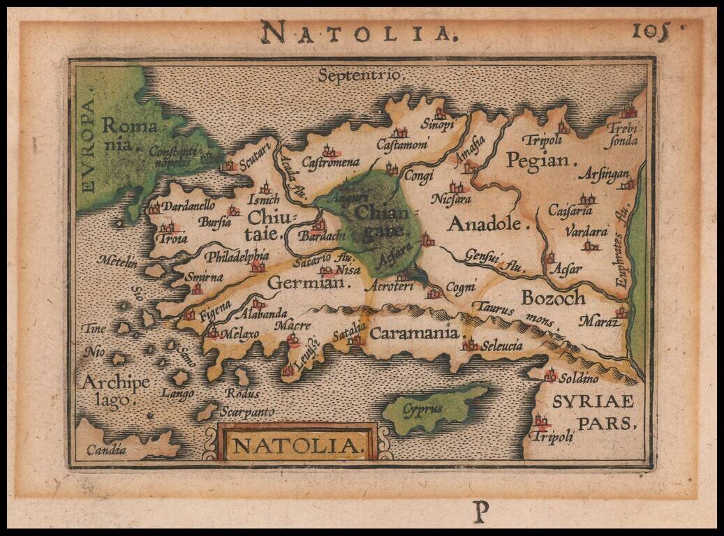
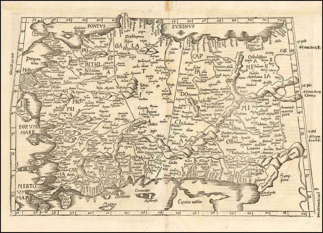
Nice example of this early state of Bertius's map of Asia Minor, which first appeared in an early edition of the Bertius Tabularum Geographicarum, published in Middelburg. The present map is one of the earliest obtainable maps of the region.
![Natoliae Quae Olim Asia Minor Nova Descriptio [with] Aegypti Recentior Descriptio [with] Carthageinis Celeberrimi Sinus Typus [shows Cyprus]](/map/small/35175bp.jpg)
Three detailed regional maps by Ortelius, from his Theatrum Orbis Terrarum, the first modern atlas of the world. The first map covers Asia Minor, Cyprus, and the Eastern Mediterranean. The second map shows the region around the Nile, as far as Aswan....
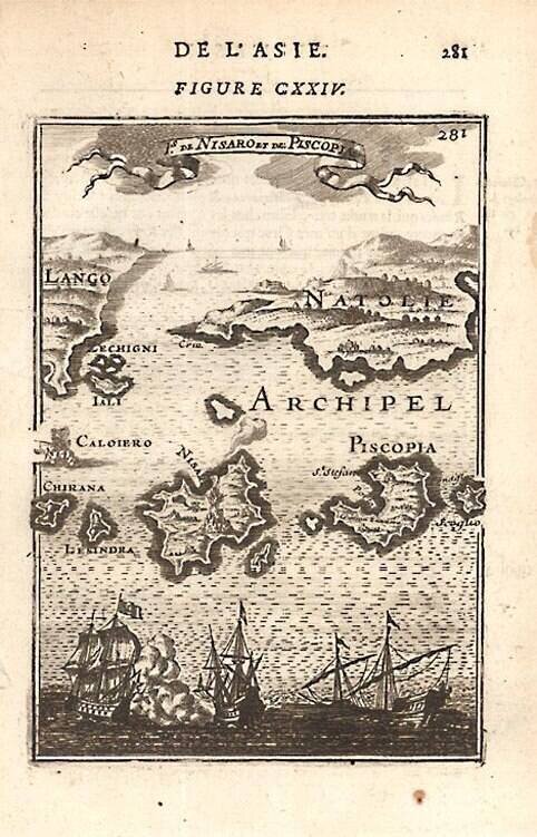
A detailed map showing Grecian Islands. From Mallet's monumental Description de l' Univers, first published in Paris in 1683, perhaps the greatest work of its kind in the 17th Century. Complete sets of this work are now fetching in excess of $15,000.00.
![[First Modern Map of Southern Africa] Tabula Moderna Secunde Porcionis Aphricae](/map/small/66800.jpg)
The First Modern Map of Southern Africa Striking example of renowned mapmaker Martin Waldseemüller's modern map of the southern half of Africa. It was included in the first separate collection of modern maps and made up part of the influential 1513...
![[Tabula Moderna Prime Partis Aphricae]](/map/small/66728.jpg)
The First Modern Map of the North Part of Africa Nice example of renowned mapmaker Martin Waldseemüller's modern map of the northern half of Africa, published in Strasbourg in 1513. This is the first printed modern map of the region, showing North...
![Tab. Mo. Primae Partis Aphricae et Tabula Secunde partis Aphricae. [Verso title.]](/map/small/55749.jpg)
One of the Earliest Obtainable Modern Maps of Africa Nice example of the 1525 edition of Lorenz Fries modern map of the northern part of Africa, the second earliest modern map to focus on the southern part of the Continent. First published in...
![[Africa] Tabula IIII. Aphricae. Hae Sunt E Cognitis Totius Orbis . . . (title on verso)](/map/small/50932.jpg)
Rare, Early Map of North Africa, From an Early Edition of Ptolemy’s Geographia Fine map of Northern Africa, one of the earliest obtainable printed maps of the area, from Lorenz Fries’ influential 1525 edition of Ptolemy’s Geographia. The...
One of the earliest obtainable modern maps of Africa. Extends from the Mountains of the Moon and Cape Bonae Spei in the South to the Mediterranean, being one of the earliest published maps of the continent.
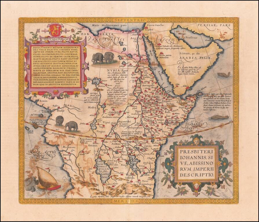
Ortelius’ Map of Central Africa, Chronicling the Christian Kingdom of Prester John Nice old color example of Ortelius' famous map of the Kingdom of Prester John, from his Theatrum Orbis Terrarum, the first modern atlas of the world. The map shows...
![Africae ut terra mariq[ue], lustrata est, propiissima ac vere genuina descriptio, observatis ad unguem gradibus longitudinis et latitudinis. Autore M. Iacobo Castaldo](/map/small/55794.jpg)
Rare old color example of De Jode's first map of Africa, from the 1578 edition of his Speculum Orbis Terrarum. The map is divided into two sections and includes an elephant, lions, battle scene, sailing ships and palm trees. The map is based on the...
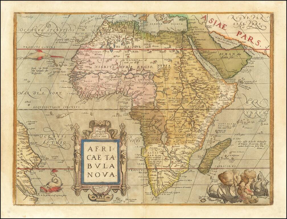
Ortelius’ Africa—One of the Most Influential Maps of the Continent of Africa Finely colored example of Ortelius' map of Africa, from Theatrum Orbis Terrarum, the first modern atlas. The map was one of the first widely-disseminated, modernized...
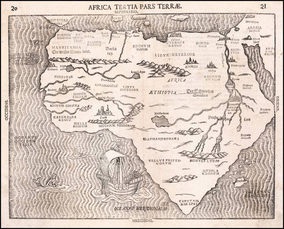
Fine Map of the African Continent, Based on the First Modern Map of Africa Nice example of Heinrich Bunting's scarce map of Africa, from his Itinerarium Sacræ Scripturæ. It is based on the first modern map of Africa, which featured in Sebastian...