Map size in jpg-format: 26.2488MiB
Click to open in high resolution (open in new tab).
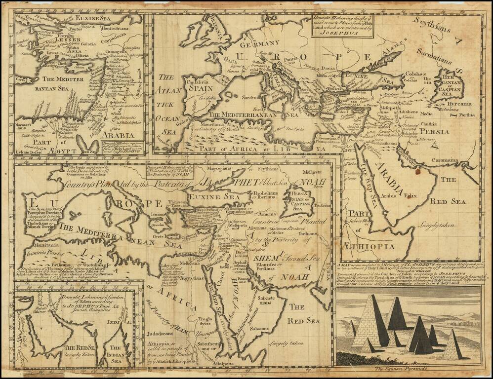
Engraved mapsheet, featuring four maps related to the writings of the Romano-Jewish historian Josephus.
The map was issued in Oxford at the beginning of the 18th century. It includes the following sub-maps:
In the lower-right corner, the Henry, Lord Bishop of London, has been replaced by an engraving of the Pyramids of Egypt.
Wells's map is one of a set of 22 maps dedicated to William, Duke of Glouchester, who at the time of publication of the maps was studying at Oxford. Edward Wells was a teacher of mathematics and geography at Christchurch College of Oxford University. Below the hemispheres is a dedication vignette, with William shown with his tutor under the tree on the right. The 13-year-old William, the heir to the throne, began studies at Christchurch in 1700 at the age of 11 and died a few months after the map was issued. On either side of this are small landscapes, one of the ships arriving in the New World and one of the Radcliffe Camera in Oxford.
Edward Wells was a Church of England clergyman and advocate for education. He published prolifically, including several atlases of the ancient and contemporary world. Wells was the son of a vicar and entered Christ Church, Oxford in late 1686. He graduated BA in 1690, MA in 1693, and worked as a tutor at his college from 1691 to 1702. Then, he entered into a living at Cotesbach, Leicestershire, from where he continued to publish his many works. He attained the degrees of BD and DD in 1704, after he was already at Cotesbach.
From roughly 1698 onward, Wells wrote many sermons, books, and atlases. He focused on catechismal and pastoral works, as well as educational books. For example, some of his first works were mathematics texts for young gentlemen, which included how to use globes and determine latitude and longitude. He also translated classical and Christian texts, sometimes adding geographical annotations.
His descriptive geographies were not overly original works, but they were popular in their time. First, he produced a Treatise of Antient and Present Geography in 1701; it went on to four more editions. Next was a Historical Geography of the New Testament (1708), accompanied by a Historical Geography of the Old Testament (1711-12).
If you are a student, write to us in telegram: @antiquemaps and indicate what material you need and for what work you need a map in high detail. We are ready to provide material on special terms. For students only!


![[Early Montanus World Map in Volume Eight of the Plantin Polyglot Bible]](/map/small/53766.jpg)