logo

1719. Carte De La Terre Sainte Divisee Dans Toutes Ses Parties Selon Le Nombre Des Tribus D'Israel . . .

  • Carte De La Terre Sainte Divisee Dans Toutes Ses Parties Selon Le Nombre Des Tribus D'Israel . . .

Carte De La Terre Sainte Divisee Dans Toutes Ses Parties Selon Le Nombre Des Tribus D'Israel . . . information:

Year of creation: 
Resolution size (pixels): 
 1490x1208 px
Disk Size: 
 604165B
Number of pages: 
 1
Place: 
 Amsterdam
Author: 

Print information. Print size (Width x height in inches):
Printing at 72 dpi 
  20.69 х 16.78
Printing at 150 dpi 
 9.93 х 8.05
Printing at 300 dpi 
 4.97 х 4.03

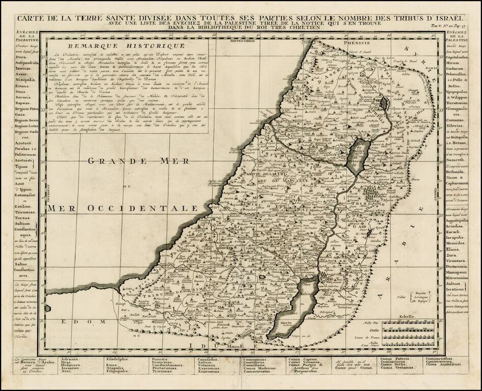
Detailed map of the Holy Land, from Chatelain's Monumental Atlas Historique et Methodique.

The map extends from Gaza to Sidon and identifies the 12 Tribes and many other historical features.

Laor, E. 213.

Special conditions for students!

If you are a student, write to us in telegram: @antiquemaps and indicate what material you need and for what work you need a map in high detail. We are ready to provide material on special terms. For students only!

Item information:

Year of creation:
Size:
1490x1208 px
Disk:
604165B
Number of pages:
1
Place:
Amsterdam
Author:
Henri Chatelain.
$9.99

Related item