Map size in jpg-format: 91.3308MiB
Click to open in high resolution (open in new tab).
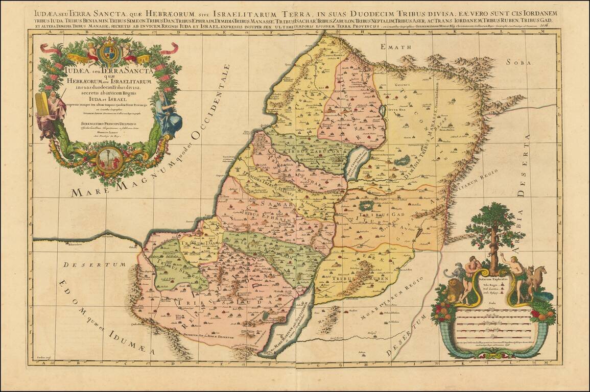
Striking large format map of the Holy Land, with tribal divisions and a wealth of place names and topographical detail, including the locations of royal and priestly cities, and sanctuaries.
Decorated with two fine cartouches. The title cartouche includes four figures; at top Moses and Aaron flank the royal coat of arms, and at bottom, a Roman soldier and a pagan figure appear on either side of the Ark of the Covenant. The lower mileage-scale cartouche features Adam and Eve in the Garden of Eden.
The map shows the lands of the 12 Tribes of Israel.
Alexis-Hubert Jaillot (ca. 1632-1712) was one of the most important French cartographers of the seventeenth century. Jaillot traveled to Paris with his brother, Simon, in 1657, hoping to take advantage of Louis XIV's call to the artists and scientists of France to settle and work in Paris. Originally a sculptor, he married the daughter of Nicholas Berey, Jeanne Berey, in 1664, and went into partnership with Nicholas Sanson's sons. Beginning in 1669, he re-engraved and often enlarged many of Sanson's maps, filling in the gap left by the destruction of the Blaeu's printing establishment in 1672.
If you are a student, write to us in telegram: @antiquemaps and indicate what material you need and for what work you need a map in high detail. We are ready to provide material on special terms. For students only!


![[Early Montanus World Map in Volume Eight of the Plantin Polyglot Bible]](/map/small/53766.jpg)