logo

1625. Terrae Chanaan Inter XII Tribus Isrel Distributae Orthographia

  • Terrae Chanaan Inter XII Tribus Isrel Distributae Orthographia

Terrae Chanaan Inter XII Tribus Isrel Distributae Orthographia information:

Year of creation: 
Resolution size (pixels): 
 5329x4185 px
Disk Size: 
 5622630B
Number of pages: 
 1
Place: 
 Netherlands
Author: 

Print information. Print size (Width x height in inches):
Printing at 72 dpi 
  74.01 х 58.13
Printing at 150 dpi 
 35.53 х 27.9
Printing at 300 dpi 
 17.76 х 13.95

An example of detailing the file of this map of in a printable high-resolution:

Click to open in high resolution (open in new tab).
Attention! this is just the central piece (central area 960x960 px) of the map file!
This is an example, so that you can see and study the level of detail of a given map. The entire Map will be fully available after payment!

Terrae Chanaan Inter XII Tribus Isrel Distributae Orthographia

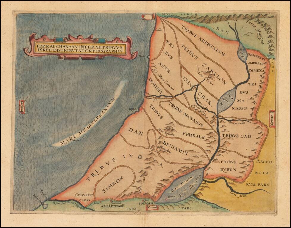
Finely colored example of this early map of the Holy Land, showing the distribution of the 12 Tribes of Israel within the Holy Land.

The present example is a rare re-issue of the original 1611 map, with "Isrel" spelled incorrectly in the title.

Laor, Holy Land, Anonymous, entry 911

Special conditions for students!

If you are a student, write to us in telegram: @antiquemaps and indicate what material you need and for what work you need a map in high detail. We are ready to provide material on special terms. For students only!

Item information:

Year of creation:
Size:
5329x4185 px
Disk:
5622630B
Number of pages:
1
Place:
Netherlands
Author:
Augustino Torniello.
$14.99

Related item