Map size in jpg-format: 1.03296MiB
Click to open in high resolution (open in new tab).
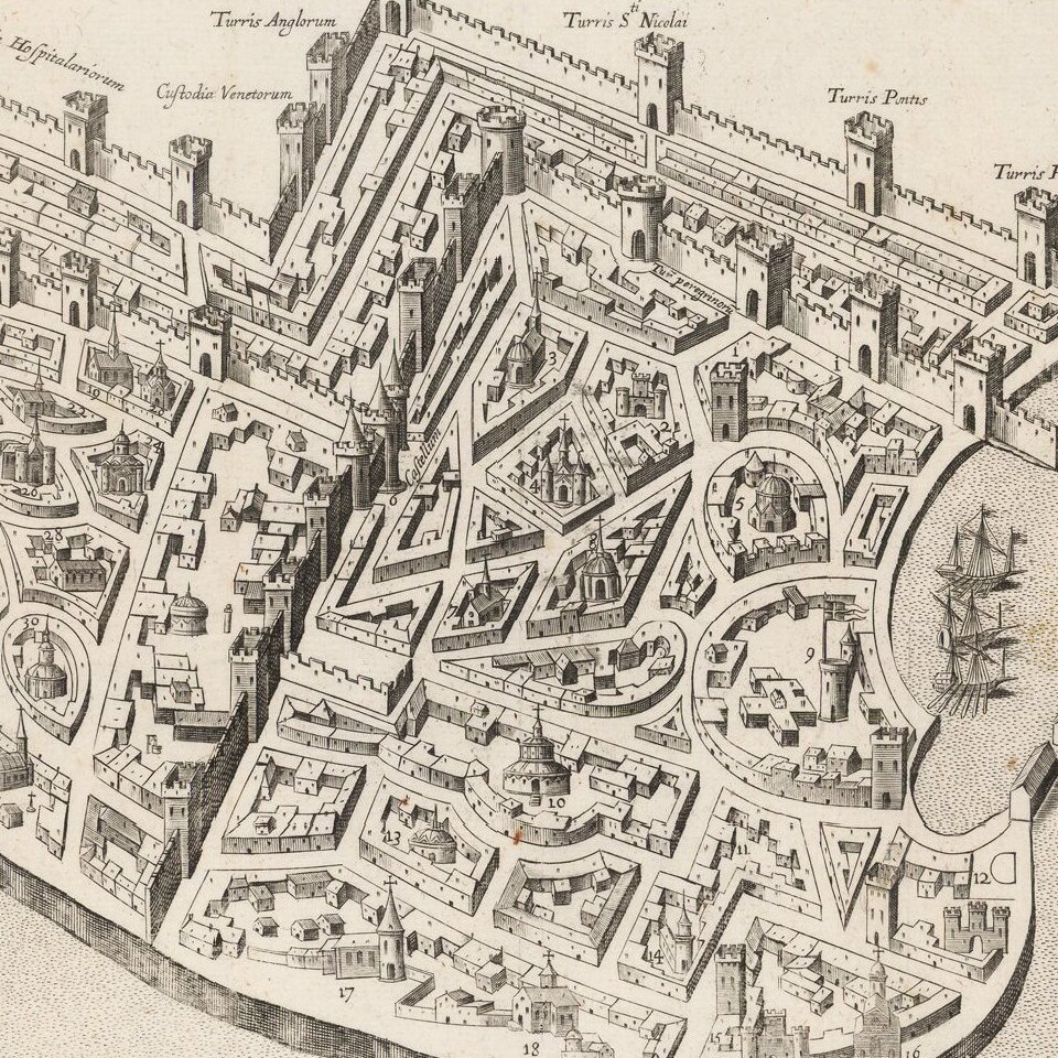
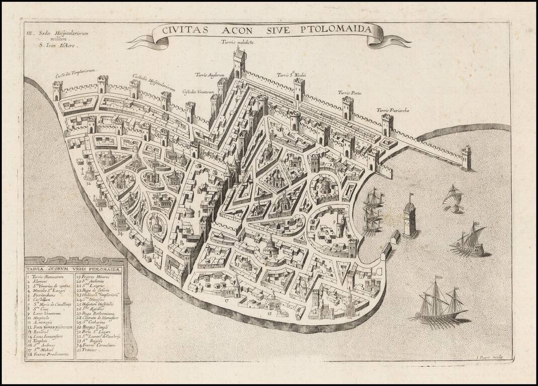
Extremely rare plan of Acre, based upon the Vesconte-Sanuto plan, intended to illustrate a period when the town was under the control of the Knights of St. John. Shows extensive fortifcations, town plan, buildings and a key identifying significant landmarks. Acre or Akko is one of the oldest continuously inhabited cities in the World. The City dates its history back to Pharaoh Thutmose III (1504-1450 BC). In its time, it was one of the major ports in the Middle East, on a par with Alexandria and Constantinople. The town became a part of the empire of Alexander the Great after his conquest of 332 BC. It was later seized by Egyptian King Ptolemy II, who renamed the city Ptolemais in the 2nd Century BC. The name flourished until the Muslim's conquered the City in the 7th Century AD. In 1104, the town was conquered by the Knights of Malta and the town was renamed St. Jean d'Acre. In 1291, the Mamluks invaded and destroyed the City, killing all the remaining Crusaders, ending its ancient history. Sheik Daher el-Omar re-established the city in the mid-18th Century when he created a small Kingdom within the Ottoman Empire. Acre was later fortified by Ahmad Pasha al Jazzer during his time as Turkish Governor (1775-1804). Napoleon attempted to take the City in 1799, but failed. Acre was taken back by the Ottoman empire, and remained under Turkish control until the region was taken by the British in 1918. The City became part of the British Mandate of Palestine. It remained under British Control until it became part of the modern state of Israel. In May 1947, it was the site of a dramatic attack/rescue by the Irgun.
If you are a student, write to us in telegram: @antiquemaps and indicate what material you need and for what work you need a map in high detail. We are ready to provide material on special terms. For students only!


![[Early Montanus World Map in Volume Eight of the Plantin Polyglot Bible]](/map/small/53766.jpg)