logo

1670. Terra Sancta, sive Promissionis, olim Palestina recens delineata, et in lucem edita per Fredericum De Wit

  • Terra Sancta, sive Promissionis, olim Palestina recens delineata, et in lucem edita per Fredericum De Wit

Terra Sancta, sive Promissionis, olim Palestina recens delineata, et in lucem edita per Fredericum De Wit information:

Year of creation: 
Resolution size (pixels): 
 13651x11288 px
Disk Size: 
 48329100B
Number of pages: 
 1
Place: 
 Amsterdam
Author: 

Print information. Print size (Width x height in inches):
Printing at 72 dpi 
  189.6 х 156.78
Printing at 150 dpi 
 91.01 х 75.25
Printing at 300 dpi 
 45.5 х 37.63

An example of detailing the file of this map of in a printable high-resolution:

Click to open in high resolution (open in new tab).
Attention! this is just the central piece (central area 960x960 px) of the map file!
This is an example, so that you can see and study the level of detail of a given map. The entire Map will be fully available after payment!

Terra Sancta, sive Promissionis, olim Palestina recens delineata, et in lucem edita per Fredericum De Wit

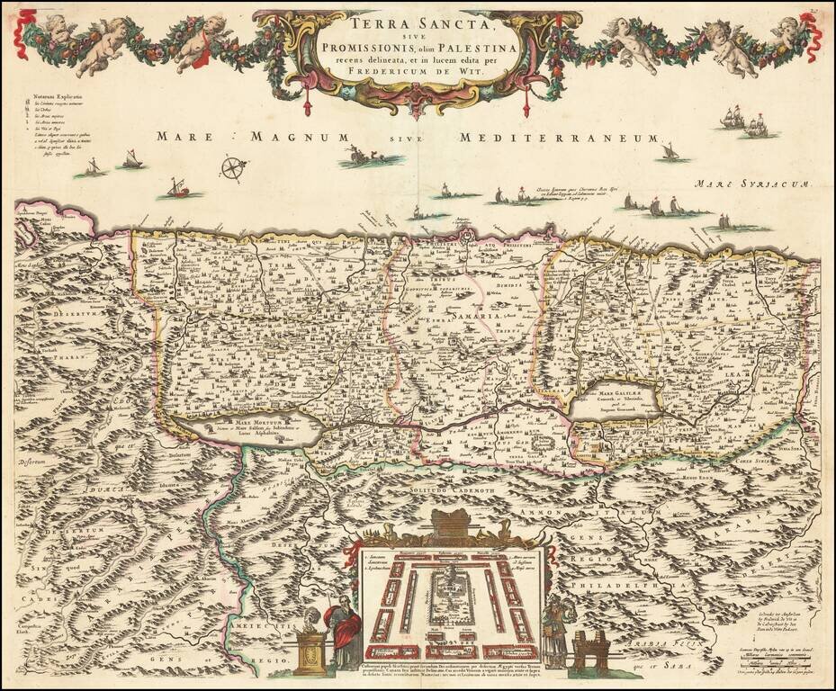
Old color example of De Wit's map of the Holy Land, oriented to the West, and divided among the Tribes of Israel on both sides of the Jordan.

The shore line runs from Sidon to Egypt. The Kishon River connects Haifa Bay to the Lake of Tiberias. Along the top, a garland is supported by 6 cherubs. At the bottom center, the encampment of the Tribes in the desert surrounding the Tabernacle, flanked by Moses and Aaron.

The map is drawn from Visscher's map of 1659, with minor changes.

Laor 860.

Special conditions for students!

If you are a student, write to us in telegram: @antiquemaps and indicate what material you need and for what work you need a map in high detail. We are ready to provide material on special terms. For students only!

Item information:

Year of creation:
Size:
13651x11288 px
Disk:
48329100B
Number of pages:
1
Place:
Amsterdam
Author:
Frederick De Wit.
$14.99

Related item