logo

1630. Palestina Sive Terrae Sanctae Descriptio

  • Palestina Sive Terrae Sanctae Descriptio

Palestina Sive Terrae Sanctae Descriptio information:

Year of creation: 
Resolution size (pixels): 
 13917x10828 px
Disk Size: 
 50.631MiB
Number of pages: 
 1
Place: 
 Amsterdam
Author: 

Print information. Print size (Width x height in inches):
Printing at 72 dpi 
  193.29 х 150.39
Printing at 150 dpi 
 92.78 х 72.19
Printing at 300 dpi 
 46.39 х 36.09

An example of detailing the file of this map of in a printable high-resolution:

Click to open in high resolution (open in new tab).
Attention! this is just the central piece (central area 960x960 px) of the map file!
This is an example, so that you can see and study the level of detail of a given map. The entire Map will be fully available after payment!

Palestina Sive Terrae Sanctae Descriptio

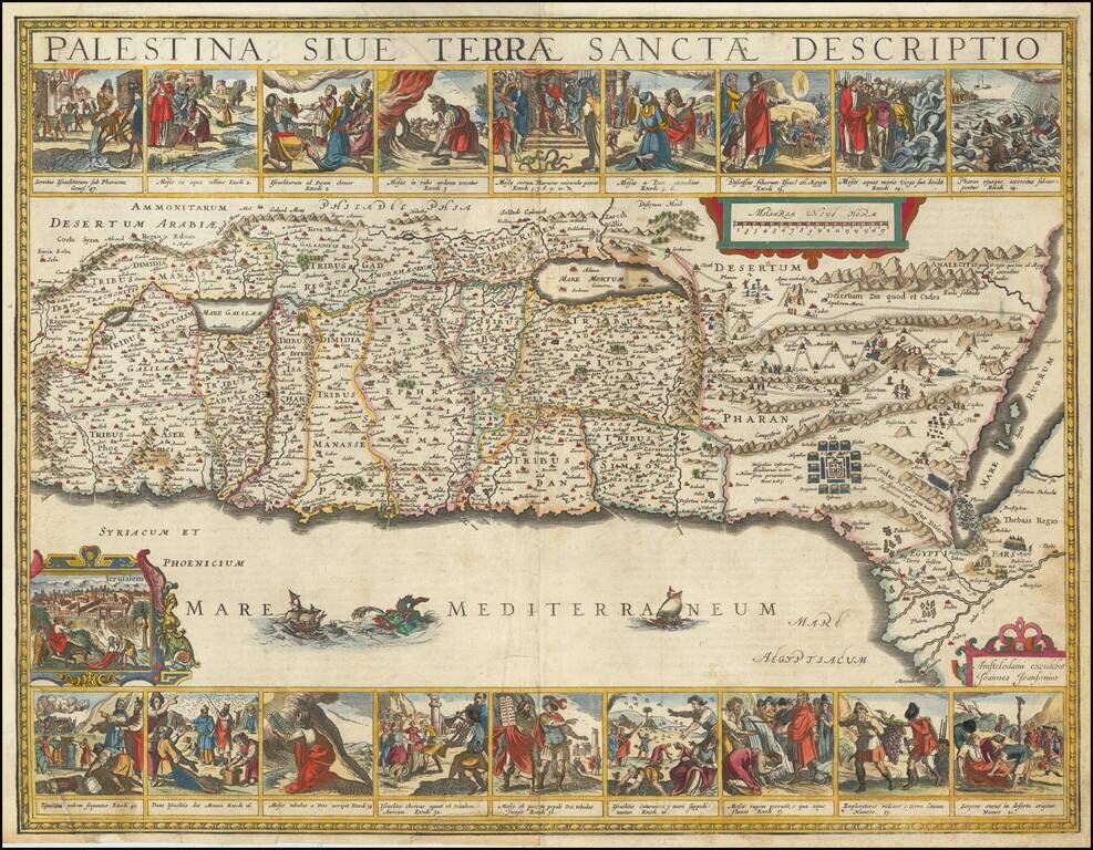
Finely colored and highly decorative map of the Holy Land, embellished with 18 decorative vignettes showing scenes of Moses from Exodus and a view of Jerusalem.

Based upon Van Andrichom, the map is oriented to the East, divided into the tribes on both sides of the Jordan, showing the shoreline from Sidon to Alexandria.

Laor 372

Special conditions for students!

If you are a student, write to us in telegram: @antiquemaps and indicate what material you need and for what work you need a map in high detail. We are ready to provide material on special terms. For students only!

Item information:

Year of creation:
Size:
13917x10828 px
Disk:
50.631MiB
Number of pages:
1
Place:
Amsterdam
Author:
Jan Jansson.
$14.99

Related item