Map size in jpg-format: 7.05247MiB
Click to open in high resolution (open in new tab).
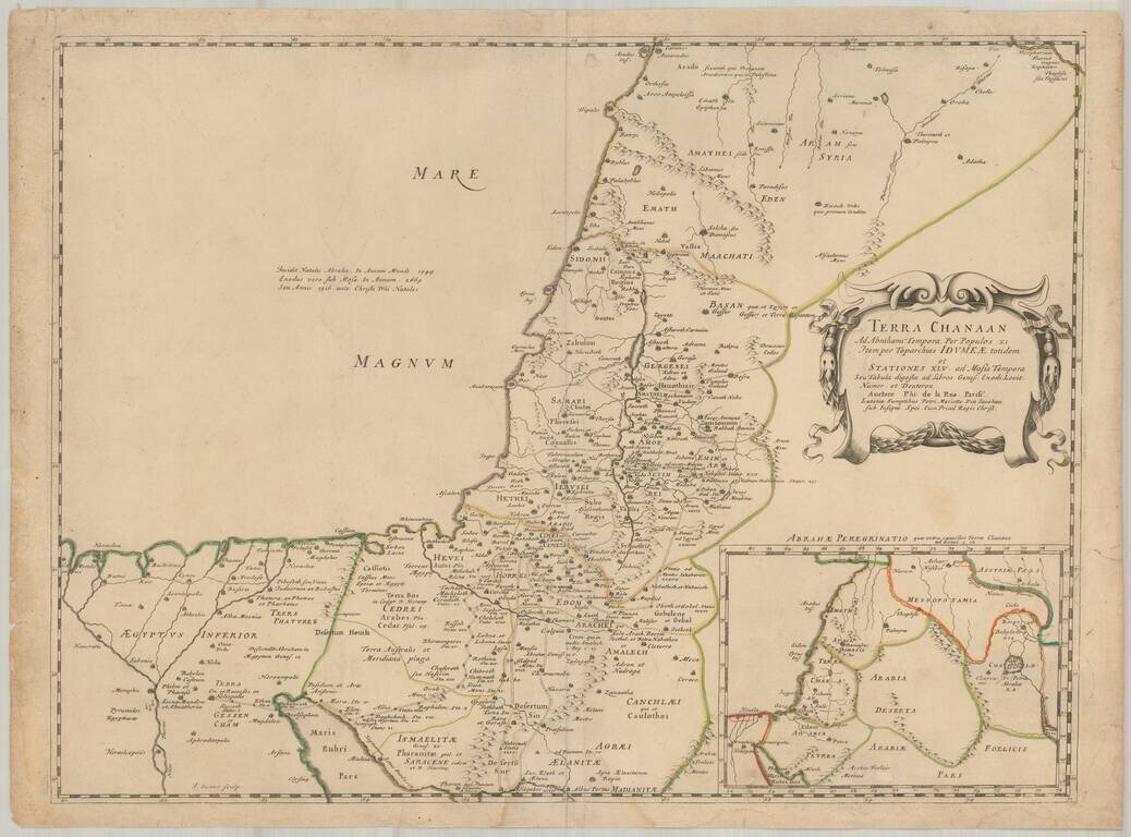
First edition of Phillipe de la Rue's scarce map of the Holy Land and contiguous regions.
The map depicts the Holy Land as it appeared during the time of the Old Testament, based upon the books of Genesis, Exodus. Levitcus, Numbers and Deuteronomy.
The map would subsequently be copied by Covens & Mortier and the Tipographia Seminaria de Padova.
If you are a student, write to us in telegram: @antiquemaps and indicate what material you need and for what work you need a map in high detail. We are ready to provide material on special terms. For students only!


![[Early Montanus World Map in Volume Eight of the Plantin Polyglot Bible]](/map/small/53766.jpg)