
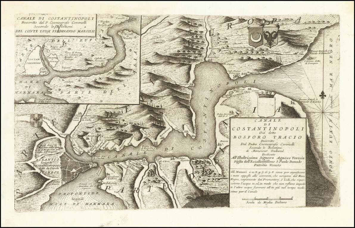
Rare Coronelli map of the Bosphorus Straits, from his Atlante Veneto. A second example of the same region appears in the inset at the top left, based upon a Relation by Count Luigi Ferdinando Marsili, an Italian scholar and eminent natural scientist,...
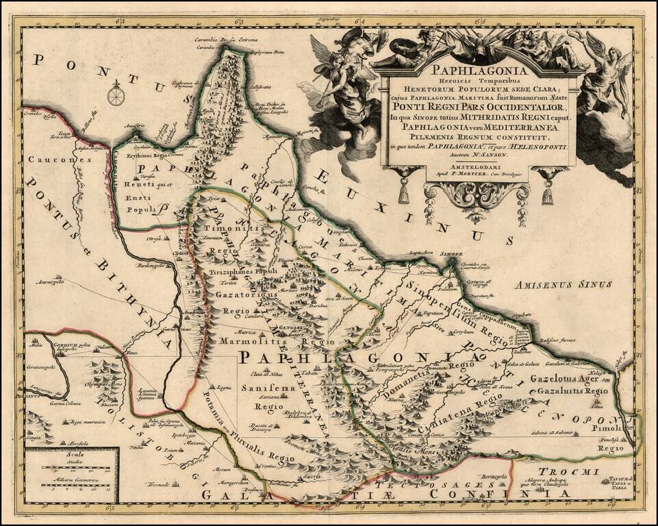
Scarce map of the Turkish Coastline of the Black Sea, centered on Sinope, based upon an earlier map by Nicholas Sanson. Remarkable decorative carouche. The map has not been recorded in a dealer catalog in the past 25 years.
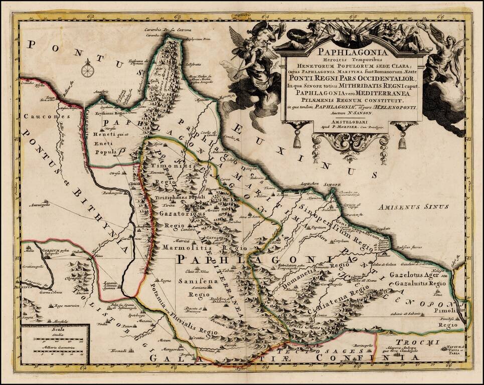
Scarce map of the Turkish Coastline of the Black Sea, centered on Sinope, based upon an earlier map by Nicholas Sanson. Remarkable decorative carouche.
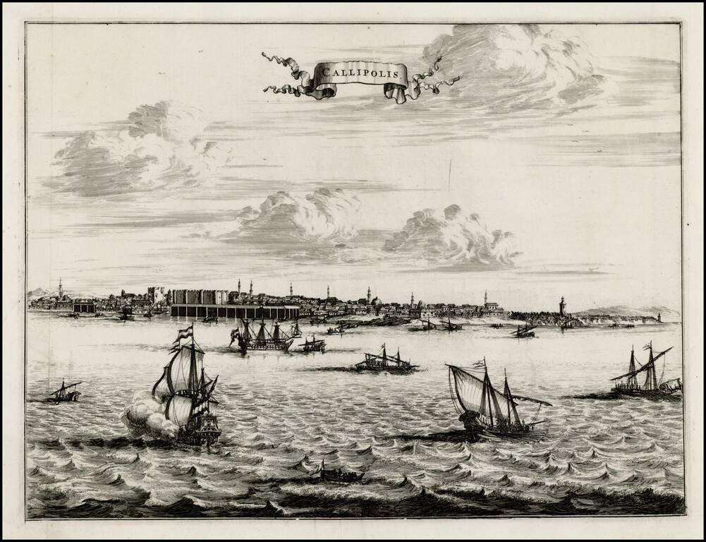
Fine early view of Gallipoli, from an unknown source. A fine view from the harbor, with sailing vessels in the foreground and a profile of buildings and Minarets on the horizon.
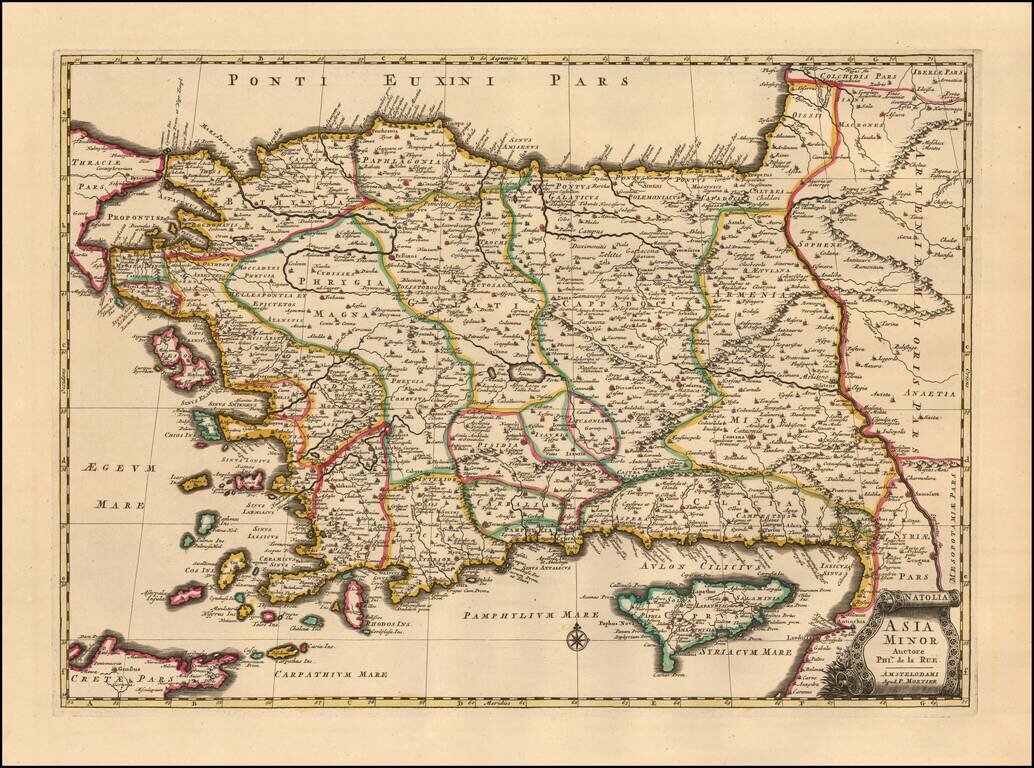
A finely detailed example Mortier's edition o of Philipe de la Rue's map of Asia Minor also known as the Anatolian peninsula, or the Anatolian plateau, which makes up the majority of modern-day Turkey. The map is centered on Ascanius Lacus (Lake...
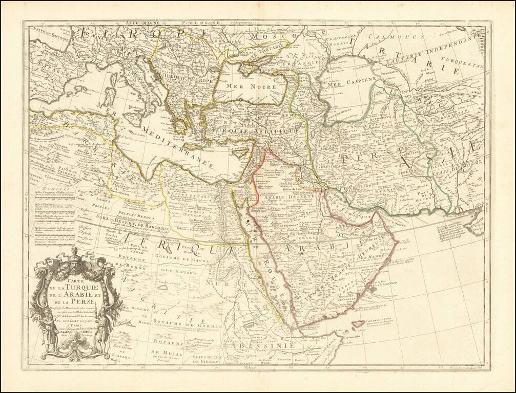
Fine example of an state of De L'Isle's map of the Turkish Empire and Arabian Peninsula, with De L'Isle's "Quai de l'Horlogie al Aigle d'Or" address, which was used only briefly after his move from Rue de Cannettes. Includes the Turkish Empire,...
![Bosphore de Thrace. Vue De Constantinople Due Cote Du Bosphore [with] Aqueduc De Constantinople [with] Colomne De Pompee](/map/small/64422.jpg)
Finely engraved and beautifully colored plate showing views of Constantinople, the aqueduct of Constantinople, and the Pompee Column. The map appeared in Chatelain's monumental Atlas Historique, published in Paris.
![[Views of Constantinople] Etat Abrege de la Maison du Grand Seigneur,](/map/small/64525.jpg)
Decorative views of Constaninople, from Chatelain's monumental Atlas Historique.

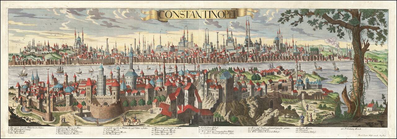
Rare view of Constantinople, extending from St. Demitre to Chateau De Sept Tours and Scutari to Fanarikiosk. The present example is credited to Le Blond and is very rare.

Fine map of the Ottoman Empire, published in Nuremberg by Christopher Weigel. Includes a decorative allegorical cartouche.

Antique Map of the Environs of Istanbul with a View of "the city of Stambul or Constantinople" from the East Side of the Bosphorus Decorative antique map and early view of Istanbul and environs. The map includes a large inset bird's-eye view of the...
Rare, Highly Detailed View of Sixteenth-Century Istanbul This exceptional view of Constantinople (Istanbul) was published by Jeremiah Wolff, the most successful map publisher in Augsburg during his time. It is sumptuously detailed and includes the...

Striking map of the region centered on Saudi Arabia, Cyprus and the Mediterranean Sea. Includes a large decorative cartouche and annotations throughout the map. Excellent detail and nice color.
Striking hand-colored engraved regional map, centered on Turkey and Asia Minor, and showing the Eastern Mediterranean, Balkans, Greece, Persia, Saudi Arabia, the Black Sea and the Caspian Sea, published by Seutter. Includes decorative cartouche and...
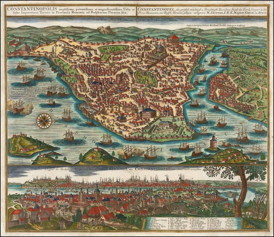
Striking plan of Istanbul, with the Bosphorus in the foreground.. The plan includes a large detailed view of the City at the bottom, with a key locating 30 landmarks. Fine old color example of Seutter's city plan and local views. Seutter engraved...
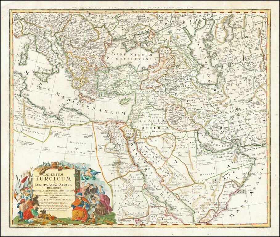
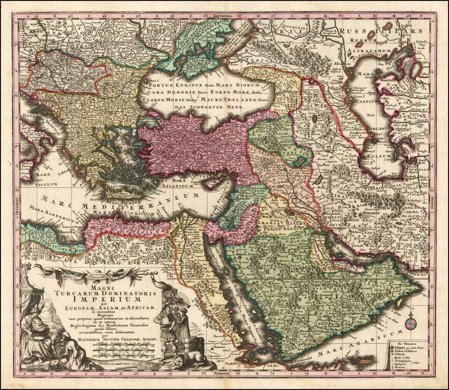
Gorgeous map of the Ottoman Empire, extending from the Persian Gulf and Red Sea to the Mediterranean and Caspian Seas, centered on Cyprus. Excellent detail and an attractive cartouche.