logo

1701. Carte De La Turquie De L'Arabie et De La Perse . . . 1701

  • Carte De La Turquie De L'Arabie et De La Perse . . . 1701

Carte De La Turquie De L'Arabie et De La Perse . . . 1701 information:

Year of creation: 
Resolution size (pixels): 
 16419x12516 px
Disk Size: 
 52.2921MiB
Number of pages: 
 1
Place: 
 Paris
Author: 

Print information. Print size (Width x height in inches):
Printing at 72 dpi 
  228.04 х 173.83
Printing at 150 dpi 
 109.46 х 83.44
Printing at 300 dpi 
 54.73 х 41.72

An example of detailing the file of this map of in a printable high-resolution:

Click to open in high resolution (open in new tab).
Attention! this is just the central piece (central area 960x960 px) of the map file!
This is an example, so that you can see and study the level of detail of a given map. The entire Map will be fully available after payment!

Carte De La Turquie De L'Arabie et De La Perse . . . 1701

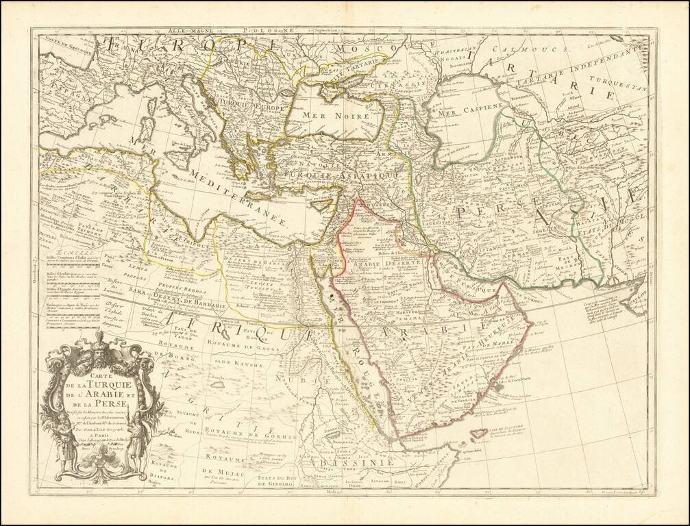
Fine example of an state of De L'Isle's map of the Turkish Empire and Arabian Peninsula, with De L'Isle's "Quai de l'Horlogie al Aigle d'Or" address, which was used only briefly after his move from Rue de Cannettes.

Includes the Turkish Empire, Mediterranean, Central Asia and parts of the Ukraine, Egypt, etc. The map was originally issued by De L'Isle, with extensive changes by Phillipe Buache in 1776 and again by Dezauche in 1780.

cf Tibbetts, G.R. #171 (Renard imprint)

Special conditions for students!

If you are a student, write to us in telegram: @antiquemaps and indicate what material you need and for what work you need a map in high detail. We are ready to provide material on special terms. For students only!

Item information:

Year of creation:
Size:
16419x12516 px
Disk:
52.2921MiB
Number of pages:
1
Place:
Paris
Author:
Guillaume De L'Isle.
$14.99

Related item