
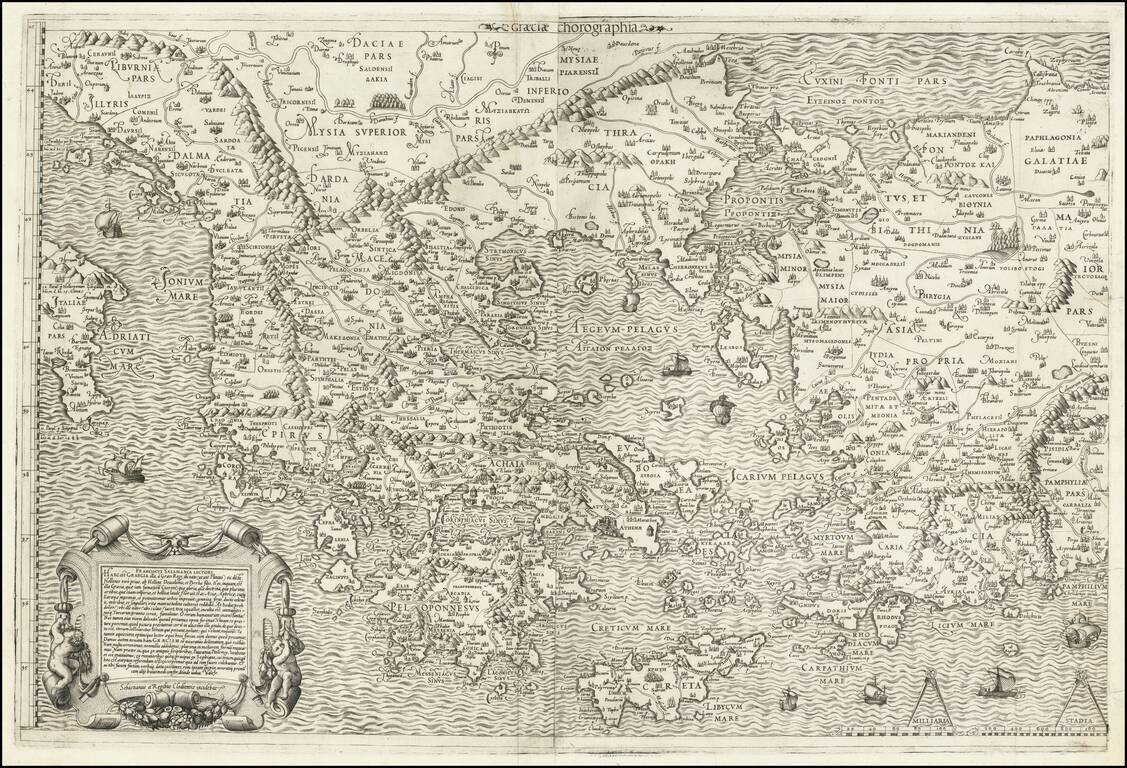
Nice example of Antonio Salamanca's 1558 map of Greece, based upon Nikolaos Sophianos's landmark 8-sheet map of Greece, from classical and modern authorities. Antonio Salamanca's map of Greece is the earliest obtainable map based upon Nikolaos...
![[Eastern Mediterranean]](/map/small/59510sb.jpg)
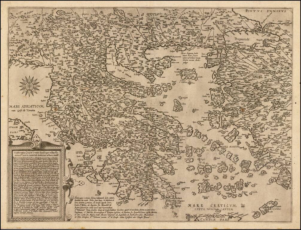
The Only Surviving Example Rare Lafreri school map of the Eastern Mediterranean and vicinity. The map is the Southeastern Sheet of an Unrecorded Map of Europe, published in Venice. The present example is the third state of three.
![[Eastern Mediterranean]](/map/small/61501sb.jpg)
Only known example of the rare map of of the Eastern Mediterranean. As note by Bifolco, this unique map is one of four sheets from a 16th century wall map of Europe, which an incomplete example survives the Civic Library of Bergamo in Italy (3 of 4...
Nice example of De Jode's modern map of Greece, which was both separately issued and included in his Speculum Orbis Terrae, drawn from the work of the Italian Renaissance Architect, Pirro Ligorio. The present example has no text on the verso and...
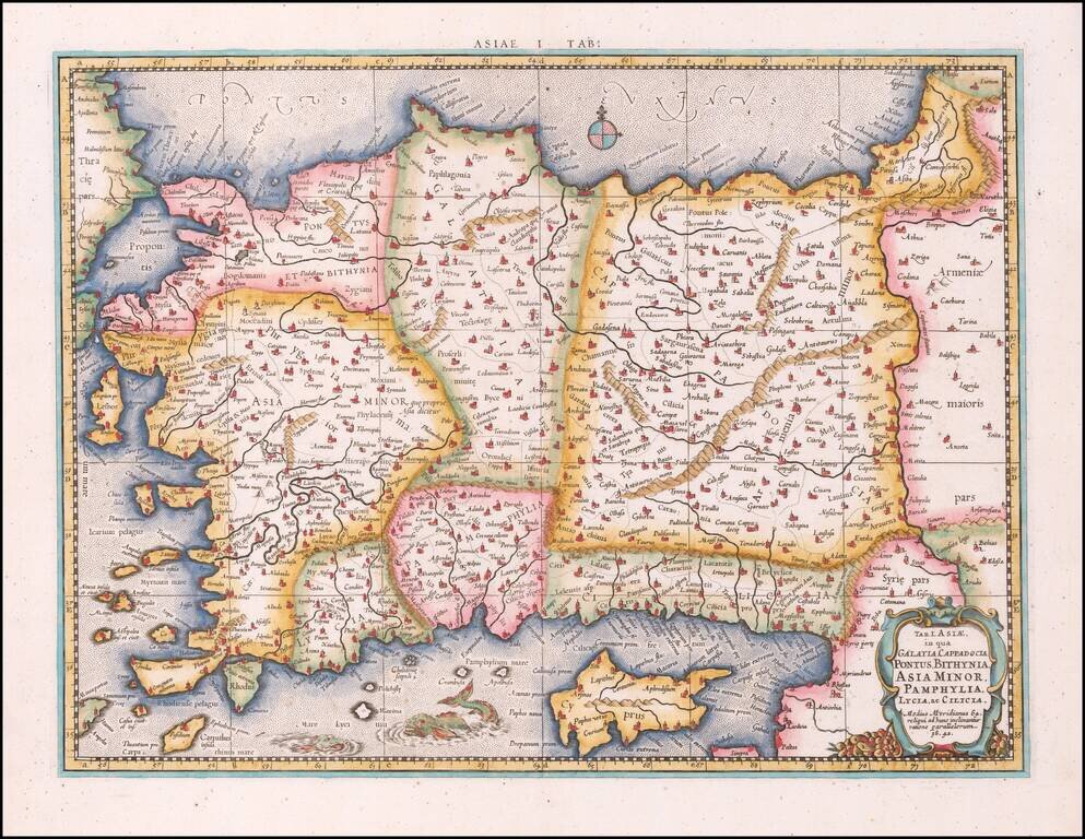
Nice example of Mercator's map of Asia, Minor and Cyprus, from Mercator's edition of Ptolemy's Geographia, first published in 1578 and republished in Amsterdam beginning in 1695. Includes a Sea Monster, cartouche and a detailed treatment of the...
Nice full color example of Munster's second map of modern Greece, from Munster's Cosmographia, one of the most influential georgaphical works of the 16th Century. Munster's Geographia (first published in 1540), and his later Cosmographia, were...
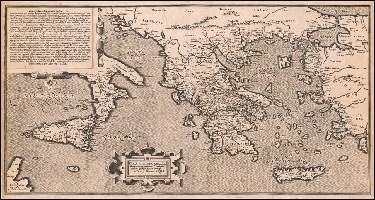
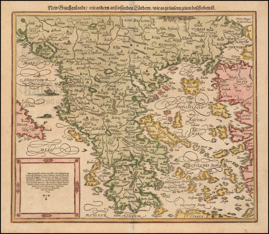
Extremely rare 16th Century map of the "New Greek Universe," by George Achatz von Eneneckel. The map extends from Sicliy and Puglia to the western coast of Asia minor, the regions controlled by the Ancient Greeks. This is the first time we have ever...
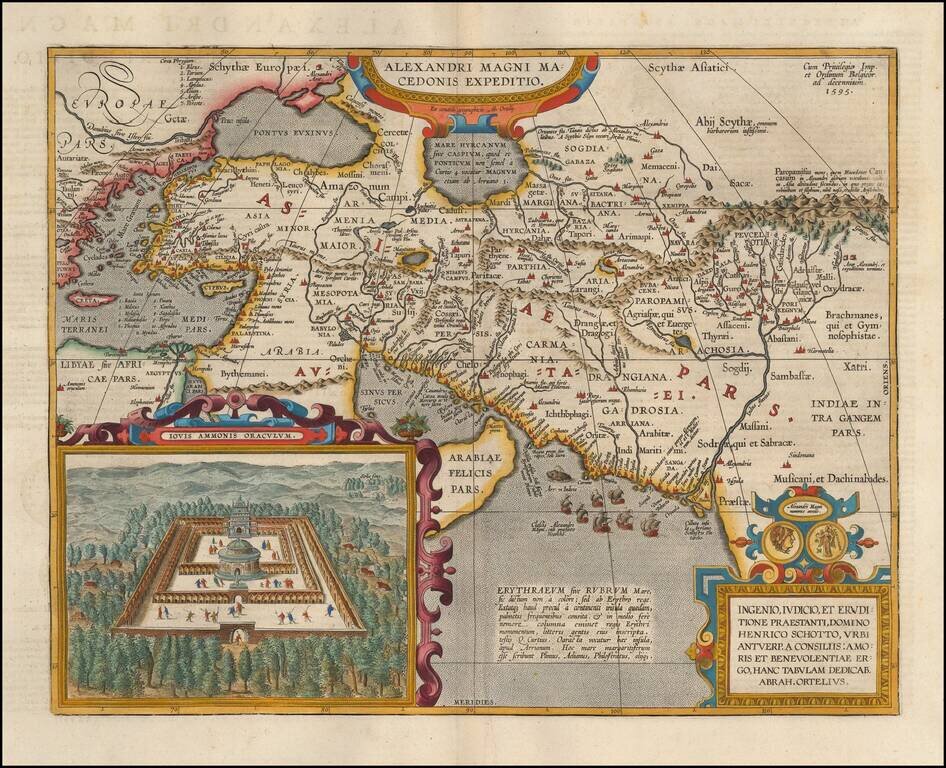
Detailed map of Alexander the Great's expedition to Macedonia. Includes an inset: Iovis Ammonis Oraculum, the oracle in Lybia which Alexander visited before he went to India. Several decorative cartouches, sailing ships, sea monsters, etc.
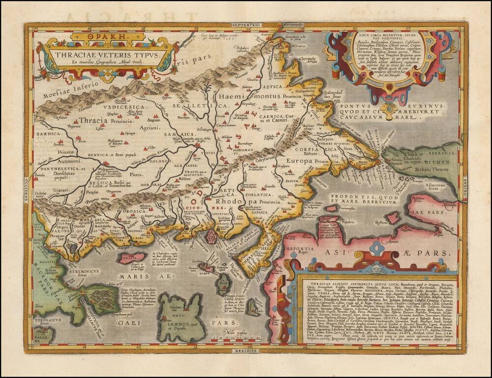
Fine map of ancient Thrace, extending from Byzantium (Istanbul) and the Bosphorus Straits to Macedonia, published by Abraham Ortelius. The map is based on Gastaldi's 1560 map of South East Europe, and on information from numerous ancient sources,...
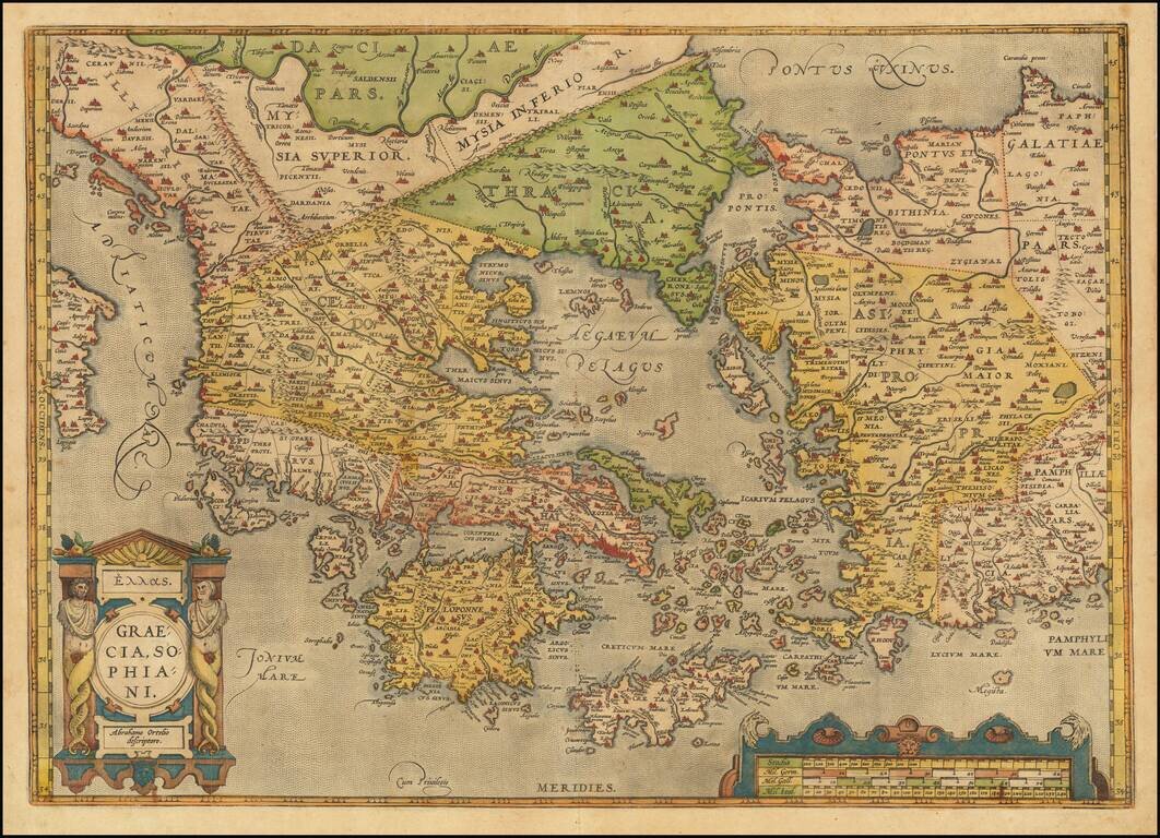
Old color example of Ortelius' decorative map of Greece, Turkey and Asia Minor, with neighboring islands, from Ortelius' Theatrum Orbis Terrarum, the first modern atlas of the world. The map is embellished by a decorative cartouche and scale of miles....
![Natolia [with Cyprus]](/map/small/44788.jpg)
Attractive full color example of this detailed map of Asia Minor and neighboring parts of the Mediterranean, Aegean and Black Seas, showing parts of Greece, the Island of Cyprus, Rhodus, etc. Includes English text.
![Natolia [with Cyprus]](/map/small/47443.jpg)
Attractive outline hand-color example of this detailed map of Asia Minor and neighboring parts of the Mediterranean, Aegean and Black Seas, showing parts of Greece, the Island of Cyprus, Rhodus, etc. Includes English text.
Langlois's Rare (Unrecorded?) Map of Greece and Turkey. Decorative map of Greece and Turkey, one of the earliest maps of the region published in France. Includes a large decorative cartouche and wide clean margins
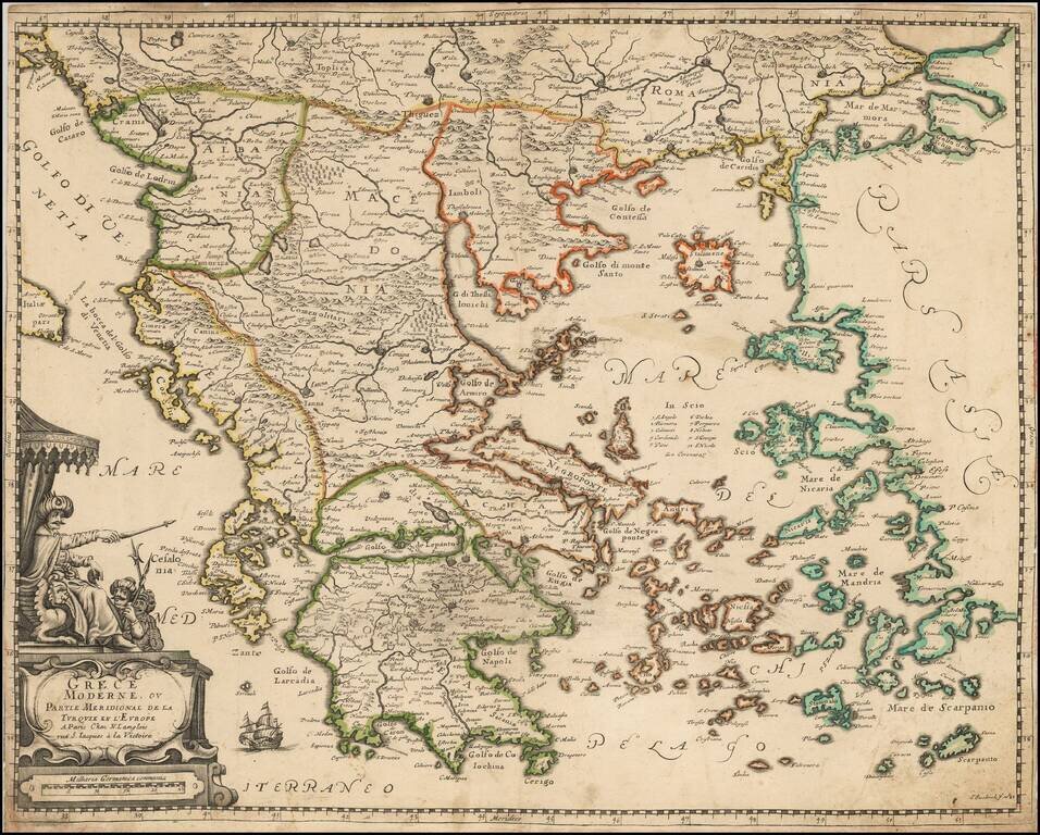
Nicolas Sanson's rare 1655 double-page engraved map of Greece and the Balkans, then the European territory of the Ottoman Empire. The map was subsequently copied by Jaillot and Covens & Mortier, in both one- and two-sheet versions.
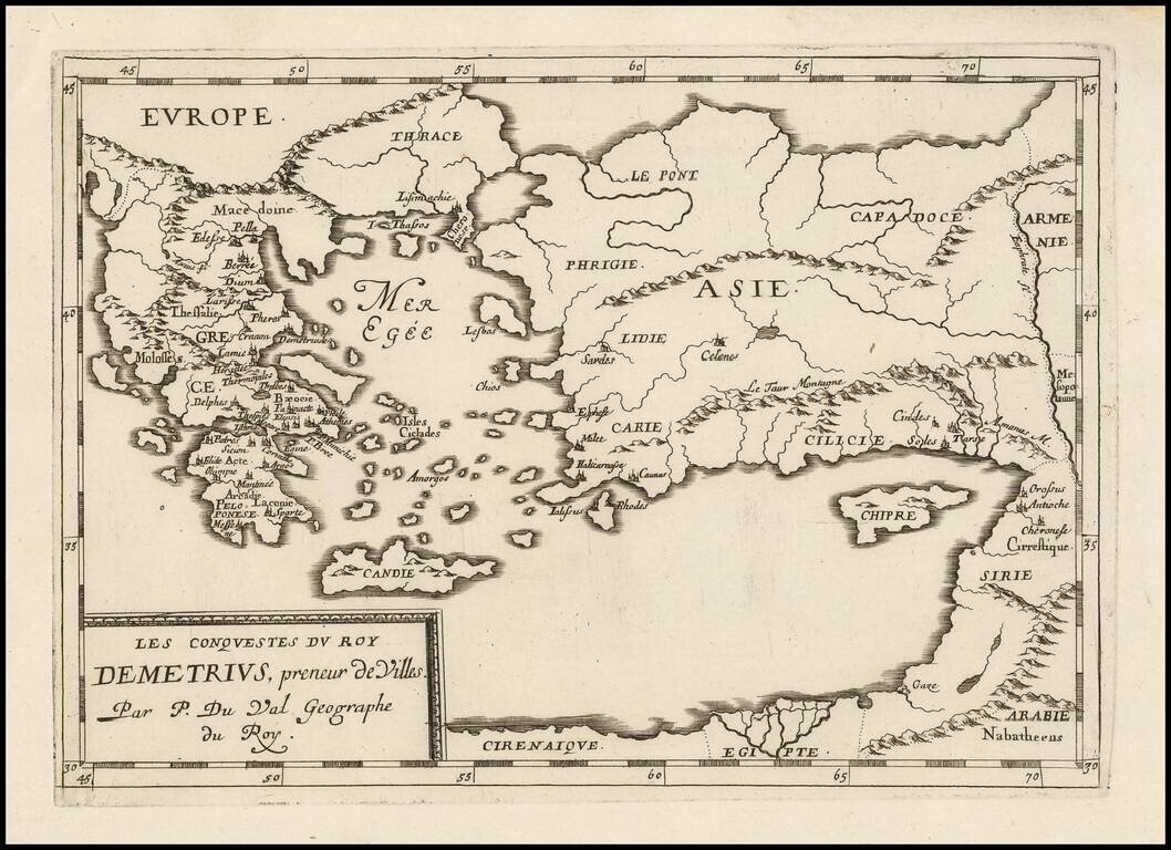
Antique map of the conquests of Demetrius I "Taker of Cities", published by Pierre Du Val in Paris, circa 1660.