
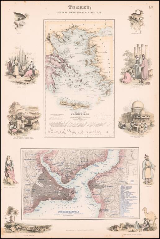
Highly detailed map of Turkey, Greece, the Greek Islands and the Aegean, with a second large map of Istanbul. Two maps on one sheet, the first showing The Grecian Archipelago, the second showing Constantinople. Decorative vignettes showing local...

An attractive antique map of western Turkey, Greece, and the Balkans with various insets. The map is highly detailed, showing many settlements, islands, railroads, and more. The map is colored in attractive pastels. The geopolitical boundaries at the...
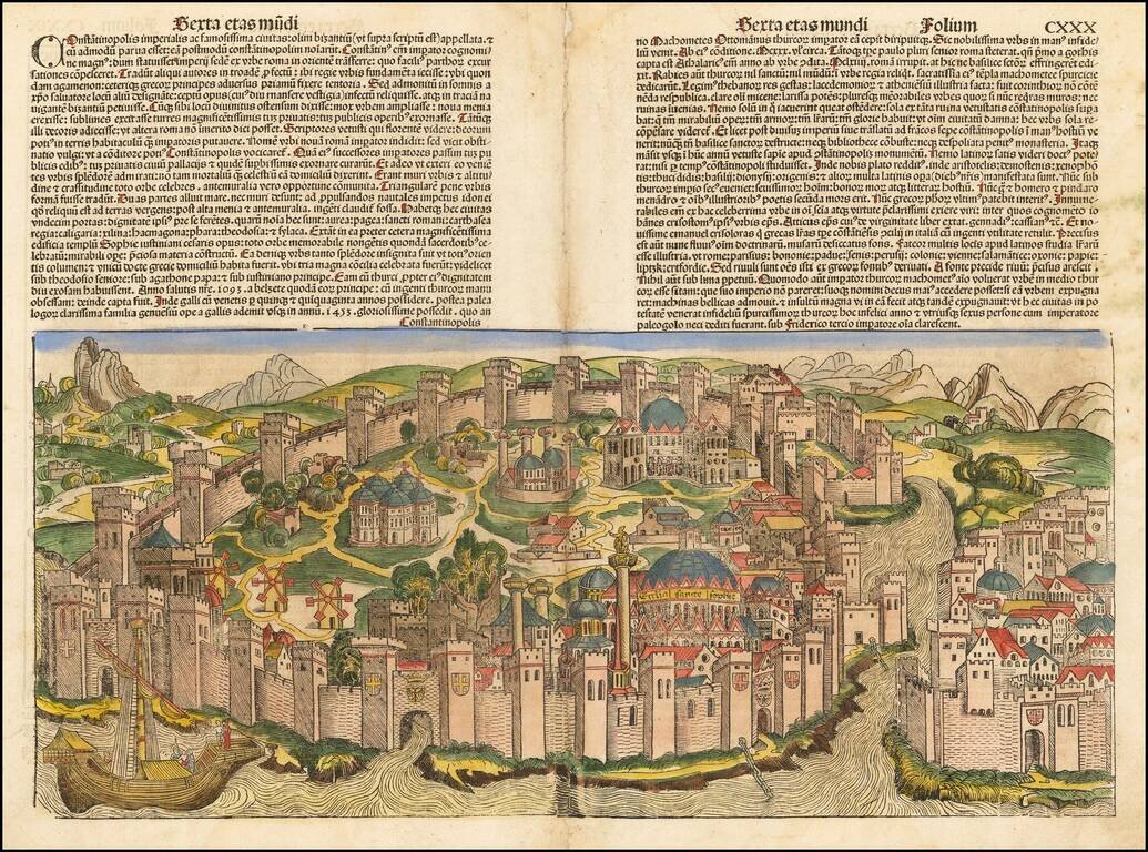
Decorative example of Hartmann Schedel's incunable view of Constantinople from Schedel's Liber Chronicum, perhaps the single most influential secular illustrated book of the 15th Century and one of the landmark printed works of the 15th Century....
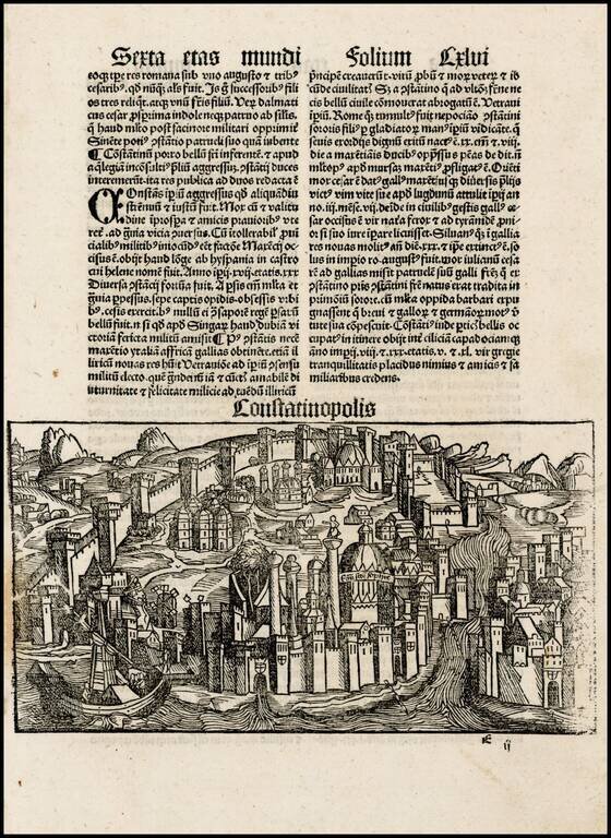
One of the earliest obtainable views of the City of Istanbul, from Schonsperger's miniature edition of Schedel's Liber Chronicum. The Liber Chronicum (Nuremberg Chronicle) was first published in the summer of 1493 in Latin. The German edition appeared...
![[Bosphorus Straits, Black Sea, Sea of Marmora]](/map/small/42361.jpg)
Interesting early map of the the region centered on the Bosphorus Straits, and the Sea of Marmora (named Palus Maeotica), which appeared in the 1538 edition of Solinus' Polyhistor, rerum toto orbe memorabilium thesaurus locupletissimus. Huic ob...
![[Asia Minor] Tabula Asiae I](/map/small/70464.jpg)
Nice example of Munster's Ptolemaic map of Asia Minor and parts of the Black Sea and Cyprus. From an early edition of Munster's Geographia, one of the most important works of the 16th Century. Sebastien Munster is generally regarded as one of the...
Fine dark impression of Gastaldi's modern map of Asia Minor, one of the earliest modern maps of the region, from Gastaldi's Geografia di Claudio Ptolemeo Alexandrino . . . , published in Venice in 1548.

Finely colored early view of Constantinople (Istanbul), one of the earliest widely distributed views of the City from the 16th Century. Munster's Geographia (first published in 1540), and his later Cosmographia, were cartographic landmarks. The...
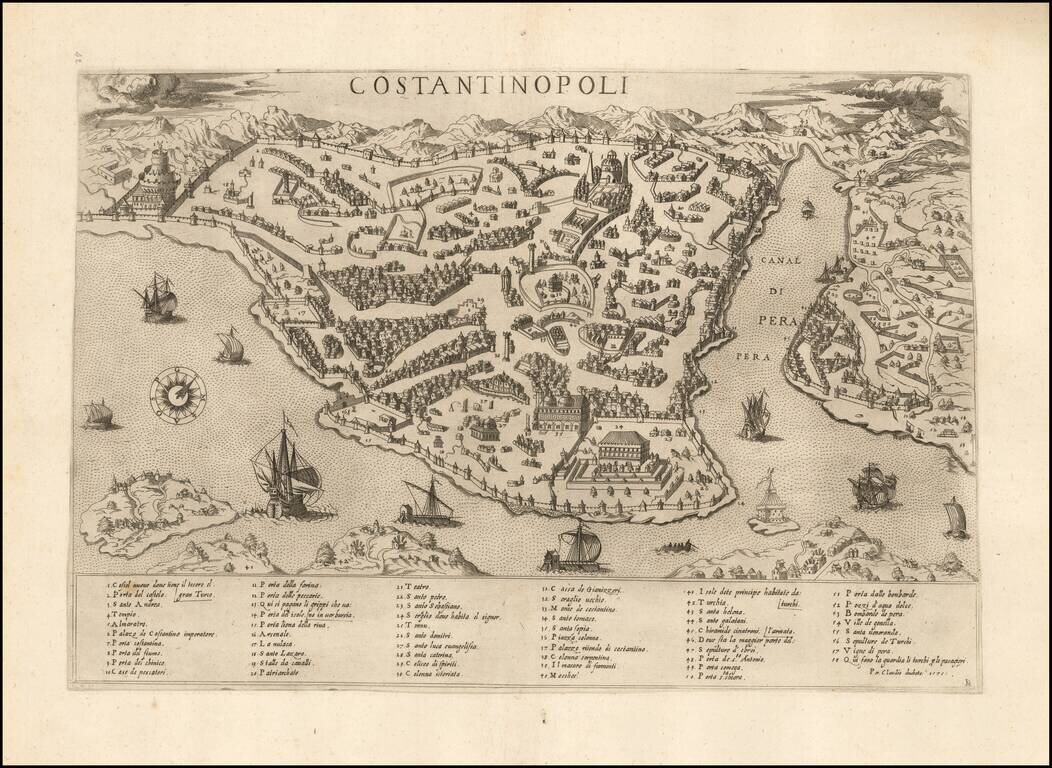
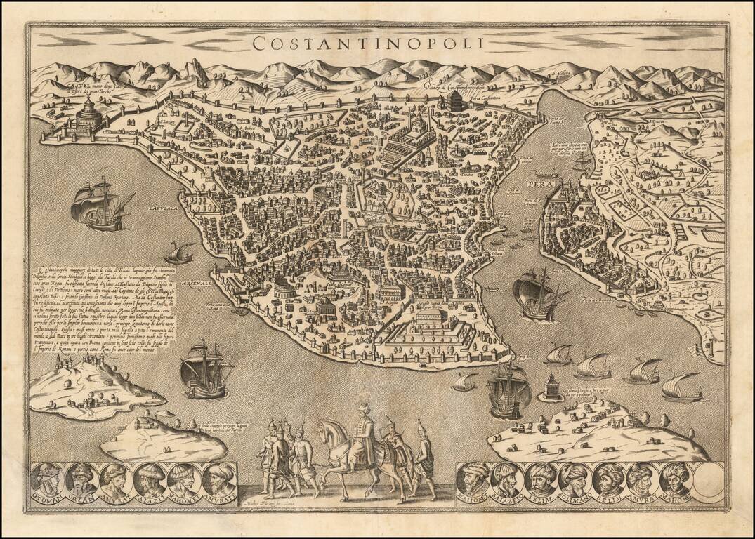
Rare Lafreri School View of Istanbul Finely executed view of Istanbul looking Southwest. The view is based upon Vavassore's view and is one of the earliest obtainable large format views of Istanbul, pre-dating Braun & Hogenberg. Includes a key...
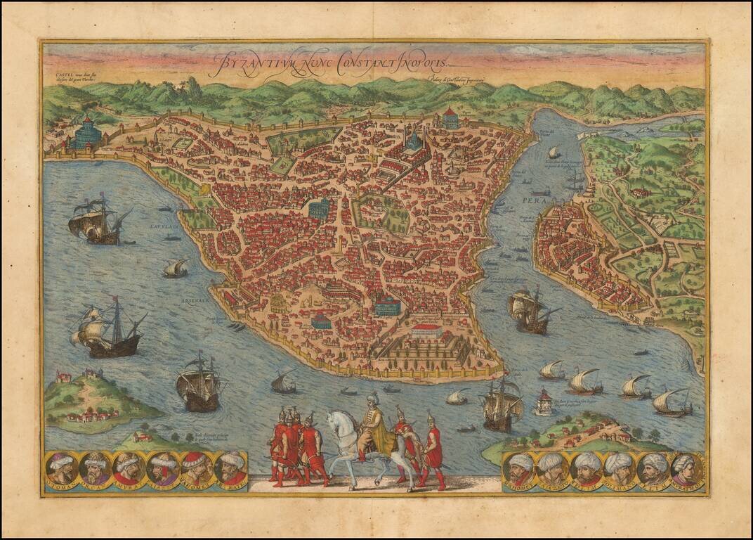
Old color example of this important early map / birdseye view of Istanbul, from Braun & Hogenberg's monumental town book. The Braun & Hogenberg view is one of the finest and most sought-after views of Istanbul. Viewed from the village of...
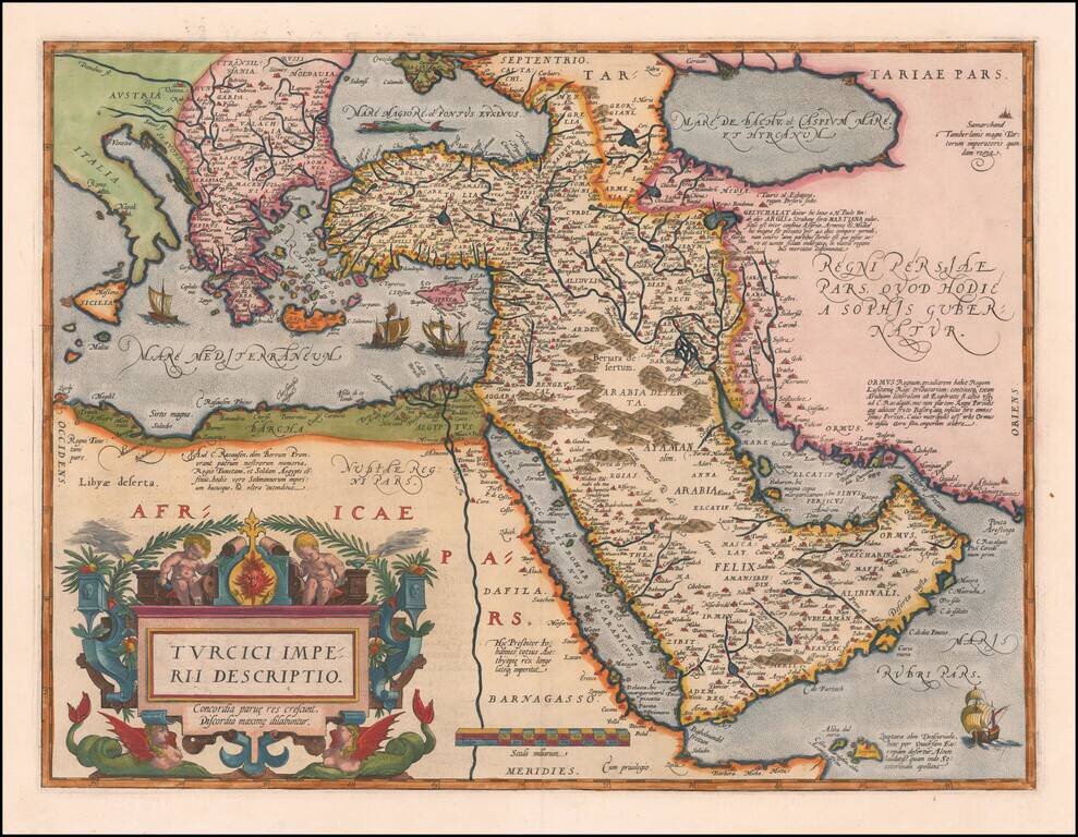
Second Edition of the Ortelius Map of the Turkish Empire Nice example of Ortelius' Turkish Empire, embracing the Middle East, Turkey and the Eastern Mediterranean from Sicily to Cyprus. The map is based upon Giacomo Gastaldi's wall map of Asia of...
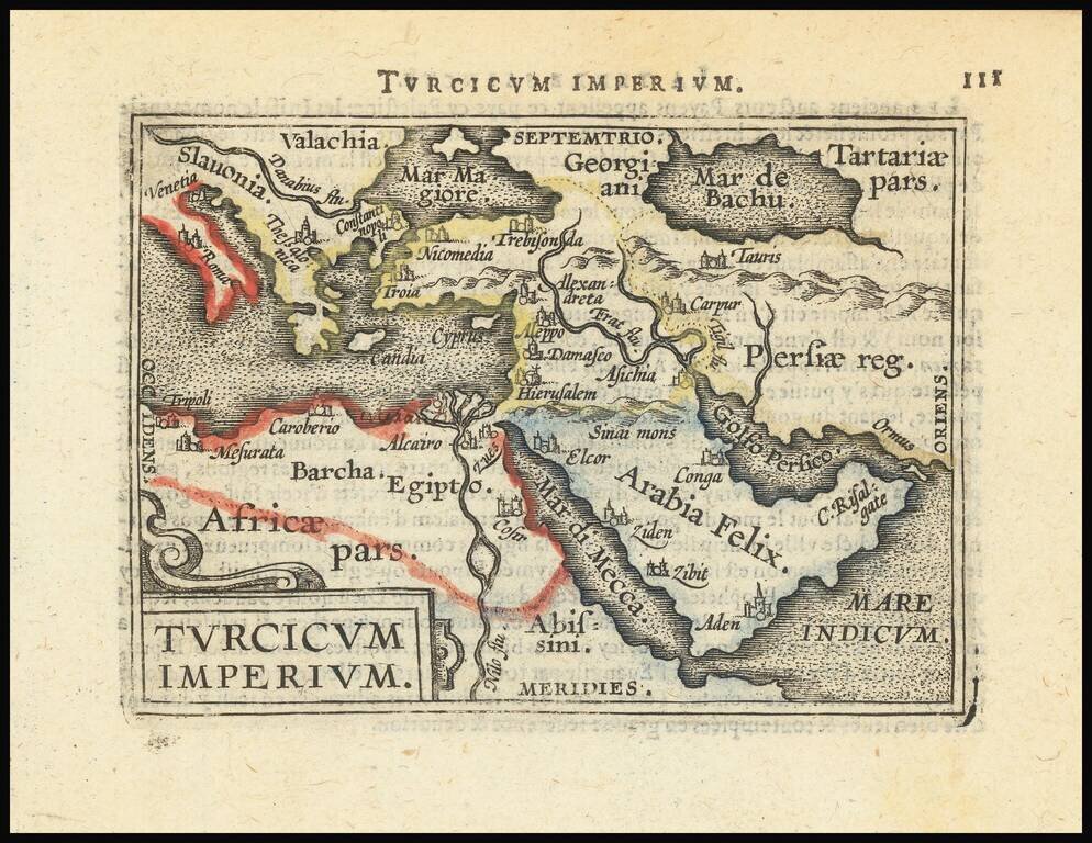
Decorative miniature map of the Turkish Empire. The map appeared in an early edition of Ortelius' Epitome, first published in 1579.
![Natolia Nuova Tavola [includes part of Cyprus]](/map/small/34783.jpg)
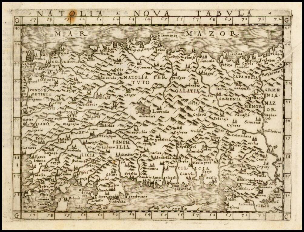
Interesting map of part of Asia Minor and Cyprus, extending from Constantinople to Armenia. Includes most of Cyprus. The map first appeared in the 1561 edition of Ruscelli's edition of Ptolemy's Geografia. Ruscelli's Atlas is an expanded edition of...
![Natolia Olim Sive Asia Minor [shows Cyprus]](/map/small/38603.jpg)
Striking full color example of Quad's map of Asia Minor and Cyprus. Engraved by Johann Bussemacher in Cologne. Fine dark impression.
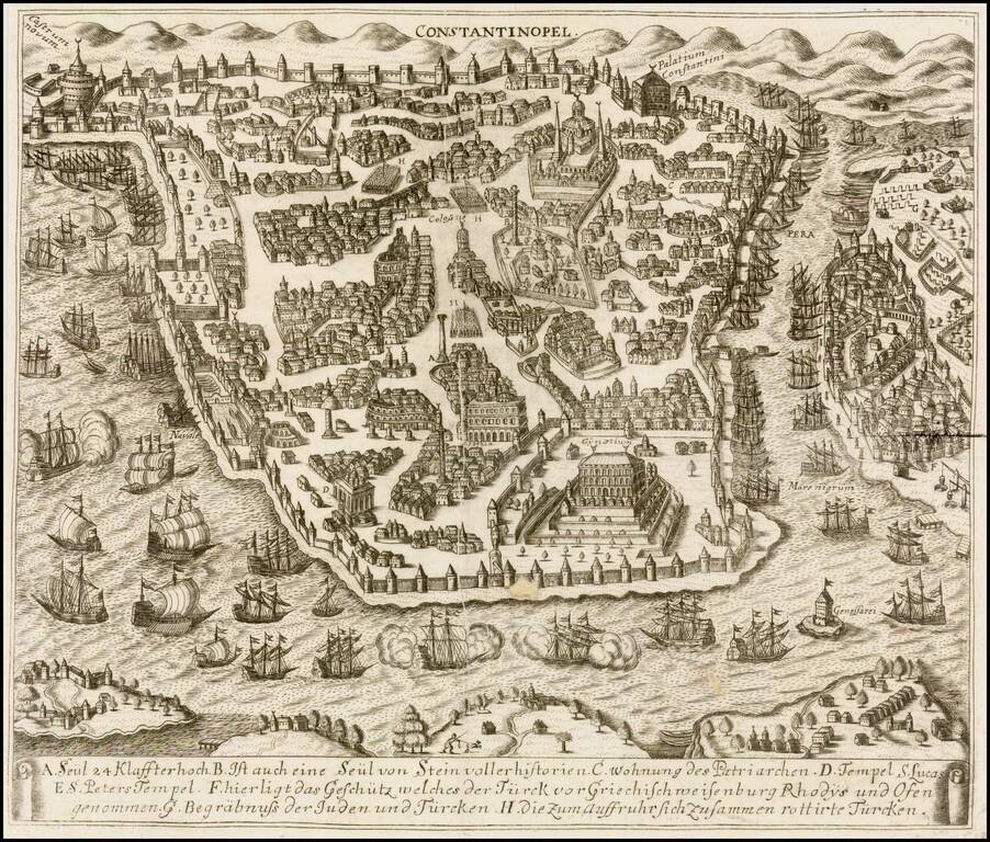
Rare 16th Century View of Istanbul Important early map / birdseye view of Istanbul, based upon the first edition of Braun & Hogenberg's view of Istanbul, first issued in 1572. The Braun & Hogenberg view is one of the finest and most...