Map size in jpg-format: 28.431MiB
Click to open in high resolution (open in new tab).
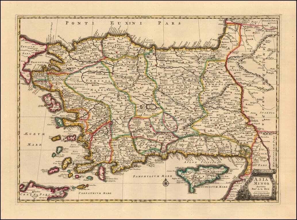
A finely detailed example Mortier's edition o of Philipe de la Rue's map of Asia Minor also known as the Anatolian peninsula, or the Anatolian plateau, which makes up the majority of modern-day Turkey.
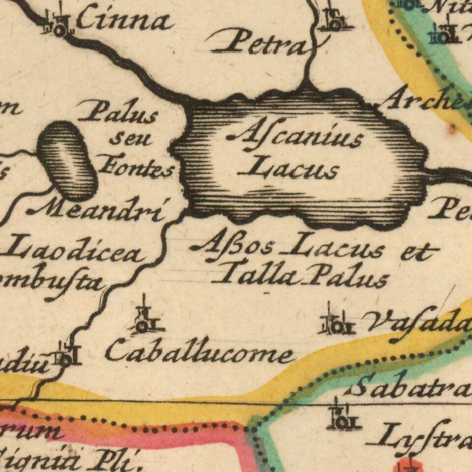
The map is centered on Ascanius Lacus (Lake Iznik) and details the region bounded by the Black Sea to the north, the Mediterranean Sea to the south, and the Aegean Sea to the west. Armenia and Syria are detailed in the east. The map also includes the islands of Cypress, Crete, Rhodes, Cos, etc.
Fine topographical details are noted throughout the region including mountain ranges, lakes, rivers, pathways, etc. The map also features a decorative cartouche.
Pierre, or Pieter, Mortier (1661-1711) was a Dutch engraver, son of a French refugee. He was born in Leiden. In 1690 he was granted a privilege to publish French maps in Dutch lands. In 1693 he released the first and accompanying volume of the Neptune Francois. The third followed in 1700. His son, Cornelis (1699-1783), would partner with Johannes Covens I, creating one of the most important map publishing companies of the eighteenth century.
If you are a student, write to us in telegram: @antiquemaps and indicate what material you need and for what work you need a map in high detail. We are ready to provide material on special terms. For students only!
![[Facsimile - 15th Century Portolan Sea Chart] Portolan des Iehuda ben Zara](/map/small/64285.jpg)