
![Turkey in Asia [with Cyprus]](/map/small/54309.jpg)
Decorative full color example of Tallis's map of Turkey in Asia. Includes large vignettes of castles in Europe and Asia, local costumes, Jerusalem and an Ostrich. Engraved for R. Montgomery Martin's Illustrated Atlas. Tallis was one of the last great...
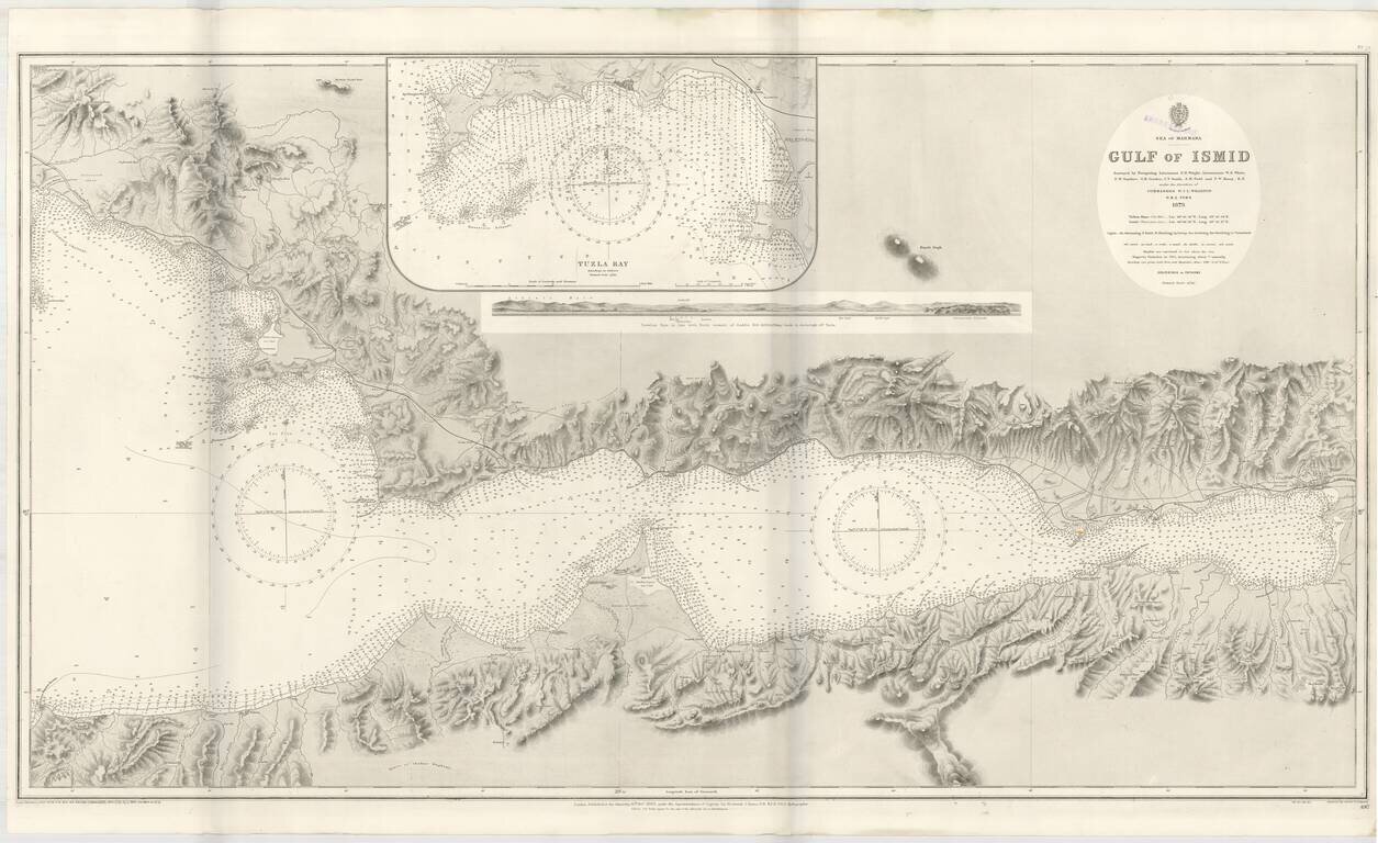
Detailed sea chart of the Gulf of Ismit, the easternmost part of the Sea of Marmara. This elaborate and highly detailed chart extends from Ismit in the east to Sedef Island (Prince Islands), Kartal and the southeastern suburbs of Istanbul in the North,...
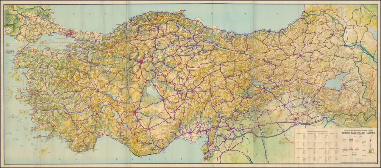
Large Format Road Map of Turkey Celebrating the Anniversary of the General Directorate of Highways Detailed general road map of Turkey focused on major highways, cities, topography, and administrative boundaries. The map’s title is centered over...
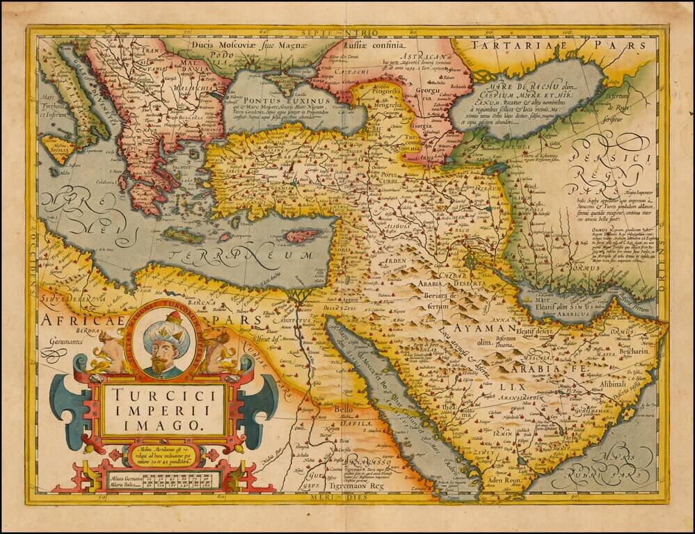
Fine Map of the Ottoman Empire from the Mercator-Hondius Atlas Striking example of this map of the Ottoman Empire, showing their territories in the Balkans, Anatolia, the Levant, the Arabian Peninsula, and North Africa. It was published by Henricus...
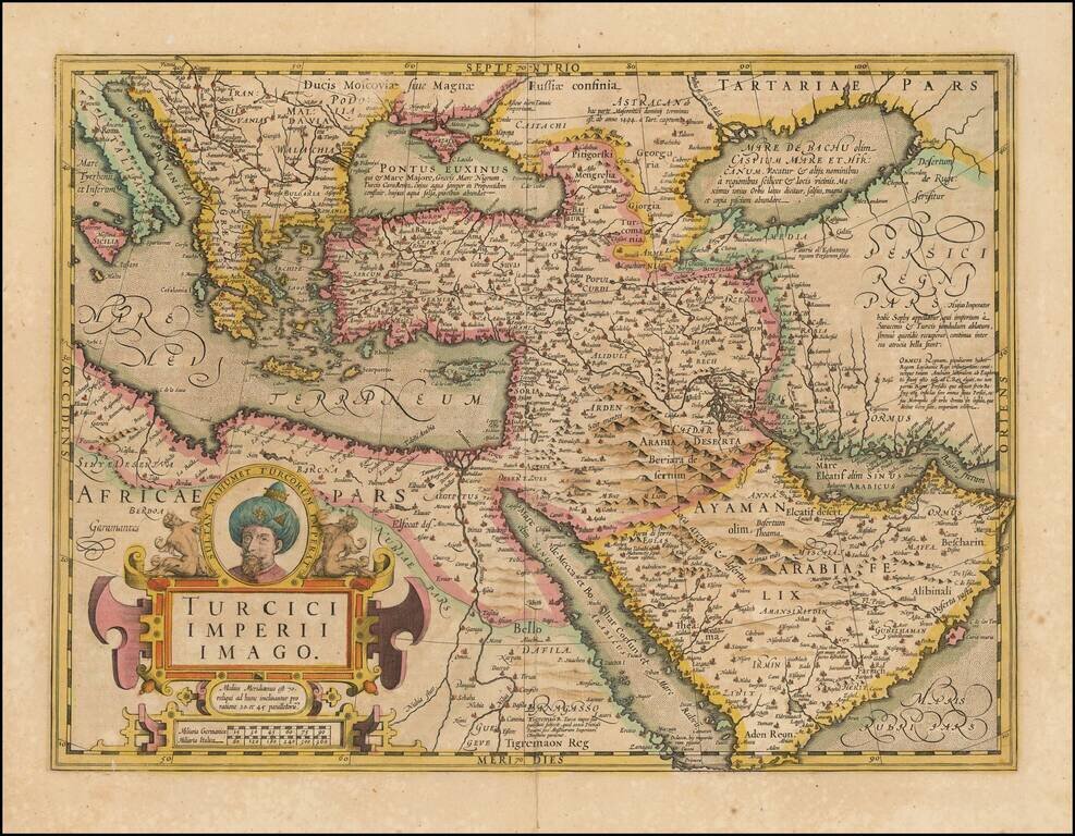
Fine Map of the Ottoman Empire from the Mercator-Hondius Atlas Striking example of this map of the Ottoman Empire, showing their territories in the Balkans, Anatolia, the Levant, the Arabian Peninsula, and North Africa. It was published by Henricus...