
![Natoliae Sive Asia Minor [shows Cyprus]](/map/small/42928.jpg)
Old color example of Mercator's map of Turkey, Asia Minor and Cyprus. Includes a decorative cartouches, sailing ship, sea monster and finely stippled seas.
Striking map of the region bounded by the Mediterranean, Greece and Itay in the west and Saudi Arabia, the Persian Gulf and Caspian Sea in the east and centered on Turkey and Cyprus. Includes English text on both sides. From the 1625-26 edition of...
![Natolia, quae olim Asia Minor [shows Cyprus]](/map/small/71119.jpg)
Fine original hand-color example of Blaeu's decorative map of Asia Minor, showing Turkey, Cyprus and the Islands in the Aegean. This attractive map shows all of Turkey, Cyprus, and the Aegean Islands to a relatively high degree of accuracy. At the...
![Natolia, quae olim Asia Minor [shows Cyprus]](/map/small/40634.jpg)
Jan Jansson's decorative engraved map of Asia Minor, showing Turkey, Cyprus, and the Islands in the Aegean. This attractive map shows all of Turkey, Cyprus and the Aegean Islands to a relatively high degree of accuracy. At the time the entire region...
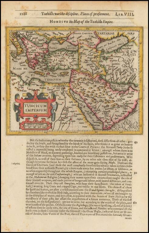
![Turcicum Imperium. Turckiche Reich. Concordia res parvae crescunt Discordia maximae dilabuntur [shows Cyprus]](/map/small/68352.jpg)
Striking full color example of Merian's map of the Turkish Empire. Extends from Sicily and Italy in the West to the Black & Caspian Seas in the North and the Gulf of Aden, Red Sea and Saudi Arabia peninsula in the South.
![Turcicum Imperium . . . [shows Cyprus]](/map/small/69623.jpg)
Decorative example of Blaeu's map of the Turkish Empire, based upon Blaeu's map of a similar title. Extends from Sicily and Italy in the west, to the Black and Caspian Seas in the north, and the Gulf of Aden, Red Sea and Saudi Arabia peninsula in the...
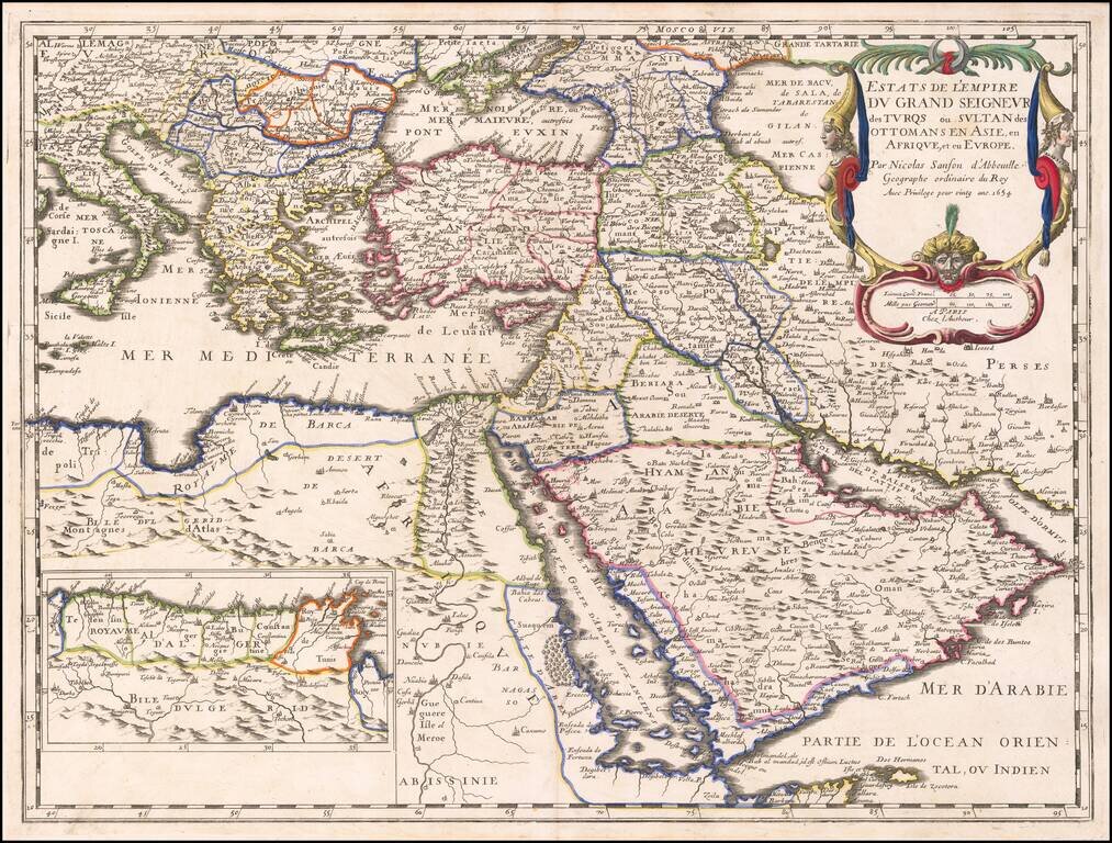
![Les Estats de L'Empire des Turqs en Asie . . . . [Includes Cyprus]](/map/small/50415.jpg)
Nicolas Sanson's circa 1650 double-page engraved map of the Ottoman Empire. The map provides a detailed look at the Turkish Empire in the middle of the 17th Century, extending to cover the Eastern Mediterranean and the western part of the Persian...
![Asia Minor [Shows Cyprus]](/map/small/43185.jpg)
Very rare map of Cyprus and Asia Minor by Phillipe de la Rue. While we were able to locate examples of the map issued by Covens & Mortier in the 18th Century, this map appears to be very rare.
The Ottoman Empire by Nicolas Sanson. Sanson's map shows the powerful Ottoman Empire of the mid-seventeenth century, extending from Italy to the Straits of Hormuz. There is excellent detail from Italy to the Caspian Sea and the Arabian Peninsula. The...

The Turkish Empire in the 17th Century A very nice example of Jansson's rare map of the Turkish Empire, based upon Blaeu's map of a similar title. The map extends from Sicily and Italy in the West to the Black and Caspian Seas in the North and the...

Antique engraved map of the retreat of The Ten Thousand, published by Pierre Du Val in Paris around 1660. The Ten Thousand (Ancient Greek: οἱ Μύριοι, oi Myrioi) were a force of mercenary units, mainly Greeks, employed by Cyrus the Younger to...
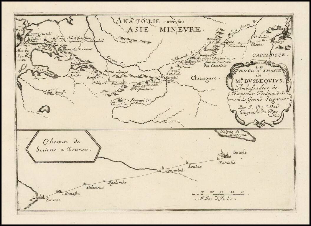
Antique engraved map of the route from Constantinople to Amasya in Turkey, and from Smyrna to Bourse. The route shown is that of Ogier Ghiselin de Busbecq, Ambassador for Ferdinand I of Austria.
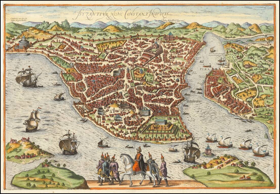
Rare map / birdseye view of Istanbul, from Jansson's monumental town book. Jansson's view is one of the finest and most sought-after views of Istanbul. Viewed from the village of Scutari, the City is shown with all its fortifications, the original...

Alexander the Great Carved Into Mount Athos Fascinatng allegorical image of Alexander the Great. The image shows at the lower right the pope, followed by a cleric holding the canopy, looking at a tablet on which is a drawing presented to him by a...
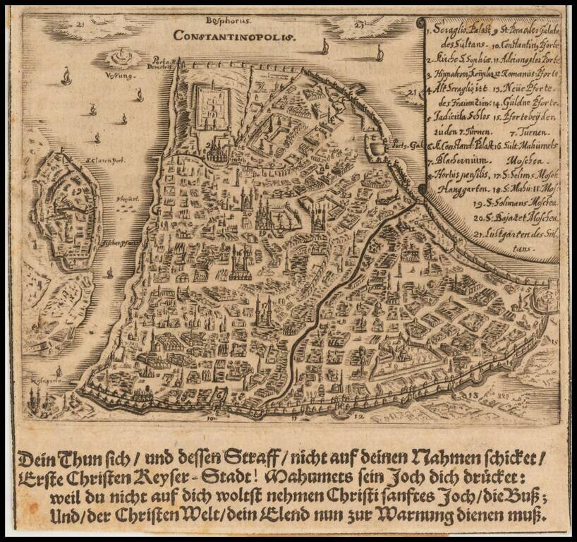
Detailed map of Istanbul, which appeared in Sigmund von Birken's Spiegel der Ehren des Höchstlöblichsten . . . published in Nuremberg in 1668. The work is a translation of a rare 16th Century book believed to have been authored by Johann Jakob...
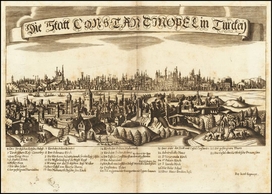
Scarce view of Constantinople by Jacob Koppmayr, a leading publisher in Augsburg. Scarce panoramic view of the ancient Byzantine capital (Istanbul) viewed from across the Bosphorus from Scutari. A numbered key (1 to 29) at bottom identifies the...