
![Tabula Europae IX [Greece & Turkey]](/map/small/60435.jpg)
Interesting map covering the region west of the Black Sea and north of the Aegean and Adriatic Seas, including the Straits of Bosphorus, from the 1542 edition of Munster's Geographia. The map is unchanged from the 1540 edition. Munster's Geographia...
![Tabula Europae IX [Greece & Turkey]](/map/small/45661.jpg)
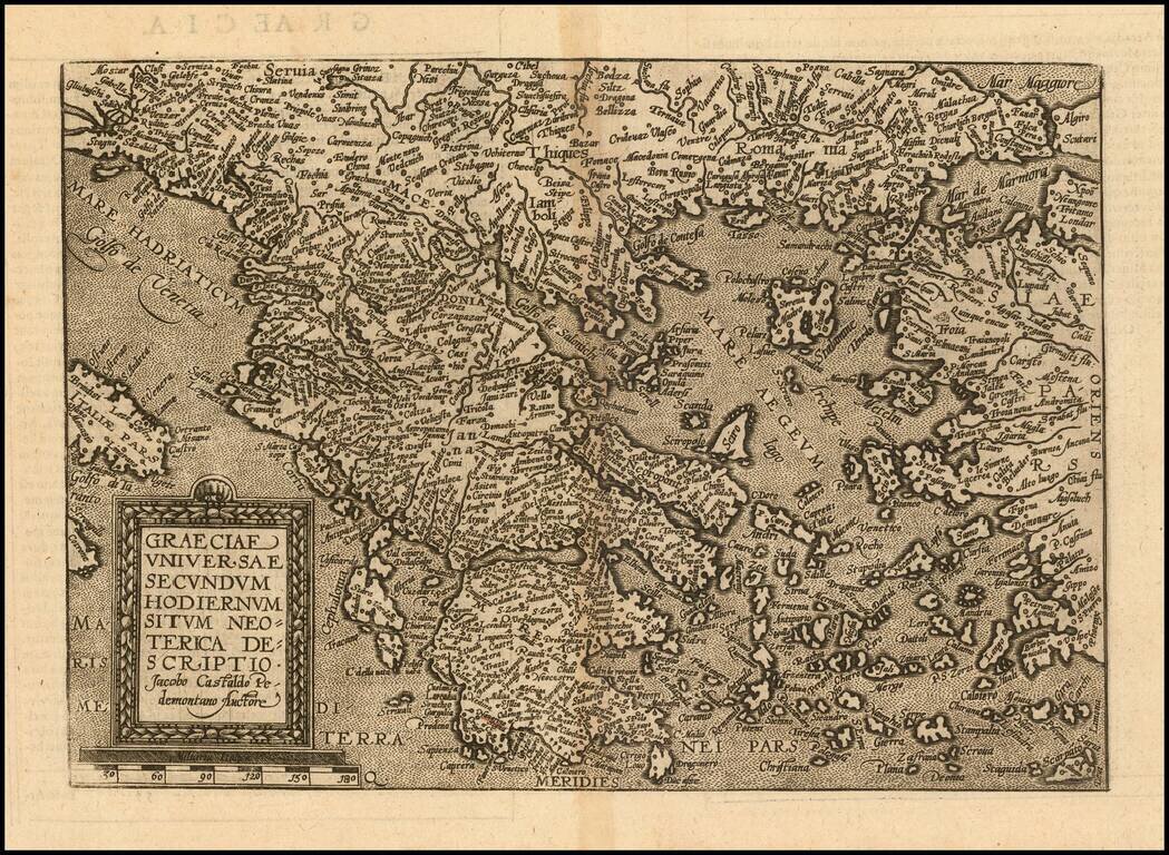
Interesting map of the region including Greece and Turkey, along with part of Dalmatia, extending east to Istanbul and the Bosphorus, from the 1548 edition of Ptolemy's Geographia. Gastaldi's maps are considered important early maps for regional...
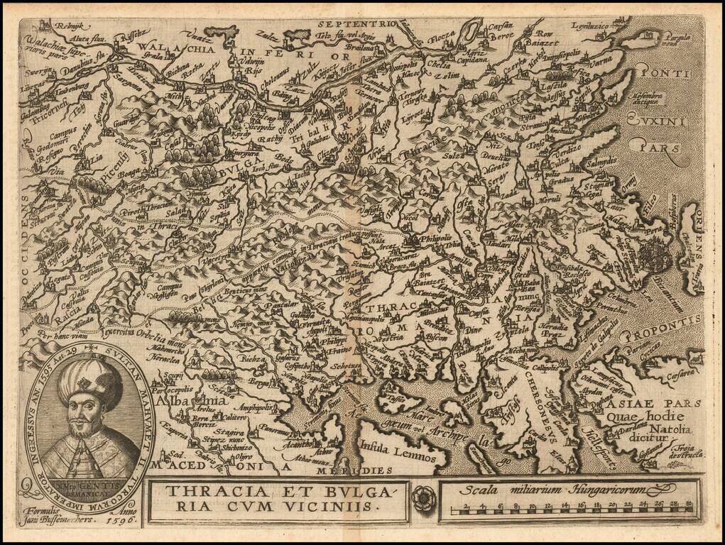
Nice example of this scarce map of Bulgaria and Western Turkey, published in Cologne. The map extends north to the Danube and east to Istanbul, centered on Philipolis (Plovdiv). Sophia is named, but is a small town. Adrianapolis (Edirne) is another...
Detailed map of Greece and neighboring regions, based upon Giacomo Gastaldi's map. The map appeared in Quad's Geographische Handtbuch . . . .
![Turcici Imperii Imago [shows Cyprus]](/map/small/68676.jpg)
Fine Map of the Ottoman Empire from the Mercator-Hondius Atlas Striking example of this map of the Ottoman Empire, showing their territories in the Balkans, Anatolia, the Levant, the Arabian Peninsula, and North Africa. It was published by Henricus...
![Constantinoplen en Egypten door Nicolaus Schmidt in enn zes Jarige Reystogt uyt Duytsland [shows Cyprus]](/map/small/57615.jpg)
Decorative map of the region bounded by Italy, Corsica, Sardinia and Sicily in the west and extending to Cyprus, Asia Minor and the Holy Land in the east. Centered on Greece and the Balkans. The map was engraved to illustrate a Dutch translation of...
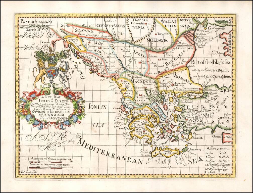
Decorative map of Turkey and the Balkans, colored by regions. This decorative map was part of a set of 22 maps dedicated to William, Duke of Glouchester, who was then an 11 year old student at Oxford.
Detailed map of the Balkans regions and Greece, toward the end of the Ottoman Empire.
![A New Map of Turkey in Europe Divided into All Its Provinces; With the Adjacent Countries of Europe and Asia . . . 1794 [shows Cyprus]](/map/small/49114.jpg)
Striking map of the eastern Mediterranean, Greece, Turkey & Cyprus, bounded by Cyprus and the Mediterranean, the Black Sea, the Adriatic and Crete, centered on Greece and Turkey. Laurie & Whittle credit as sources maps published by the...
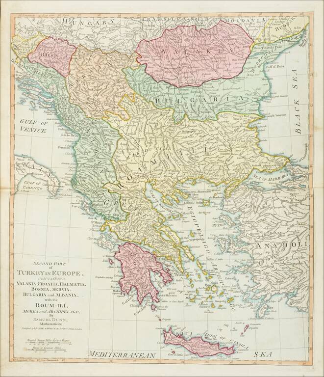
Detailed map of Greece and environs from Crete and the Mediterranean to the Black Sea and the Balkans, centered on Roum-Ili. From Dunn's New Atlas or Mundane System of Geography.
![A New Map of Turkey In Europe, Divided into its Provinces . . . 1801 [Cyprus]](/map/small/71260.jpg)
Detailed map of Turkey, Greece, Bosnia, Dalmatia, Serbia, Bulgaria, Moldova, Romania and Albania, and the contiguous islands, including Cyprus and Crete. Colored by countries. One of the best large format English atlas maps of the period.
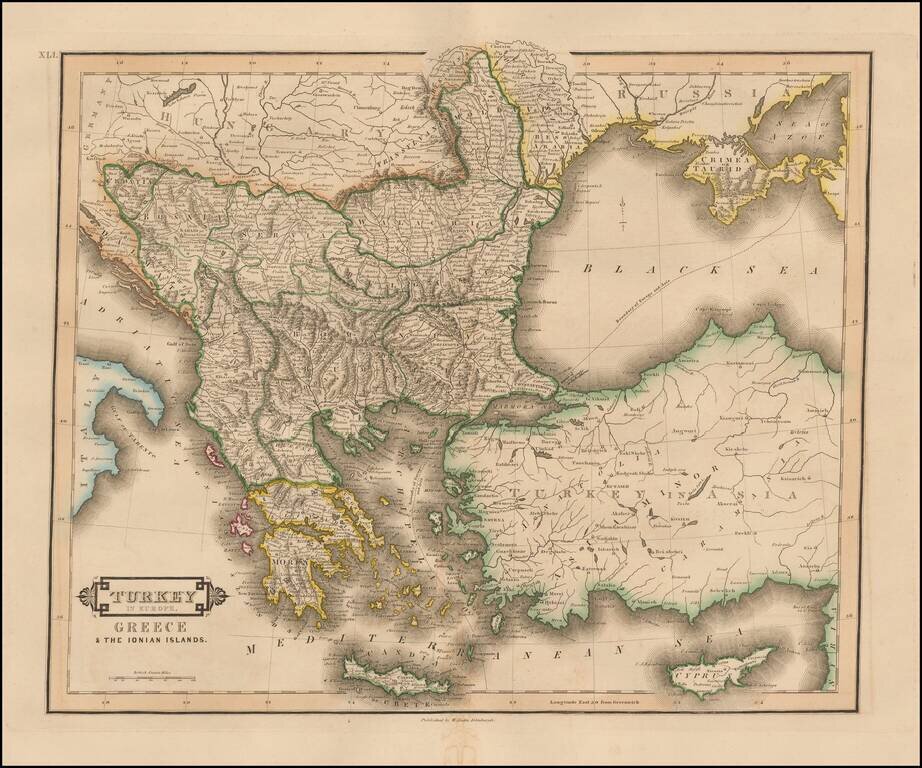
Striking and highly detailed map of Turkey, Greece, the Balkans, Cyprus and the Black Sea. Colored by regions. Excellent detail throughout.
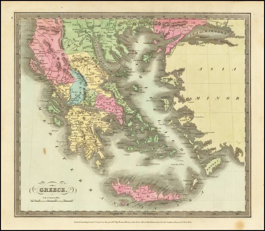
Marvelous detailed map of Greece, Turkey, Macedonia, Crete, and surrounding islands from this scarce American atlas.
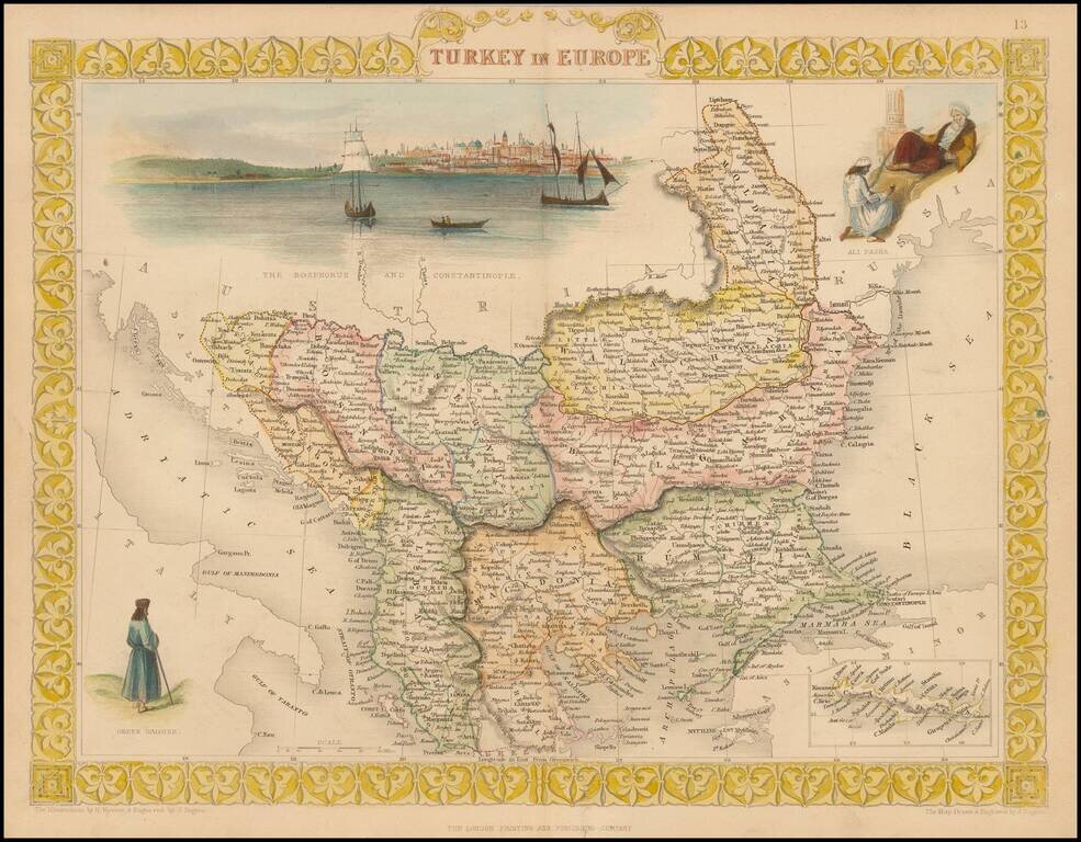
Striking full color example of Tallis' map of European Turkey. Decorative Vignettes of Ali Pasha, The Bosphorus and Constantinople and a Greek Caloyer figure, also inset of island of Cadia. Engraved for R. Montgomery Martin's Illustrated Atlas....
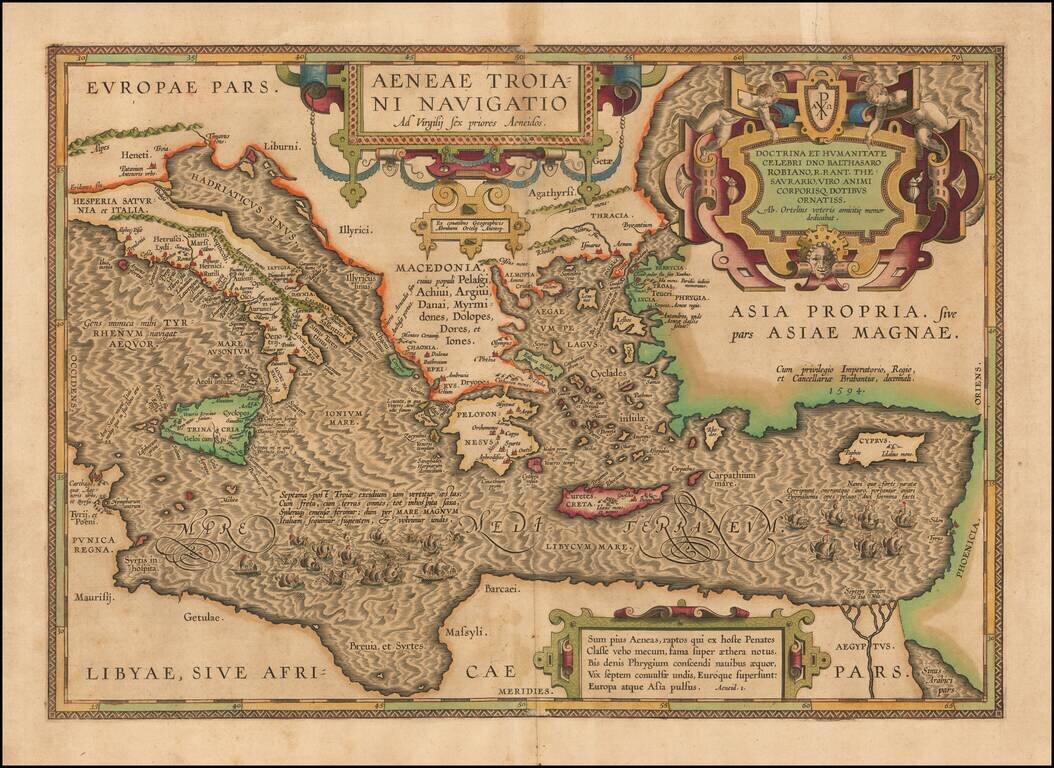
On the Trail of Aeneas, the Trojan—Historical Map of the Mediterranean Sea Chronicling the Story of the Aeneid A finely-detailed map of the eastern Mediterranean Sea, published in Ortelius’ Parergon, his historical atlas of the ancient world. The...
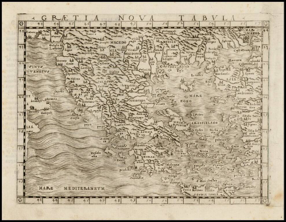
Fine unfolded example of Gastaldi's modern map of Greece, one of the earliest modern maps of Greece, from Gastaldi's Geografia di Claudio Ptolemeo Alexandrino . . . , published in Venice in 1548. Giacomo Gastaldi is considered as the foremost Italian...