Map size in jpg-format: 938744B
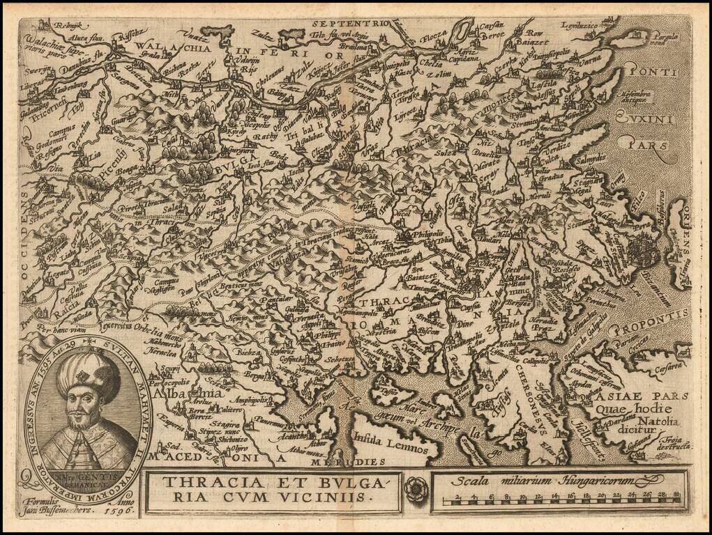
Nice example of this scarce map of Bulgaria and Western Turkey, published in Cologne.
The map extends north to the Danube and east to Istanbul, centered on Philipolis (Plovdiv). Sophia is named, but is a small town. Adrianapolis (Edirne) is another major town shown on the map.
The present map was produced by one of the primary Cologne School mapmakers, Johann Bussemacher. The Cologne School of cartography was perhaps the only group of mapmakers competing with the Low Countries-based map publishing houses at the end of the 16th century (De Jode and Ortelius). For more on the Cologne School, see: Meurer, Atlantes Colonienses. Die Kolner Schule der Atlas Kartographie 1570-1610.
If you are a student, write to us in telegram: @antiquemaps and indicate what material you need and for what work you need a map in high detail. We are ready to provide material on special terms. For students only!