![Tabula Europae IX [Greece & Turkey]](/map/small/45661.jpg)
Map size in jpg-format: 540142B
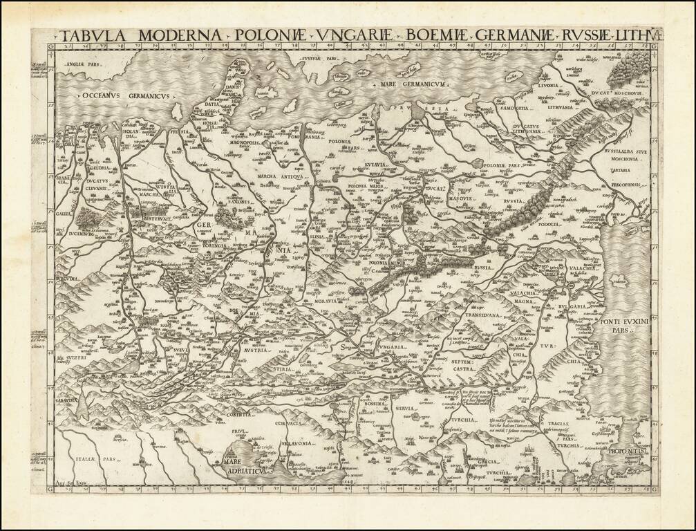
Interesting map of the region including Greece and Turkey, along with part of Dalmatia, extending east to Istanbul and the Bosphorus, from the 1548 edition of Ptolemy's Geographia.
Gastaldi's maps are considered important early maps for regional collectors.
Giacomo Gastaldi was one of the most important Italian mapmakers of the early 16th Century. His set of maps for the 1548 edition of the 'Geographia' are among the earliest examples of his work, in a long and distinguished career. This edition was the first pocket-sized edition. Despite being prepared on a small format, the maps are clearly and attractively engraved. Gastaldi was the first to add regional maps of the American continent, with important maps of the eastern seaboard, a map of what is now the southern United States, of South America, and separate maps of Cuba and Hispaniola. Gastaldi published only a single edition, but his maps were copied by Girolomo Ruscelli for over 50 years.
If you are a student, write to us in telegram: @antiquemaps and indicate what material you need and for what work you need a map in high detail. We are ready to provide material on special terms. For students only!