logo

1855. Southern Germany (with insets of Nuremberg, Munich, Mayence, Frankfort and State of Frankfort)

  • Southern Germany (with insets of Nuremberg, Munich, Mayence, Frankfort and State of Frankfort)

Southern Germany (with insets of Nuremberg, Munich, Mayence, Frankfort and State of Frankfort) information:

Year of creation: 
Resolution size (pixels): 
 7382x11221 px
Disk Size: 
 23.8347MiB
Number of pages: 
 1
Place: 
 London

Print information. Print size (Width x height in inches):
Printing at 72 dpi 
  102.53 х 155.85
Printing at 150 dpi 
 49.21 х 74.81
Printing at 300 dpi 
 24.61 х 37.4

An example of detailing the file of this map of in a printable high-resolution:

Click to open in high resolution (open in new tab).
Attention! this is just the central piece (central area 960x960 px) of the map file!
This is an example, so that you can see and study the level of detail of a given map. The entire Map will be fully available after payment!

Southern Germany (with insets of Nuremberg, Munich, Mayence, Frankfort and State of Frankfort)

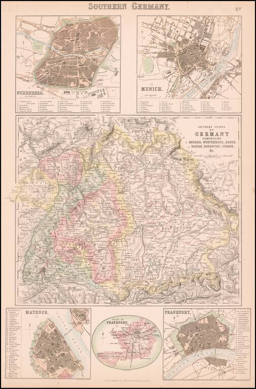
Detailed map of central and northern Germany, with 5 detailed inset plans.

The plans include Nuremberg, Munich, Mayence, Frankfort and State of Frankfort.


Special conditions for students!

If you are a student, write to us in telegram: @antiquemaps and indicate what material you need and for what work you need a map in high detail. We are ready to provide material on special terms. For students only!

Item information:

Year of creation:
Size:
7382x11221 px
Disk:
23.8347MiB
Number of pages:
1
Place:
London
Author:
Archibald Fullarton & Co..
$14.99

Related item