logo

1937. Hansestadt Hamburg und der Neue Hamberger Hafen Nebst den vom Lande Hamburg an Preussen abgetretenen Gemeinden. Von R. Schleifer.

  • Hansestadt Hamburg und der Neue Hamberger Hafen Nebst den vom Lande Hamburg an Preussen abgetretenen Gemeinden.  Von R. Schleifer.

Hansestadt Hamburg und der Neue Hamberger Hafen Nebst den vom Lande Hamburg an Preussen abgetretenen Gemeinden. Von R. Schleifer. information:

Year of creation: 
Resolution size (pixels): 
 12390x10879 px
Disk Size: 
 16.1472MiB
Number of pages: 
 1
Place: 
 Gotha

Print information. Print size (Width x height in inches):
Printing at 72 dpi 
  172.08 х 151.1
Printing at 150 dpi 
 82.6 х 72.53
Printing at 300 dpi 
 41.3 х 36.26

An example of detailing the file of this map of in a printable high-resolution:

Click to open in high resolution (open in new tab).
Attention! this is just the central piece (central area 960x960 px) of the map file!
This is an example, so that you can see and study the level of detail of a given map. The entire Map will be fully available after payment!

Hansestadt Hamburg und der Neue Hamberger Hafen Nebst den vom Lande Hamburg an Preussen abgetretenen Gemeinden.  Von R. Schleifer.

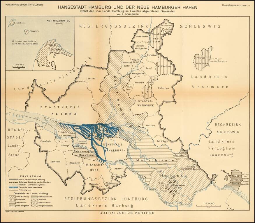
Detailed map of the area around the city of Hamburg.

The map illustrates the growth of the various regions of this Hanseatic port, on the eve of World War II.

The map translates as follows:

Hanseatic City of Hamburg and the New Hamburg Harbor Besides the municipalities assigned to Prussia by the Land of Hamburg. By R. Schleifer.


Special conditions for students!

If you are a student, write to us in telegram: @antiquemaps and indicate what material you need and for what work you need a map in high detail. We are ready to provide material on special terms. For students only!

Item information:

Year of creation:
Size:
12390x10879 px
Disk:
16.1472MiB
Number of pages:
1
Place:
Gotha
Author:
Augustus Herman Petermann.
$14.99

Related item