Map size in jpg-format: 1.50979MiB
Click to open in high resolution (open in new tab).
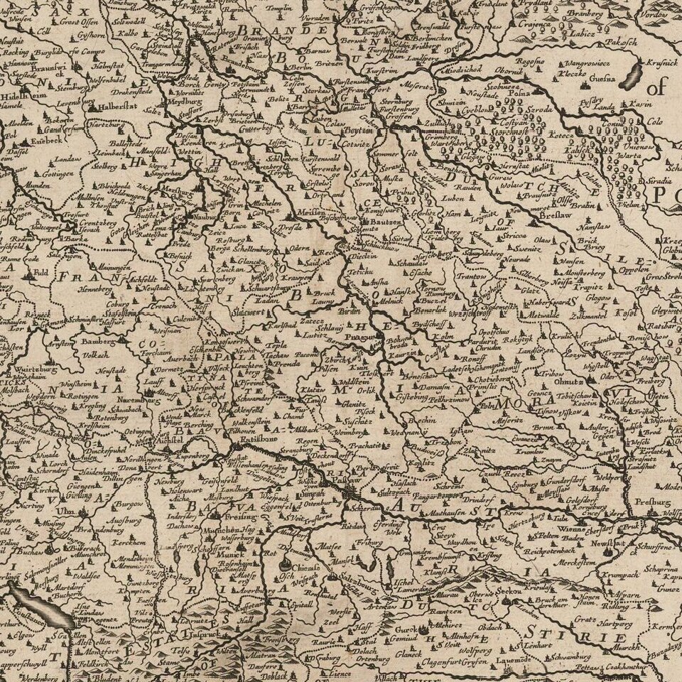
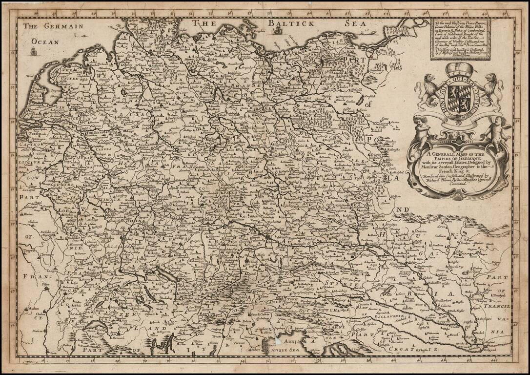
A striking dark impression of Richard Blome's scarce map of the German Empire, the earliest folio sized map of the region to be engraved in England.
The map features an elaborate heraldic cartouche and a dedication to Prince Rupert, Count Palatine of the Rhine, Duke of Banaria &c. Duke of Cumberland, Earle of Holderness, Knight of the order of the Garner, Governor of Windsor Castle. Includes ornate coat of arms.
While Speed's atlas was published prior to Blome, the plates were printed in Amsterdam. The map demonstrates the naïve engraving style characteristic of 17th Century English engravers. Blome's maps, because of their rarity and importance in the history of English Cartography, are essential items for regional collectors.
Blome first began engraving maps for his Geographical Description Of The Four Parts Of The World in 1667. The completed volume was in small folio, and contained 24 maps (plus one duplicated), engraved by Francis Lamb, Thomas Burnford and Wenceslas Hollar. Blome's principal handicap in the production of the atlas was the lack of a domestic mapmaking environment comparable with that in Europe. Also, to finance his work, he undertook subscribers, in exchange for a promise to add their coat of arms to certain maps. In later editions, if the renewal fee was not paid, Blome added a different subscribers coat of arms, leading to multiple images on various editions of the same map.
If you are a student, write to us in telegram: @antiquemaps and indicate what material you need and for what work you need a map in high detail. We are ready to provide material on special terms. For students only!


