Map size in jpg-format: 49.7777MiB
Click to open in high resolution (open in new tab).
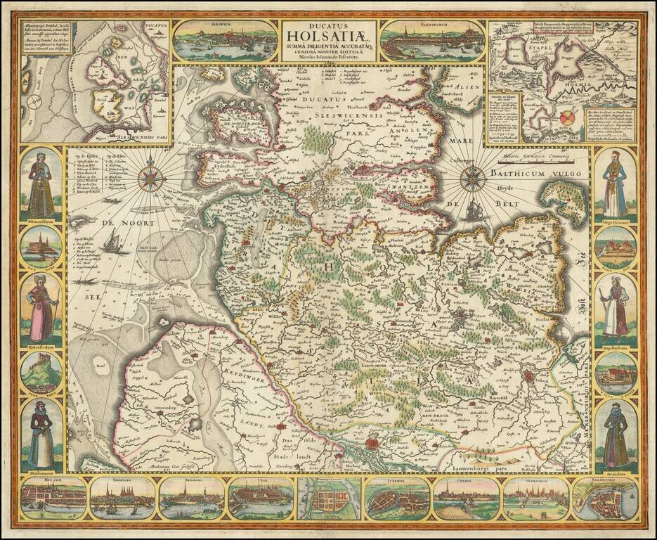
Decorative map of the Duchy of Holstein, engraved by Claus Janszoon Visscher.
The map is flanked by images of costume and city views, with additional city views across the bottom, with 2 more at the top and two localized maps.
An early state of the map, dated 1644.
If you are a student, write to us in telegram: @antiquemaps and indicate what material you need and for what work you need a map in high detail. We are ready to provide material on special terms. For students only!


