
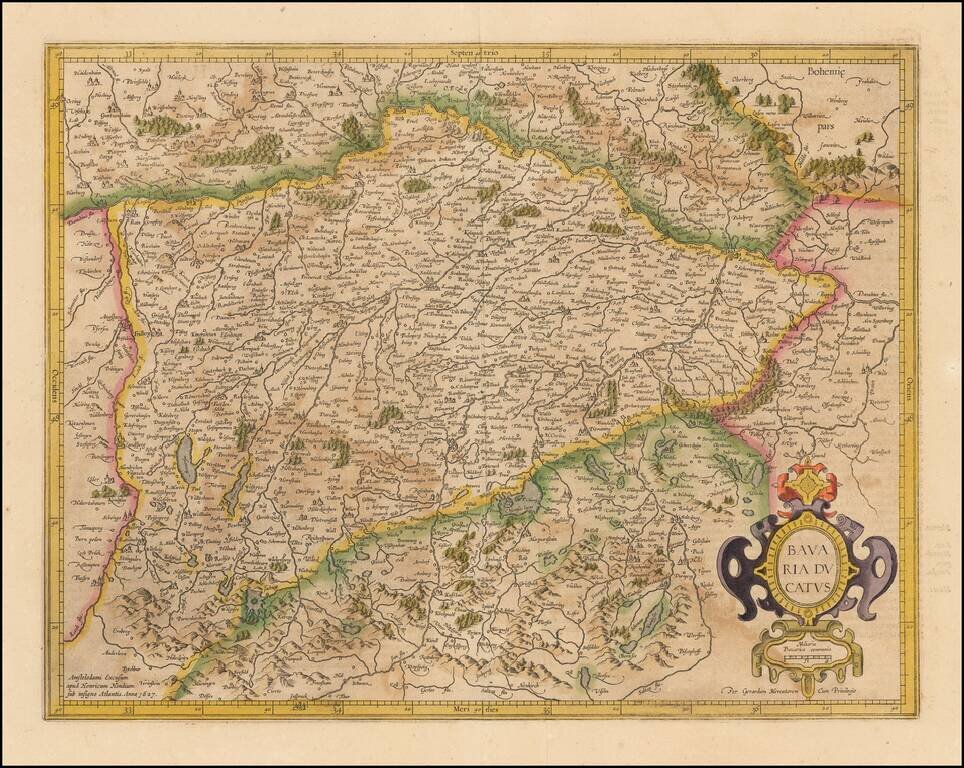
Nice old color example of Mercator's detailed regional map of Germany. The map map shows the course of the Danube in the north, flowing through Ingolstadt, Strassburg, and Passau and extending to the Alpine cities of Fussen, Partenkirchen, Innsburck...
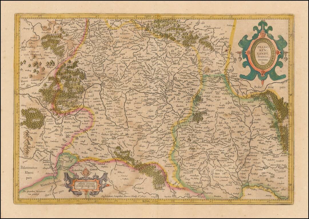
Mercator's double-page engraved German regional map, here in old hand. The map shows Frankfurt am Main, Heidelberg, Wurzburg and the course of the upper Main River, extending east to Regensburg and Eger in Bohemia.
Old color example of Mercator's regional map of a part of Germany from an early edition of the Mercator-Hondius Atas.
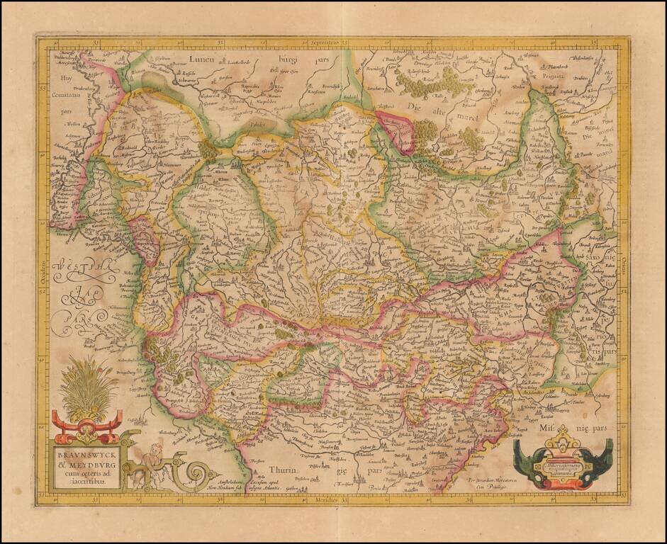
Nice old color example of Mercator's detailed regional map of a portion of Northwestern Germany. Includes Hamburg, Luneburg, etc.
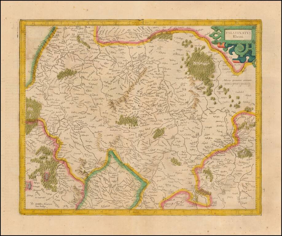
Nice example of Mercator's detailed regional map of Germany. The map extend north to Frankfurt, Bingen and Bachrach and south to the Alsace Region of France, following the Upper Rhine. Heidelberg is near the center of the map.

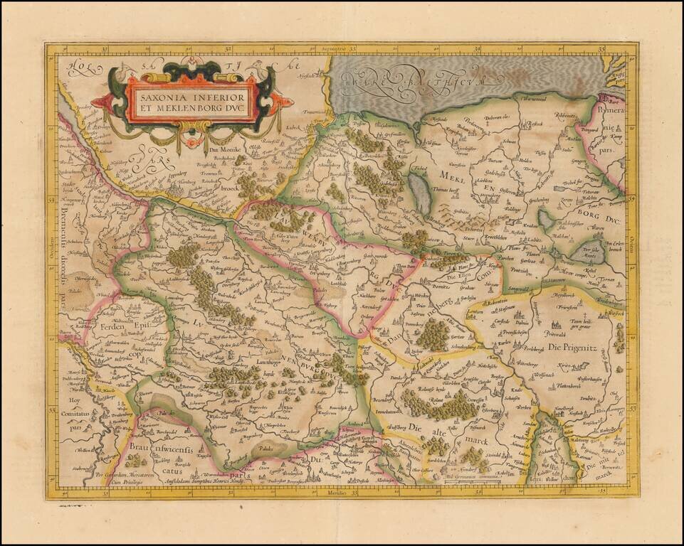
Detailed map of Holstein, extending south to include Hamburg and Lubeck. From an early edition of Mercator's Atlas.
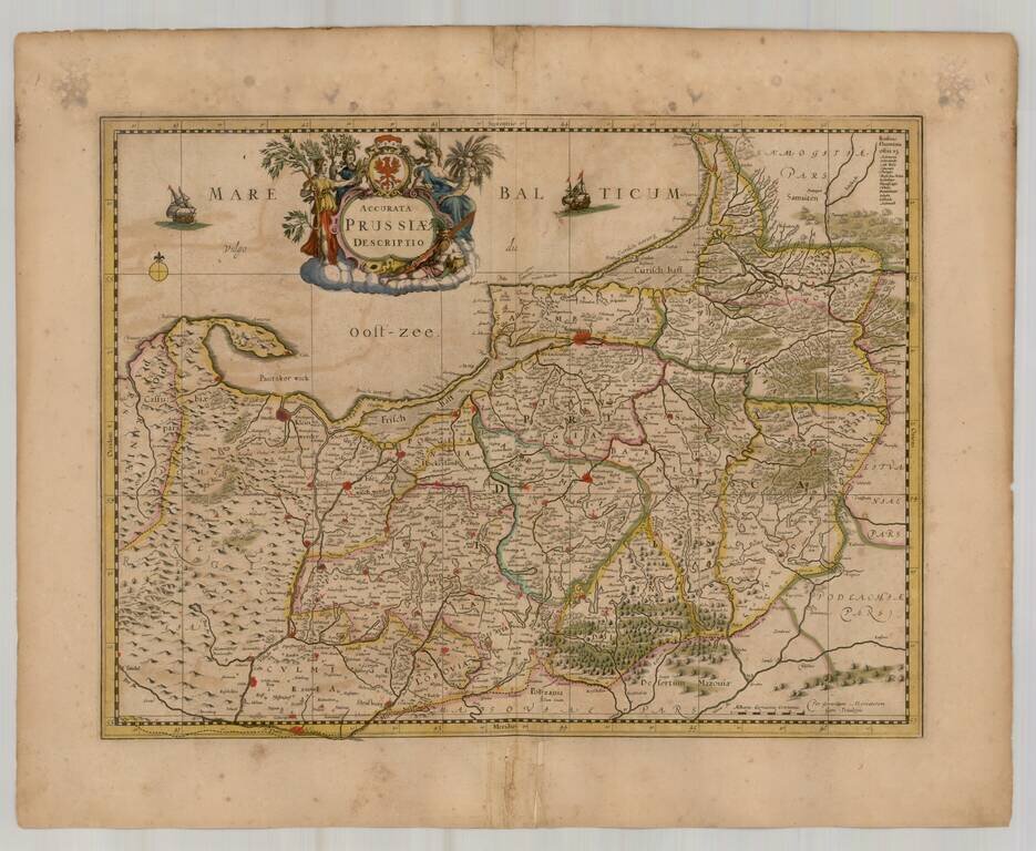
Scarce map of Prussia, published by Gerard Mercator in Amsterdam. Covers most of the North of Poland and parts of Kalingrad and Southern Lithuania.
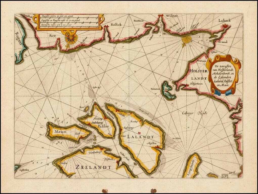
Fine example of this rare sea chart of part of the coastlines of Germany and Denmark, published by Blaeu in his Zeespiegel, first published in 1623. The present chart is oriented with South at the top and includes Lubeck, Wismer and Rostock, along the...
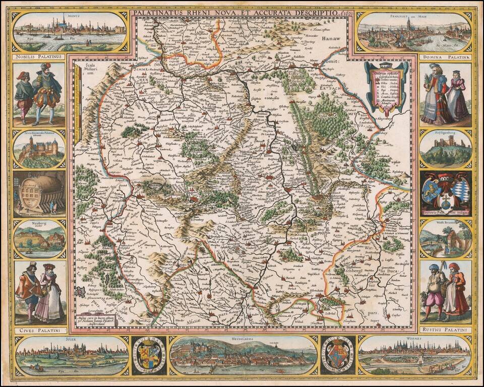
First State of Visscher's Map of the Rhine Valley Finely colored example of Nicholaus Visscher's decorative map of the German Rhine River Valley. The map follows the course of the Rhine River from the area near Baden-Baden in the south to just south...
![[Untitled Map of Central Westphalia]](/map/small/51478.jpg)
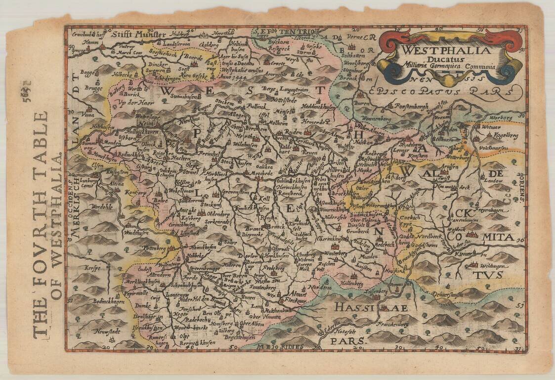
Nice example of the Mercator-Hondius regional map of Westphalia, in modern-day Germany.
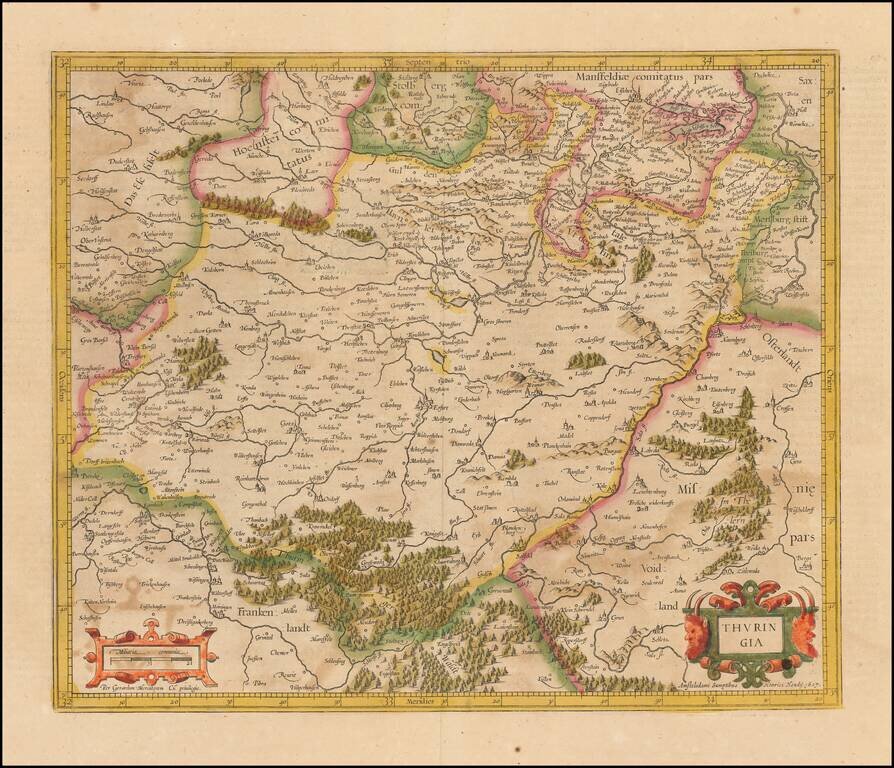
Old color example of Hondius' regional map of Germany, from the Atlas Sive Cosmograhia. The map is centered on Erfurt, Weimar and Gotha.
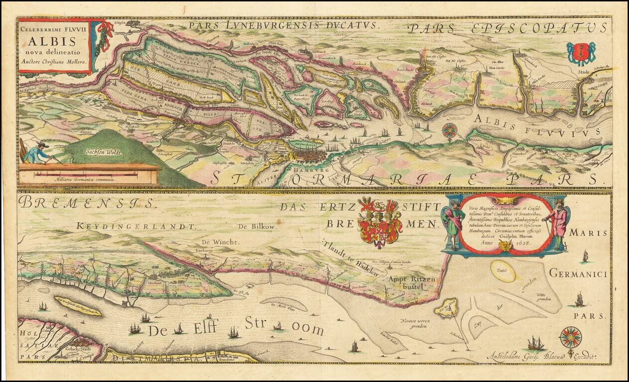
Fine example of Blaeu's map of the lower Elbe River, including Hamburg. The map is oriented with south at the top and divided into two sections, each of which includes an elaborate coat of arms.
Decorative regional map of Germany. Includes decorative cartouche. From an English Edition of the Mercator-Hondius Atlas. Nice full color example.
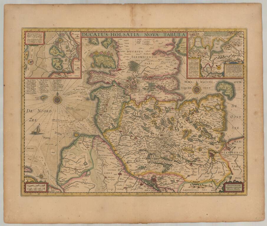
Old color example of Henricus Hondius' map of the Duchy of Holstein. Includes 2 large inset maps. Extends to Hamburg, Lubeck, Kiel, etc.
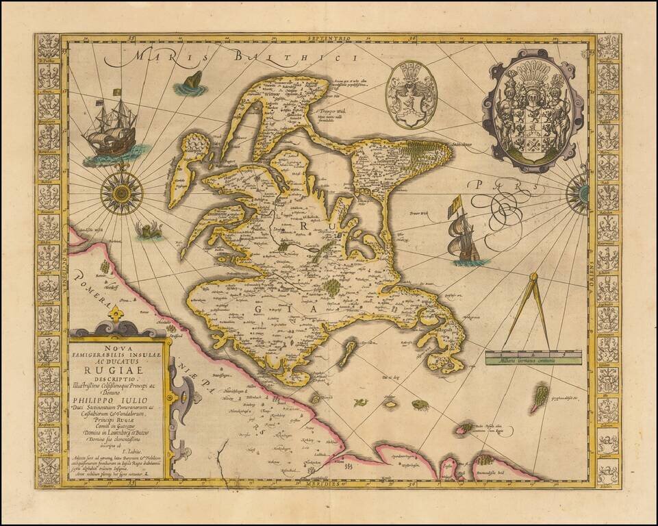
Striking hand-colored example of this decorative map, including two compass roses, sailing ships, sea monsters and massive coat of arms, plus the smaller coat of arms along both side borders, filled with the coats of arms of the island's leading...
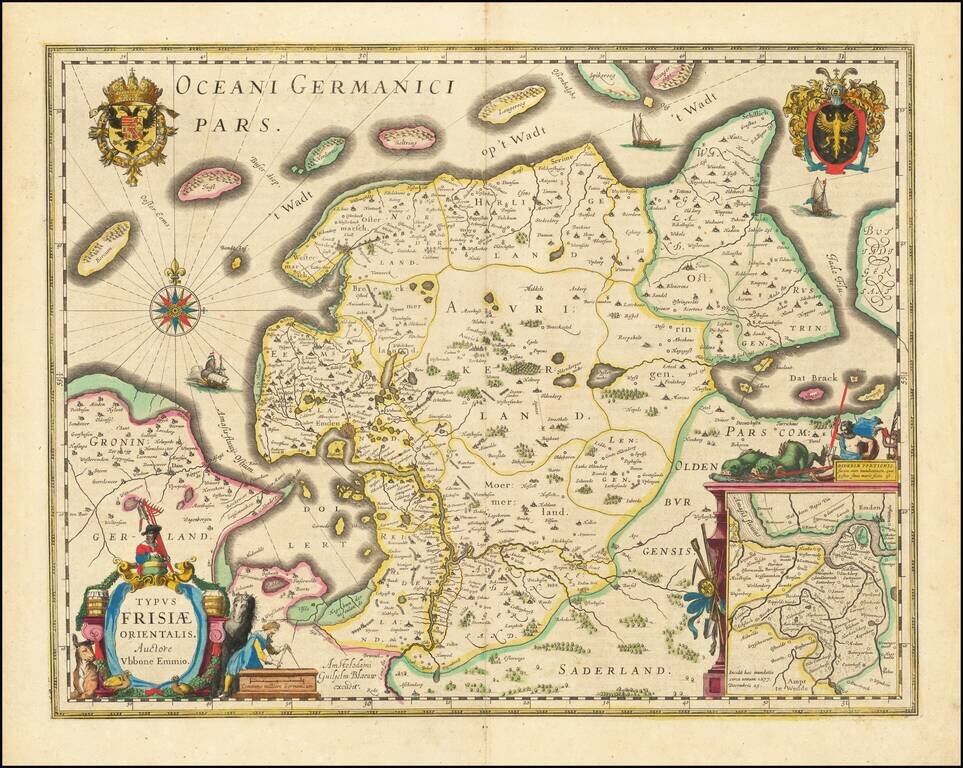
A beautiful example of Blaeu's map of East Friesland and the area around Emden and Norden. Large inset map of the mouth of the Amasis River. The map is decorated with a large title cartouche and two large coats of arms, plus elegant border details...